Storms Over The Tennessee Valley
**No afternoon Weather Xtreme video today due to travel**
QUICK NOTES: I will be in the field this afternoon as we look back on 4.27.11….
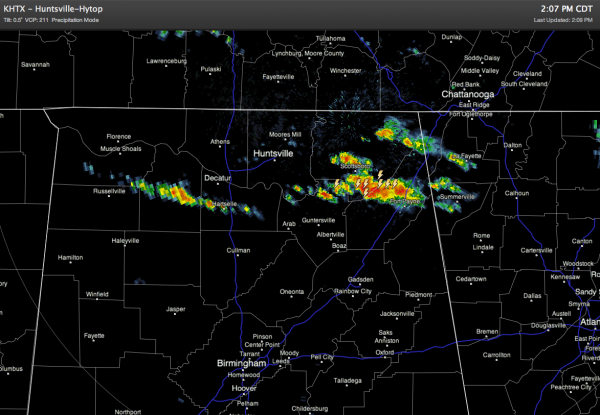
*Isolated storm are forming over the Tennessee Valley at mid-afternoon… see the radar below…
Showers and storms should be confined to the far northern part of Alabama this evening, and they will fade away as the sun goes down. A strong storm is possible, but severe weather is not expected.
OUR WEEKEND: An upper ridge will grow stronger, meaning a sunny, warm weekend for Alabama. Look for a high in the mid 80s tomorrow, followed by upper 80s Sunday.
NEXT WEEK: The weather still looks warm and mostly dry with the upper ridge overhead, and the primary storm track well to the north. We might see a shower or two along the way, but they should be few and far between. Highs will remain generally in the 80s.
See the morning Weather Xtreme video for more long range ideas and graphics.
WEATHER BRAINS: Don’t forget you can listen to our weekly 90 minute netcast anytime on the web, or on iTunes. This is the show all about weather featuring many familiar voices, including our meteorologists here at ABC 33/40.
CONNECT: You can find me on all of the major social networks…
Don’t forget to watch our one hour special… “Remembering April 27” at 6:00 p.m. on ABC 33/40. My next Weather Xtreme video will be posted bright and early Monday morning by 7:00… Brian Peters will have the video updates tomorrow and Sunday. Enjoy the weekend!
Category: Alabama's Weather


