Wild images of hail (photos and dual-pol radar)
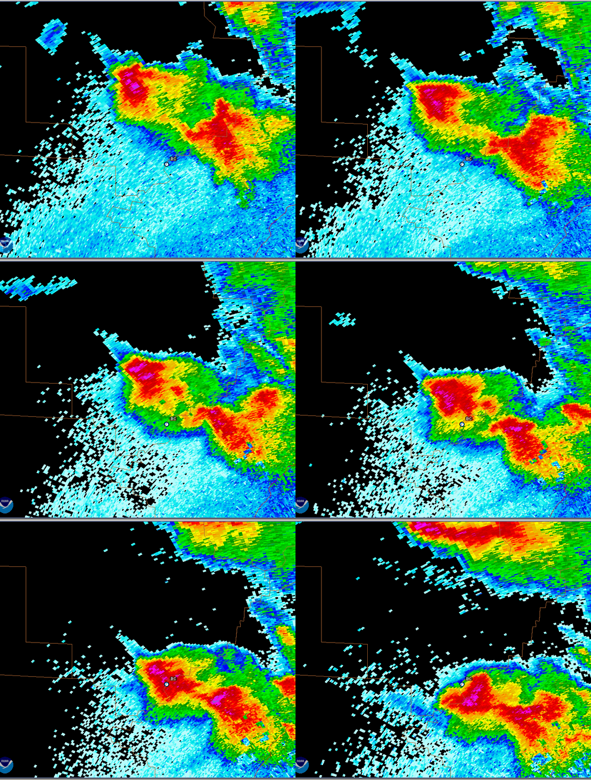
This was the radar loop around 700 pm on March 31, when a hailstorm came across my location at Bluff Creek on the Warrior River. The radar shows the purple shades (near 70 dBZ, or 100 times as much return as 50 dBZ that as is the lower edge of red on radar in its logarithmic pattern.)
I have never personally seen hail that large. What was perhaps more fascinating was the speed and force the hailstones fell with (we’ll discuss that below), and the noise they made. I was fortunate to be outside on a screened-in porch, and with a tin-roof boathouse near me, it sounded like a machine gun for a while. There was a strong smell of pine and other trees in the air, as the hail knocked branches off trees.
1. Photos and video
First of all, some photos and video. The hailstorm came through Bluff Creek mainly after dark, so you couldn’t see much while it was happening. That was not the case over Smith Lake earlier. Watch the lake and listen to the noise of the intense hailstorm.
<iframe width=”560″ height=”315″ src=”https://www.youtube.com/embed/AWaFRZVyVfg” frameborder=”0″ allowfullscreen></iframe>
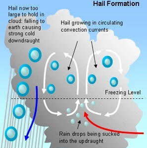
Hail is ice that falls from a thunderstorm. It forms when strong thunderstorm updrafts hold ice crystals up in a storm long enough, for them to get big enough, to fall to the ground without melting. Some hailstones make several trips through the updraft and downdraft of a storm (see diagram from NC State).
2. Radar images (including dual pol)
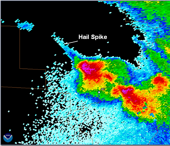
First of all, the large hail over Walker County that night produced a huge “hail spike” (see below). The radar determines the distance a raindrop or piece of ice reflects energy from by timing how long it takes for the emitted energy to get back to the radar. In cases of large hail, enough of the radar beam may bounce off a hailstone down to the ground, back up to other hailstones, then back to the radar, making the radar think the reflector was farther away than it was. This creates a streak of false echo beyond the storm (farther from the radar) in large hail.
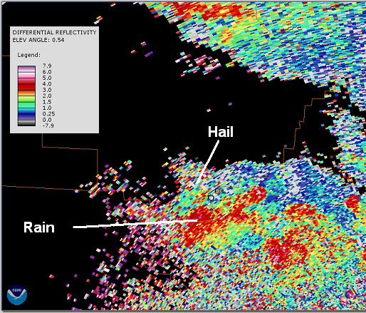
You may have heard that the National Weather Service is upgrading its radar network to “dual polarization”, or dual-pol. This means the radar sends out the traditional horizontally-oriented radio waves, and also vertically-oriented ones, to detect precipitation. Since raindrops are actually flat like hamburgers when they fall, the horizontal waves will bounce back to the radar more efficiently than vertical ones. In hail, the shapes are more spherical or irregular and tumble as they fall, so the horizontal and vertical waves bounce back to the radar more equally. Using these measurements, the radar computes differential reflectivity (Zdr), or a ratio of returned horizontal waves divided by vertical waves. In rain, the Zdr is high, since most returned energy is horizontal. In hail or snow, the Zdr is often low, since you get an equal amount of horizontal and vertical.
Take a look at the Zdr picture below. The area near Bluff Creek shows low Zdr, indicating hail, while areas around it show higher Zdr, indicating rain. There are other random areas of low Zdr, but if they are not coupled with overall high reflectivity, they typically do not indicate hail.
These measurements will also be helpful in finding the rain/snow line in the winter.
There are other dual-polarization measurements that we can discuss in later blogs, including the correlation coefficient (that has been shown to indicate tornado debris in some cases) and the specific differential phase (to better quantify rain rates).
Category: Met 101/Weather History


