Early Afternoon Update
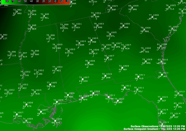
Below is a look at the current weather situation across Alabama at the lunch hour…
Note that Tuscaloosa and Montgomery have soared to 75 degrees, with 73 at Anniston and Birmingham. We need to get to the low 80s today to reach record levels… I doubt if it gets that warm, but we are close.
Note the dew points are in the 60s up to Montgomery (the dew point at Montgomery is up to 63), with upper 50s up to I-20.
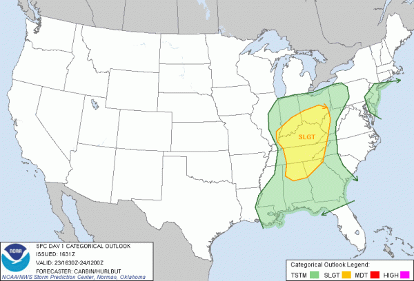
The latest SPC convective outlook is below…
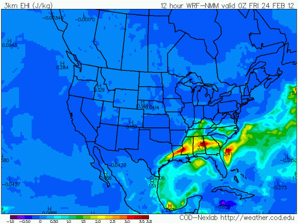
And, below is the forecast EHI valid at 6 p.m…
Note the maximum EHI values over Central Alabama.
Bottom line is that we don’t see much change. Tonight’s thunderstorm event will be a high shear, low CAPE event. Should instability values come in higher than forecast, the threat will be more significant.
Morning sounds shows a capped atmosphere across Alabama this afternoon, and more than likely we won’t see anything on radar for the rest of the afternoon.
TONIGHT: The main window for strong to severe storms in Alabama will come from about 7:00 p.m. through 3:00 a.m. The main risk will be from hail and strong straight line winds along a broken squall line that moves through the state, but any discreet cells will need to be monitored for signs of rotation, and an isolated tornado is certainly not out of the question based on the shear profiles.
Stay tuned for updates…
Category: Alabama's Weather


