Snow, cold update
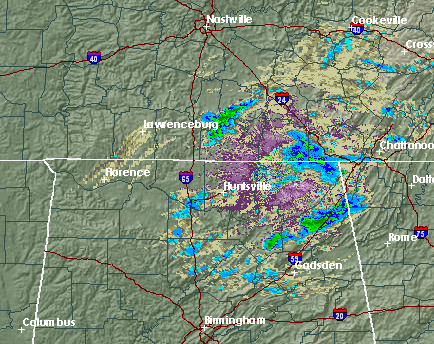
Light snow showers continue over north Alabama this evening, mainly north of TCL-BHM-ANB. However, a few reports of snow in NE Jefferson County (Clay/Pinson/Trussville areas)! The snow has been a little heavier to the north, with slick spots developing, mainly on bridges, in HSV metro and over near Florence. I’m glad I’m not driving home over the I-65 bridge over the TV River today! Be careful tonight and tomorrow morning and check road conditions before heading out in case we get a little more snow than originally thought, mainly north US-278, but even a few elevated roads in the BHM and ANB areas could get icy.
As the big upper-level low and associated divergence moves through tonight, more light snow can be expected. The snow is a little like summer showers, as the air is unstable. It is 29 at the ground at UAH right now, but the MPR indicates it is 3 degrees at 4,000 ft., so the air is unstable!
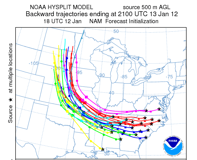
Our air is coming from far up north and fast. The trajectory model below shows that the air in Alabama tomorrow at 3 pm will have come from South Dakota.
It won’t be surprising to see temperatures drop more tonight, as it is in the teens and 20s upstream in MS, TN, AR, and MO. Wind chill in the morning may be near 15 at times as far south as BHM, so bundle the kids up! At least we are in a progressive pattern, and after a cold day tomorrow (highs in the 30s) and a cold night tomorrow night (lows 20-25 mainly), it will start to warm up by Saturday.
Category: Winter Weather


