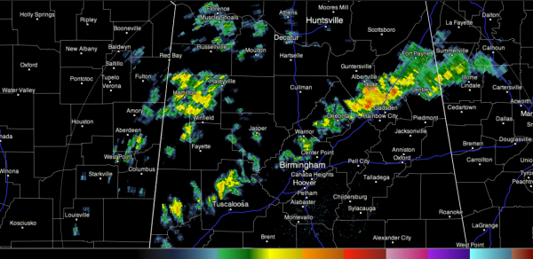
Showers/Storms Weakening
Our line of showers and storms is approaching I-59 tonight from Gadsden south. North of there, it is already east of the Interstate in DeKalb and Etowah Counties. South of Blount county, the line become broken and is just showers.
The storms are weakening as we have lost the heating of the day.
There are other showers over Marion County and near the Quad-Cities of Northwest Alabama.
The stronger storms today did produce some hail, as well as locally heavy rain.
The front that has served as a focal point for the storms today will stall over North Alabama. Subsequent upper level disturbances will combine with the front and instabilities that will develop with the heating of the day tomorrow, Monday and Tuesday to produce more showers and storms over the next three days.
Category: Alabama's Weather


