Snow analysis – 200 pm
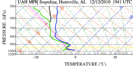
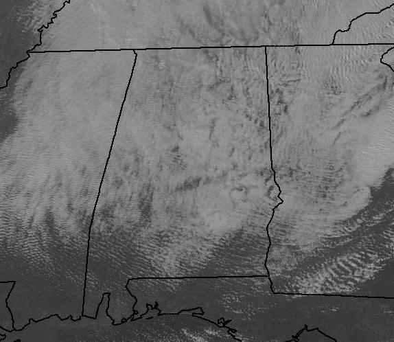
Convective snow showers (caused by moisture and instability, similar to summer thunderstorms) continue over north and central Alabama this afternoon. Looking at the radiometer data, that gives us a sounding of the atmosphere every one minute, shows temperatures decreasing rapidly with height, again like summertime.
The blue line shows temperature. Notice it goes from about 28 F (-2 C) at the surface at UAH to -4 F at 800 mb, or about 6,000 feet! This is very unstable, and is helping the snow showers to keep developing. You can see the updraft and downdrafts in the clouds. (Also notice the gravity waves due to air crossing the mountains in NE AL and N GA.)
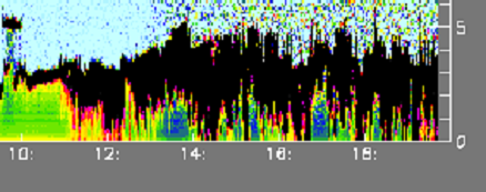
In convective showers like this, it may snow moderately for a while, then the downdraft between showers will cause drying, with no snow and even brighter skies. A time-height sectionThe UAH ceilometer (a laser-type device that shows clouds and precipitation) shows the periodic nature of the falling snow.
The snow showers will keep coming, off and on, for several more hours, until the low-levels dry out tonight.
Once the sun goes down, temperatures will fall through the 20s, and be near 20 tomorrow morning. With winds gusting to 30 mph at times, wind chills will be near zero late tonight and tomorrow moring. Bundle the kids up big time for school. Wear plenty of layers, and make sure to wear a hat.
Category: Met 101/Weather History


