Frost Advisory Issued for Parts of North and Central Alabama Late Tonight
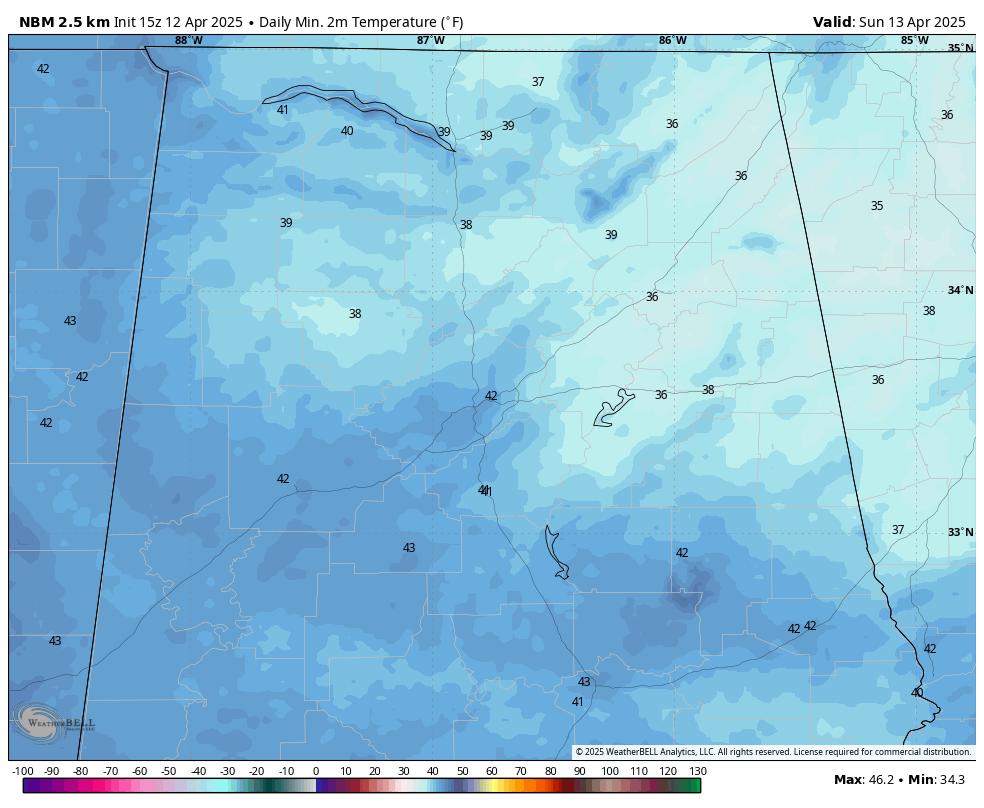
Lows by Sunday morning
Frost Advisory Issued for Parts of North and Central Alabama Late Tonight
The National Weather Service has issued a Frost Advisory for much of northeast and central Alabama, in effect from 1:00 AM to 8:00 AM CDT Sunday. A chilly air mass settling in overnight will cause temperatures to dip into the mid 30s, leading to frost formation in several areas.
?? What to Expect:
- Temperatures as low as 36°F across valleys and rural areas
- Frost development possible in open, sheltered locations
- Potential harm to sensitive outdoor vegetation
? Areas Included:
- From NWS Huntsville: Jackson and DeKalb Counties (including Scottsboro, Fort Payne, and Rainsville)
- From NWS Birmingham: Blount, Etowah, Calhoun, Cherokee, Cleburne, St. Clair, Talladega, Clay, and Randolph Counties (including Anniston, Gadsden, Centre, Heflin, Sylacauga, Roanoke, and Moody)
? Gardeners Take Note:
Frost may cause damage to tender plants, flowers, and early-season gardens. Take precautions this evening by covering plants or moving them indoors if possible.
Frost conditions should end by mid-morning Sunday as temperatures rise into the upper 60s and 70s with full sunshine expected by afternoon.
Stay warm tonight—and protect those spring blooms!
Category: Alabama's Weather, ALL POSTS, Severe Weather, Social Media
About the Author (Author Profile)
Bill Murray is the President of The Weather Factory. He is the site's official weather historian and a weekend forecaster. He also anchors the site's severe weather coverage. Bill Murray is the proud holder of National Weather Association Digital Seal #0001 @wxhistorianSubscribe
If you enjoyed this article, subscribe to receive more just like it.


