Severe Thunderstorm Warning for Parts of Southeastern and East Central Alabama Until Midnight
Severe Thunderstorm Warning for Portions of Southeastern and East Central Alabama Until Midnight
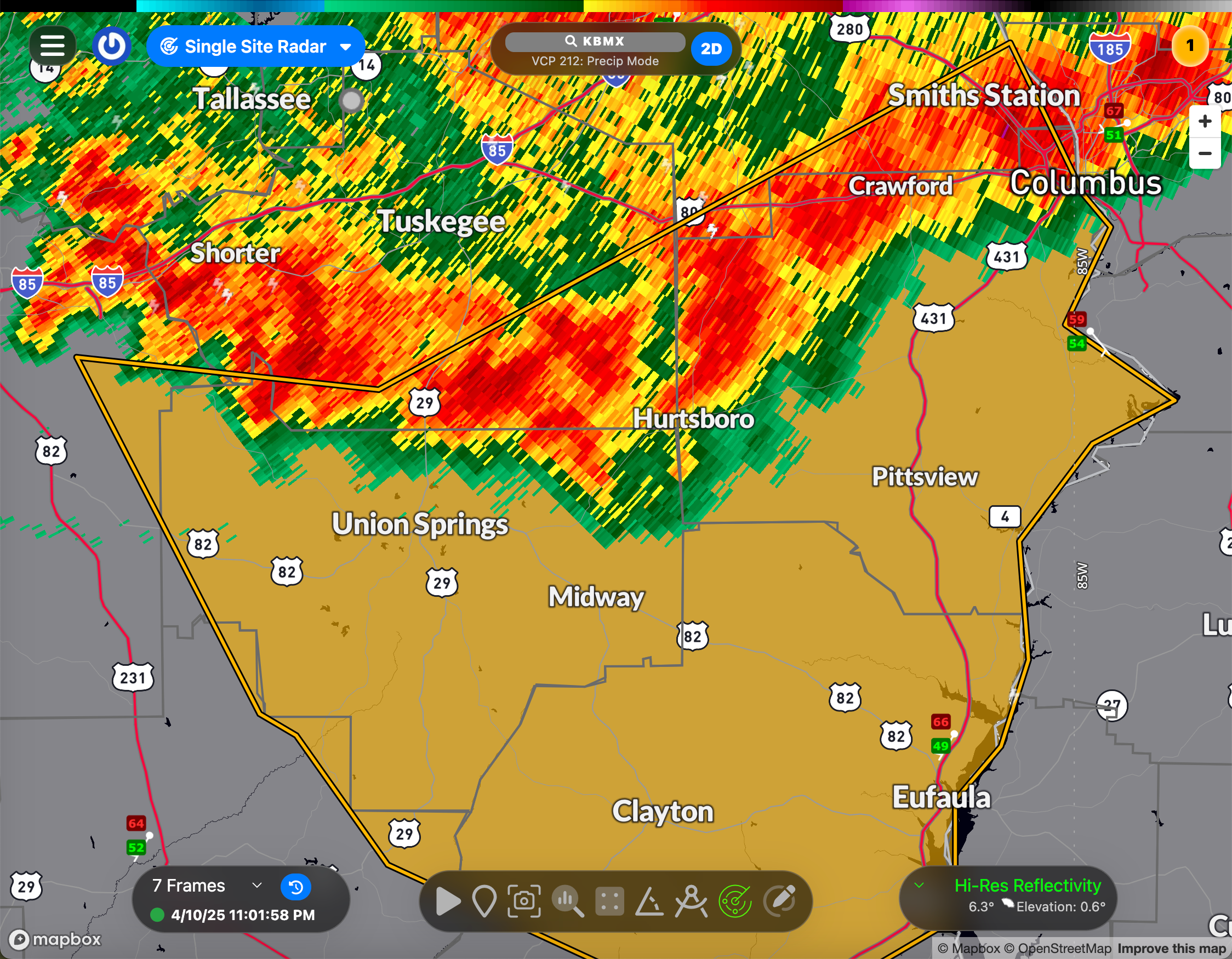
The National Weather Service in Birmingham has issued a Severe Thunderstorm Warning effective until 12:00 AM CDT for the following counties:
- Northeastern Pike County
- Southeastern Lee County
- Bullock County
- Southeastern Macon County
- East Central Montgomery County
- Barbour County
- Russell County
At 10:56 PM CDT, radar indicated a line of severe thunderstorms stretching from Uchee to near Union Springs to Pike Road, moving southeast at 50 mph. These storms are producing wind gusts up to 60 mph, capable of causing damage to roofs, siding, and trees.
Locations in the path of these storms include: Midway, Seale, Smiths, Fort Davis, Union Springs, Pickett, Josie, Mount Andrew, Shopton, Uchee Creek, Clayton Municipal Airport, High Ridge, and Beans Crossroads.
Precautionary Actions: Move to a safe shelter immediately—preferably an interior room on the lowest floor of a sturdy building. Secure any loose outdoor objects, and avoid windows until the storm passes.
This line of storms is part of a broader severe weather event affecting parts of Alabama late this evening. Stay weather-aware and continue to monitor trusted sources for updates.
Category: Alabama's Weather, ALL POSTS, Severe Weather, Social Media
About the Author (Author Profile)
Bill Murray is the President of The Weather Factory. He is the site's official weather historian and a weekend forecaster. He also anchors the site's severe weather coverage. Bill Murray is the proud holder of National Weather Association Digital Seal #0001 @wxhistorianSubscribe
If you enjoyed this article, subscribe to receive more just like it.


