Severe Thunderstorm Warning for Central Talladega and Clay Counties Until 10:00 PM CDT
Severe Thunderstorm Warning for Central Talladega and Clay Counties Until 10:00 PM CDT
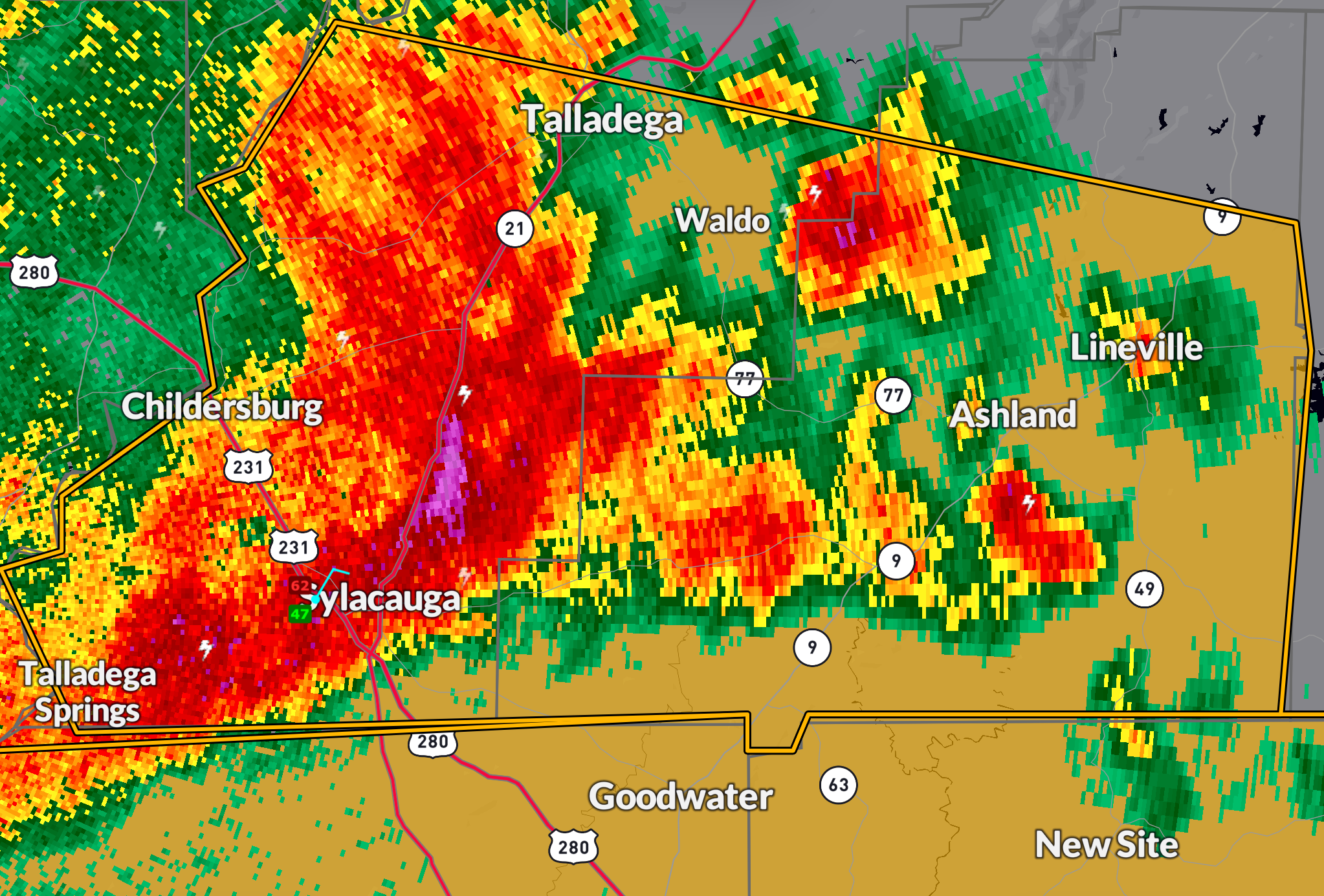
The National Weather Service in Birmingham has issued a Severe Thunderstorm Warning for central Talladega and central Clay counties in east central Alabama, in effect until 10:00 PM CDT.
At 9:14 PM CDT, a severe thunderstorm was located near Talladega, moving slowly east at 10 mph. This storm is producing 60 mph wind gusts and quarter-size hail, capable of damaging vehicles and causing damage to roofs, siding, and trees.
Locations in the path include: Talladega, Ashland, Waldo, Ironaton, Gunthertown, and Chandler Springs.
Precautionary Action: Residents in the warning area should seek shelter immediately in an interior room on the lowest floor of a sturdy building. Stay away from windows and avoid using electronic devices until the storm passes.
This warning is part of an active severe weather evening across the region. Monitor local media and official weather sources for additional updates and warnings.
Category: Alabama's Weather, ALL POSTS, Severe Weather, Social Media
About the Author (Author Profile)
Bill Murray is the President of The Weather Factory. He is the site's official weather historian and a weekend forecaster. He also anchors the site's severe weather coverage. Bill Murray is the proud holder of National Weather Association Digital Seal #0001 @wxhistorianSubscribe
If you enjoyed this article, subscribe to receive more just like it.


