Severe Thunderstorm Warning for Tallapoosa and Coosa Counties Until 10:45 PM CDT
Severe Thunderstorm Warning for Tallapoosa and Coosa Counties Until 10:45 PM CDT
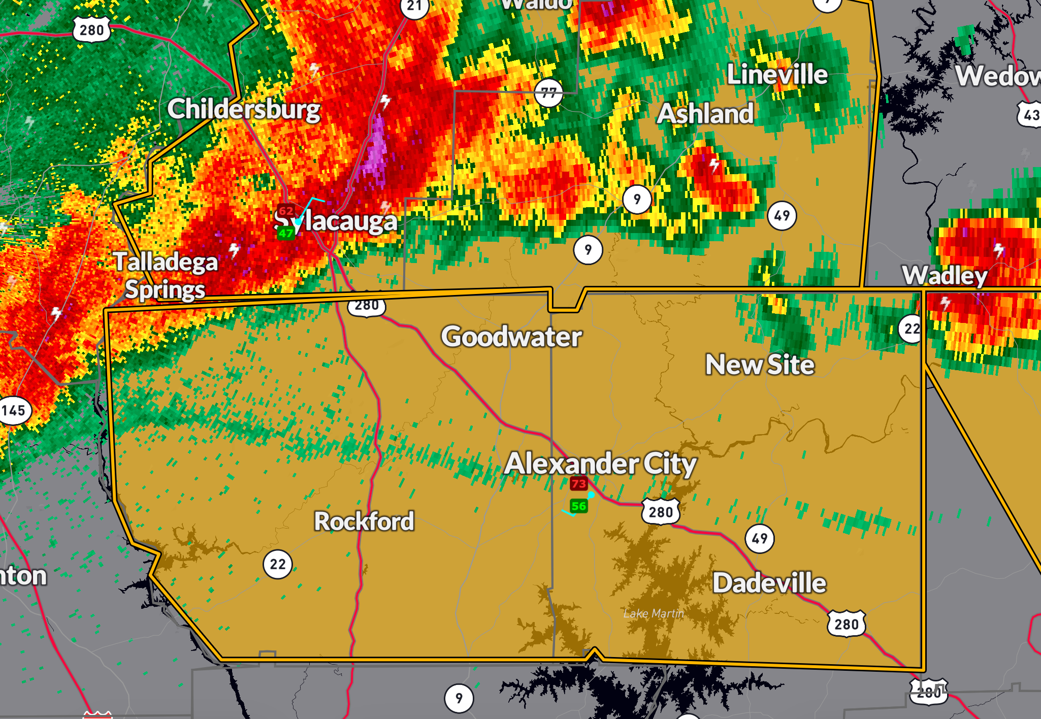
The National Weather Service in Birmingham has issued a Severe Thunderstorm Warning for Tallapoosa and Coosa Counties in east central Alabama, in effect until 10:45 PM CDT.
At 9:28 PM CDT, a severe thunderstorm was located over Sylacauga, moving southeast at 50 mph. Radar indicated wind gusts up to 60 mph, capable of producing damage to roofs, siding, and trees. Hail is also possible, though currently estimated at less than 0.75 inches in diameter.
Locations in the path of this storm include: Rockford, Goodwater, Jacksons’ Gap, Mitchell Lake, Paint Creek, Lay Lake, Horseshoe Bend, Unity, Equality, Dollar, Ray, Hatchet, Hissop, Hillabee Creek, and portions of Western Lake Martin, including the Horseshoe Bend National Military Park and Highway 9/22 corridors.
Precautionary Action: For your protection, move to an interior room on the lowest floor of a sturdy building. Avoid windows and secure outdoor items that could become airborne.
This storm is part of an ongoing severe weather event affecting much of Central and East Central Alabama tonight. Stay tuned to local media or weather alerts for additional warnings.
Category: Alabama's Weather, ALL POSTS, Severe Weather, Social Media
About the Author (Author Profile)
Bill Murray is the President of The Weather Factory. He is the site's official weather historian and a weekend forecaster. He also anchors the site's severe weather coverage. Bill Murray is the proud holder of National Weather Association Digital Seal #0001 @wxhistorianSubscribe
If you enjoyed this article, subscribe to receive more just like it.


