The Alabama Weather Picture at 9:20 p.m.
Winds are gusting to 46 mph at the SHelby County Airport in Calera now.
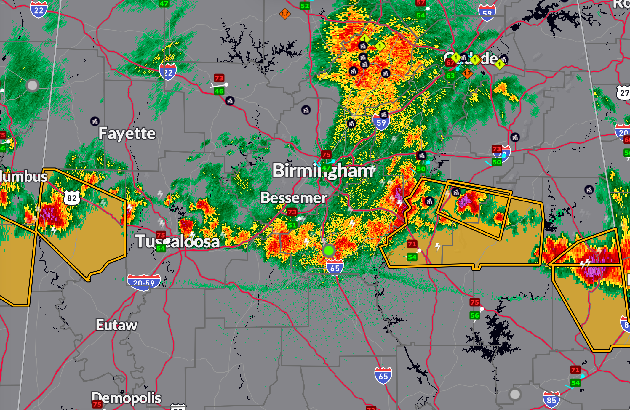
Active Severe Thunderstorm Warnings (as of 9:17 PM CDT)
- Randolph County
Wind: 60 MPH Hail: 1.25 in
Expires: 9:45 PM CDT - Pickens County
Wind: 60 MPH Hail: 1.00 in
Expires: 9:45 PM CDT - Jefferson County
Wind: 60 MPH Hail: <0.75 in
Expires: 9:30 PM CDT - Chambers County
Wind: 60 MPH Hail: 1.25 in
Expires: 10:00 PM CDT - Talladega and Clay Counties
Wind: 60 MPH Hail: <0.75 in
Expires: 10:15 PM CDT
Storm Damage Reports Since 8:00 PM CDT
- Anniston (Calhoun Co): Trees down across the city.
- Newell (Randolph Co): Trees and powerlines down.
- Alpine (Talladega Co): Trees down near 2 NNW Alpine.
- Talladega (Talladega Co): Numerous trees down.
- Pell City (St. Clair Co): Numerous trees down.
- Jasper (Walker Co): Numerous trees down across the area.
- Partridge Crossroads (Jefferson Co): Trees and powerlines down on Warrior-Jasper Rd and Mayfield Rd.
- Crossville (Lamar Co): Widespread tree and powerline damage from Sulligent to Vernon.
Category: Alabama's Weather, ALL POSTS, Severe Weather, Social Media
About the Author (Author Profile)
Bill Murray is the President of The Weather Factory. He is the site's official weather historian and a weekend forecaster. He also anchors the site's severe weather coverage. Bill Murray is the proud holder of National Weather Association Digital Seal #0001 @wxhistorianSubscribe
If you enjoyed this article, subscribe to receive more just like it.


