Severe Thunderstorm Warning for Central Walker County Until 9:00 PM CDT
Severe Thunderstorm Warning for Central Walker County Until 9:00 PM CDT
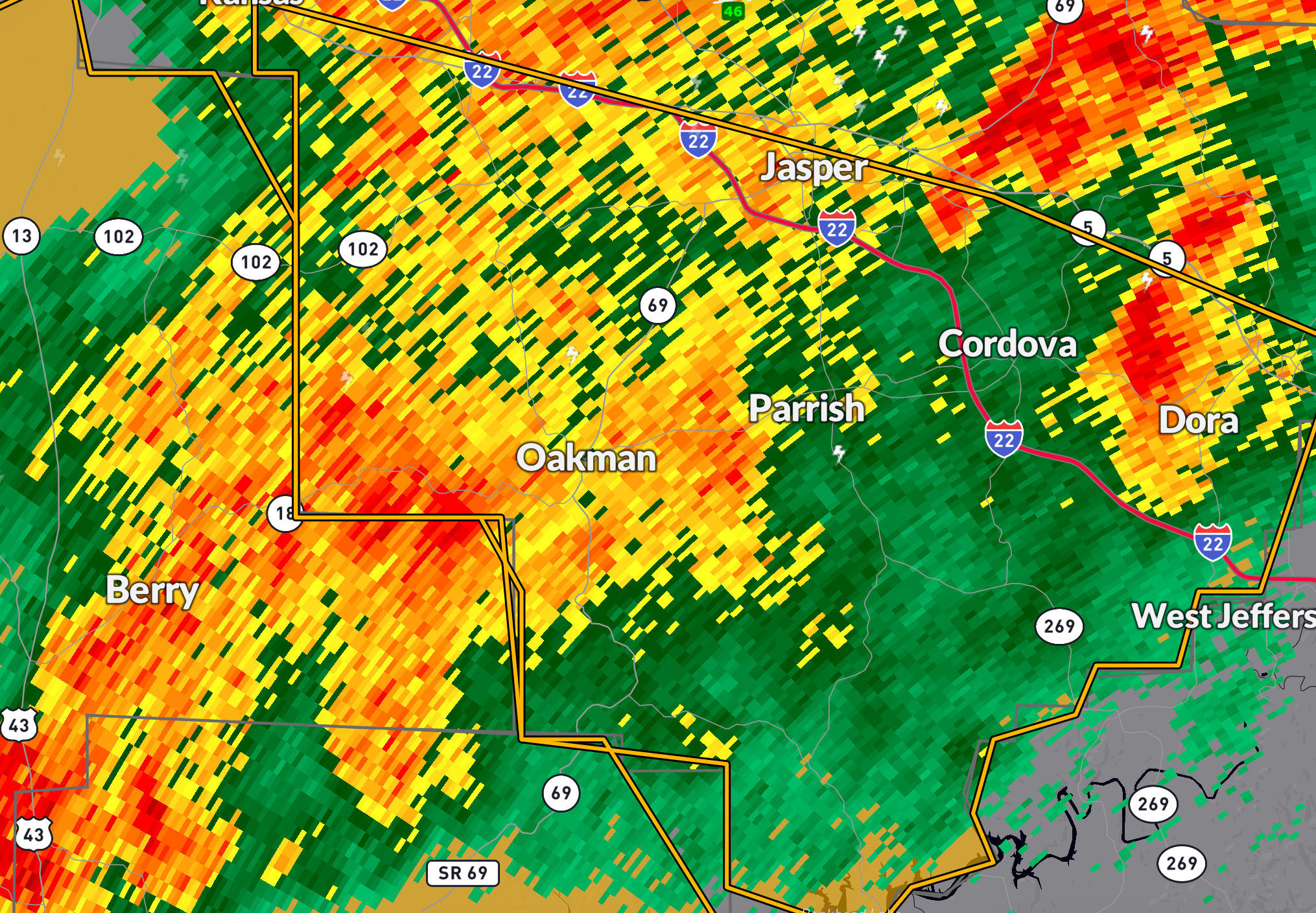
A strong thunderstorm is moving into Central Walker County this evening. At 8:22 PM CDT, radar indicated a severe thunderstorm over Oakman, about 9 miles southwest of Jasper, moving southeast at 40 mph. The primary threat with this storm is wind gusts up to 60 mph, which could lead to damage to roofs, siding, and trees.
Locations in the path include: Oakman, Sumiton, Dora, Cordova, Parrish, Quinton, Burnwell, Townley, Goodsprings, Gorgas Steam Plant, The Wye, Rocky Hollow, Corona, Holly Grove, and nearby communities in Central Walker County.
Take shelter immediately in a sturdy structure, away from windows and exterior walls. This warning remains in effect until 9:00 PM CDT. Continue to monitor local alerts and remain weather aware as storms continue tonight.
Category: Alabama's Weather, ALL POSTS, Severe Weather, Social Media
About the Author (Author Profile)
Bill Murray is the President of The Weather Factory. He is the site's official weather historian and a weekend forecaster. He also anchors the site's severe weather coverage. Bill Murray is the proud holder of National Weather Association Digital Seal #0001 @wxhistorianSubscribe
If you enjoyed this article, subscribe to receive more just like it.


