Severe Thunderstorm Warning for Randolph, Clay, and East Central Talladega Counties Until 9:45 PM CDT
Severe Thunderstorm Warning for Randolph, Clay, and East Central Talladega Counties Until 9:45 PM CDT
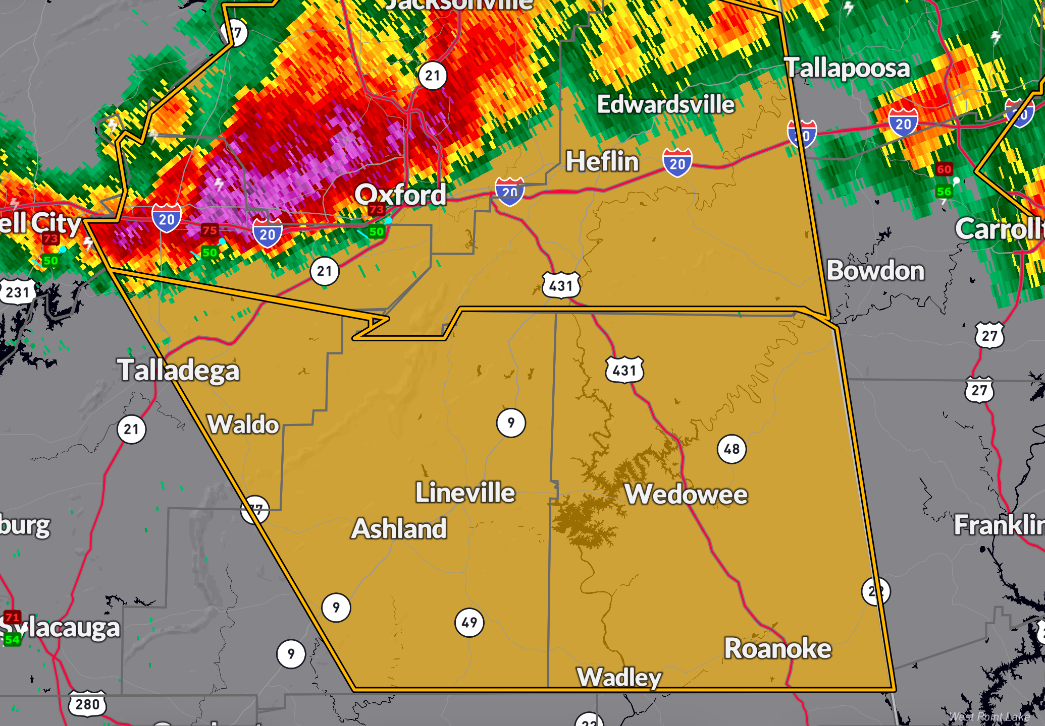
A strong thunderstorm is moving rapidly across east central Alabama this evening. At 8:07 PM CDT, radar indicated a severe storm near Bynum or Cobb Town, moving southeast at 45 mph. This storm is capable of producing 60 mph wind gusts and quarter-size hail, which could damage vehicles, trees, roofs, and siding.
Locations under threat include: Lake Wedowee, Roanoke, Lineville, Woodland, Graham, Barfield, Camp Mac, R.L. Harris Dam, Rock Mills, and other nearby communities across Randolph, Clay, and eastern Talladega counties.
If you’re in the path of this storm, take shelter immediately in a sturdy building, away from windows. This warning remains in effect until 9:45 PM CDT. Stay weather aware as more storms remain possible across the region tonight.
Category: Alabama's Weather, ALL POSTS, Severe Weather, Social Media
About the Author (Author Profile)
Bill Murray is the President of The Weather Factory. He is the site's official weather historian and a weekend forecaster. He also anchors the site's severe weather coverage. Bill Murray is the proud holder of National Weather Association Digital Seal #0001 @wxhistorianSubscribe
If you enjoyed this article, subscribe to receive more just like it.


