Be Ready for Strong Winds from Ootflow Boundary Birmingham Metro!
Gusty Outflow Winds Moving Through the Birmingham Metro
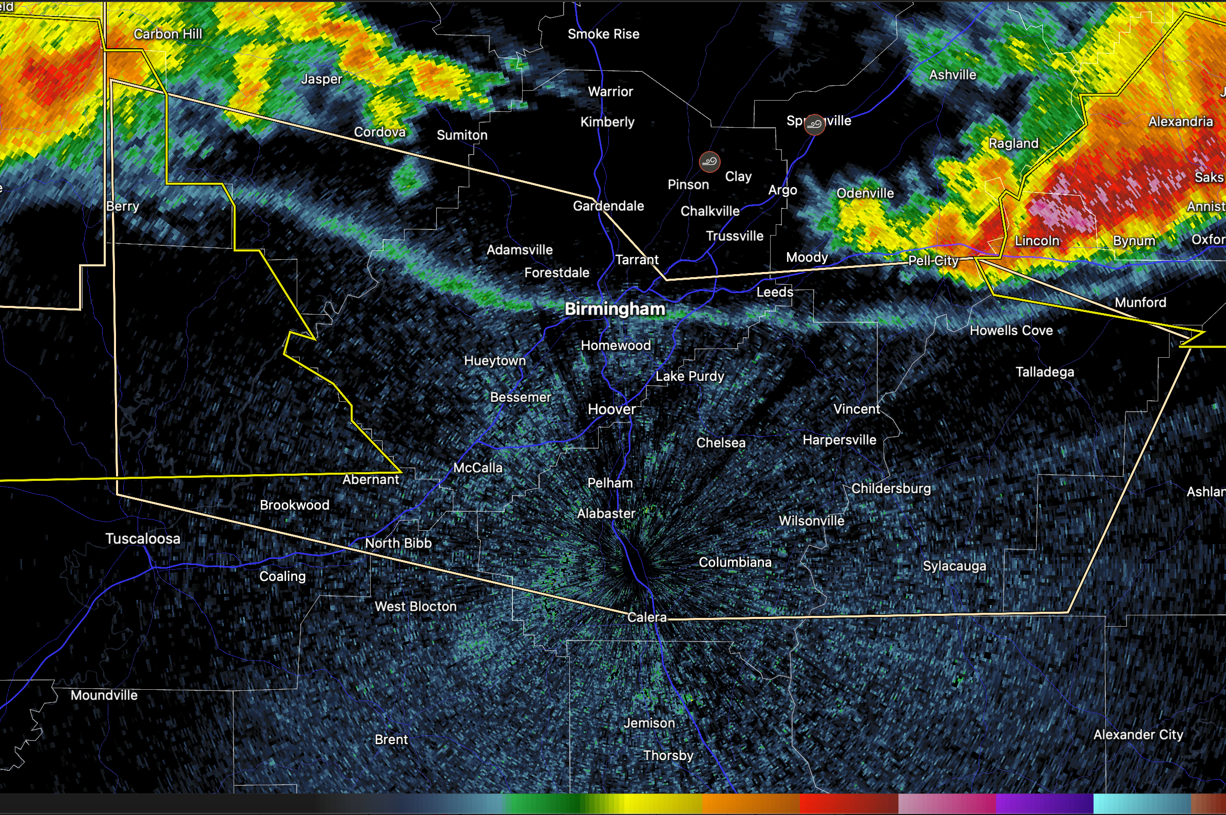
An outflow boundary is moving south through the Birmingham metro this evening, producing wind gusts up to 50 mph. As of 7:47 PM CDT, radar indicated strong gusty winds along a line from Riverside to Fultondale to northwest of Oakman, moving south at 40 mph. These winds may knock down tree limbs and blow around unsecured objects.
Impacted areas include: Mountain Brook, Liberty Park, The Summit, McAdory, Brookwood, Oak Grove, Highland Park Golf Course, and surrounding neighborhoods across Jefferson, Shelby, and adjacent counties.
A Severe Thunderstorm Watch remains in effect until 11:00 PM CDT. While this is not a severe storm, the gusty outflow winds can still be hazardous—if outdoors, seek shelter indoors.
Category: ALL POSTS
About the Author (Author Profile)
Bill Murray is the President of The Weather Factory. He is the site's official weather historian and a weekend forecaster. He also anchors the site's severe weather coverage. Bill Murray is the proud holder of National Weather Association Digital Seal #0001 @wxhistorianSubscribe
If you enjoyed this article, subscribe to receive more just like it.


