West Alabama Storms Growing: Severe Thunderstorm Warning for Lamar, Fayette, Pickens, and Northern Tuscaloosa Counties Until 9:15 PM CDT
Severe Thunderstorm Warning for Lamar, Fayette, Pickens, and Northern Tuscaloosa Counties Until 9:15 PM CDT
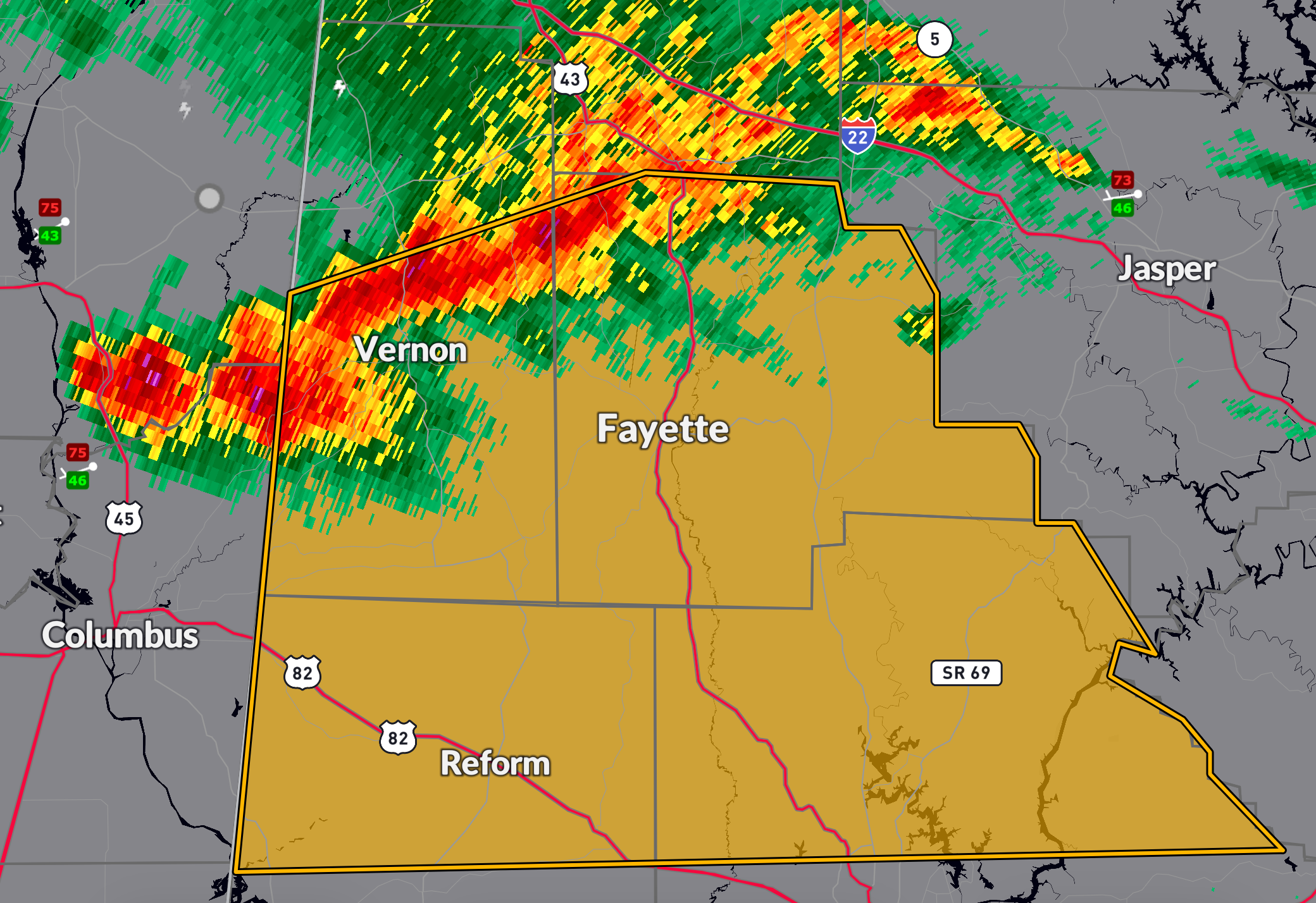
A fast-moving line of severe thunderstorms is racing across West Central Alabama this evening. At 7:53 PM CDT, storms capable of producing 60 mph wind gusts were located from near Bluff to near Steens, moving southeast at an impressive 65 mph. These winds may cause damage to roofs, siding, trees, and could down power lines.
Areas at greatest risk include: Fayette, Berry, Samantha, Lake Tuscaloosa, Lake Lurleen State Park, Moores Bridge, Cody, Ethelsville, and surrounding rural communities across Lamar, Fayette, northern Pickens, and northern Tuscaloosa counties.
Due to the speed of this line, storms may move through a location quickly but still produce damaging wind gusts. If you’re in the path, move to an interior room on the lowest floor of a sturdy building immediately. This warning is in effect through 9:15 PM CDT. Remain alert for additional warnings as the evening progresses.
Category: Alabama's Weather, ALL POSTS, Severe Weather, Social Media
About the Author (Author Profile)
Bill Murray is the President of The Weather Factory. He is the site's official weather historian and a weekend forecaster. He also anchors the site's severe weather coverage. Bill Murray is the proud holder of National Weather Association Digital Seal #0001 @wxhistorianSubscribe
If you enjoyed this article, subscribe to receive more just like it.


