Severe Thunderstorm Warning for Calhoun, Cleburne, and Northeastern Talladega Counties Until 8:30 PM CDT
Severe Thunderstorm Warning for Calhoun, Cleburne, and Northeastern Talladega Counties Until 8:30 PM CDT
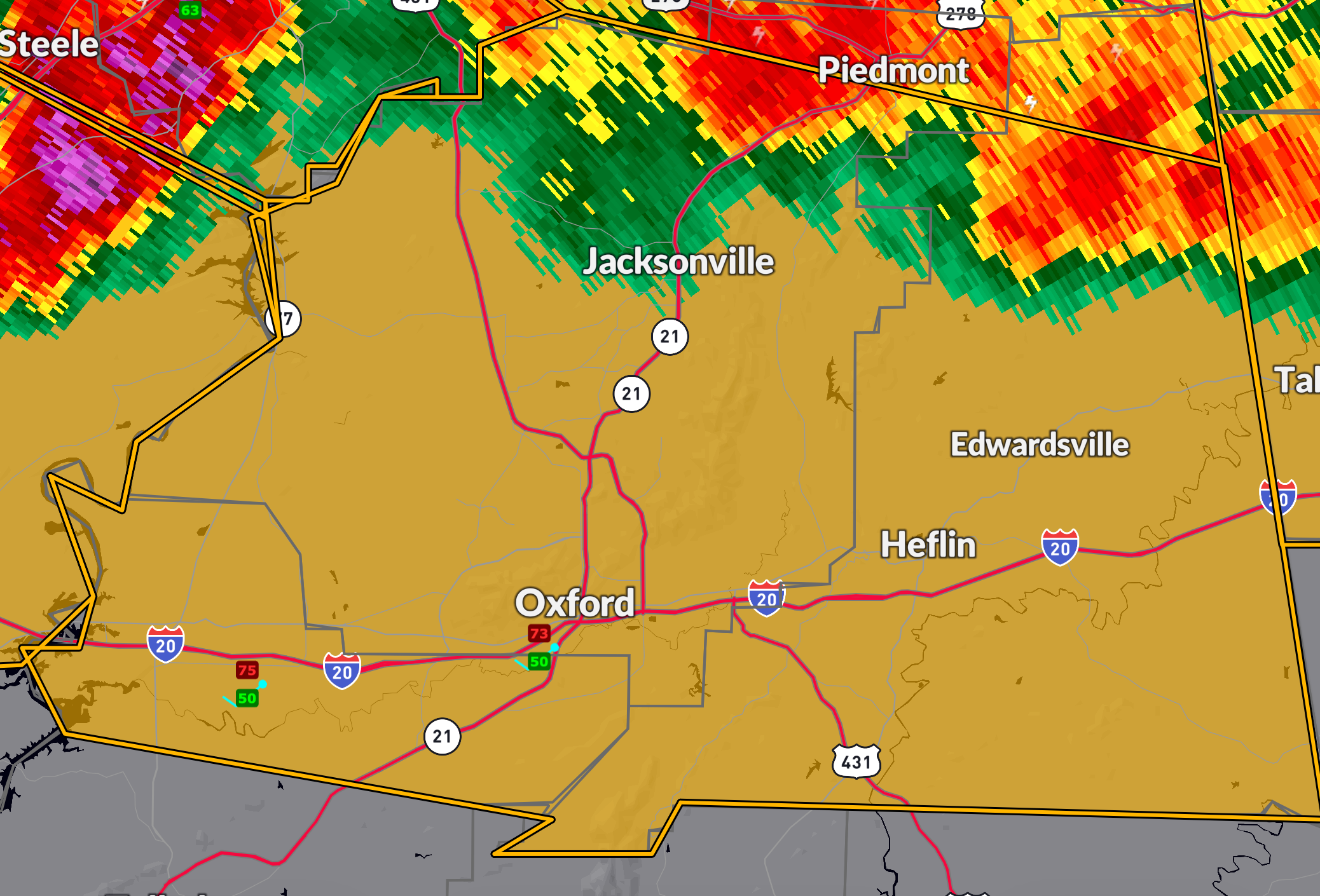
A strong storm is sweeping across East Central Alabama this evening. At 7:40 PM CDT, a severe thunderstorm near Neely Henry Lake—close to Rainbow City—was moving southeast at 45 mph. This storm is capable of producing 60 mph wind gusts and quarter-size hail, which may damage vehicles, roofs, siding, and trees.
Areas at risk include: Anniston, Jacksonville, Heflin, Lincoln, Alexandria, Weaver, Hobson City, Choccolocco, the Talladega Superspeedway, and surrounding communities. The storm is moving quickly, and impacts could be brief but intense.
Take shelter immediately in a sturdy building, away from windows and exterior walls. Remain weather aware as this storm pushes southeastward through Calhoun, Cleburne, and northeastern Talladega counties through 8:30 PM CDT.
Category: Alabama's Weather, ALL POSTS, Severe Weather, Social Media
About the Author (Author Profile)
Bill Murray is the President of The Weather Factory. He is the site's official weather historian and a weekend forecaster. He also anchors the site's severe weather coverage. Bill Murray is the proud holder of National Weather Association Digital Seal #0001 @wxhistorianSubscribe
If you enjoyed this article, subscribe to receive more just like it.


