Severe Thunderstorm Warning for Walker, Blount, Jefferson, and St. Clair Counties Until 8:30 PM CDT
A tree is down on a house on Joy Rd in Blount County. Occupants are uninjured per 911.
 `
`
BULLETIN – IMMEDIATE BROADCAST REQUESTED
Severe Thunderstorm Warning
National Weather Service Birmingham AL
715 PM CDT Thu Apr 10 2025
The National Weather Service in Birmingham has issued a
* Severe Thunderstorm Warning for…
Northeastern Walker County in central Alabama…
Blount County in central Alabama…
Northeastern Jefferson County in central Alabama…
St. Clair County in central Alabama…
* Until 830 PM CDT.
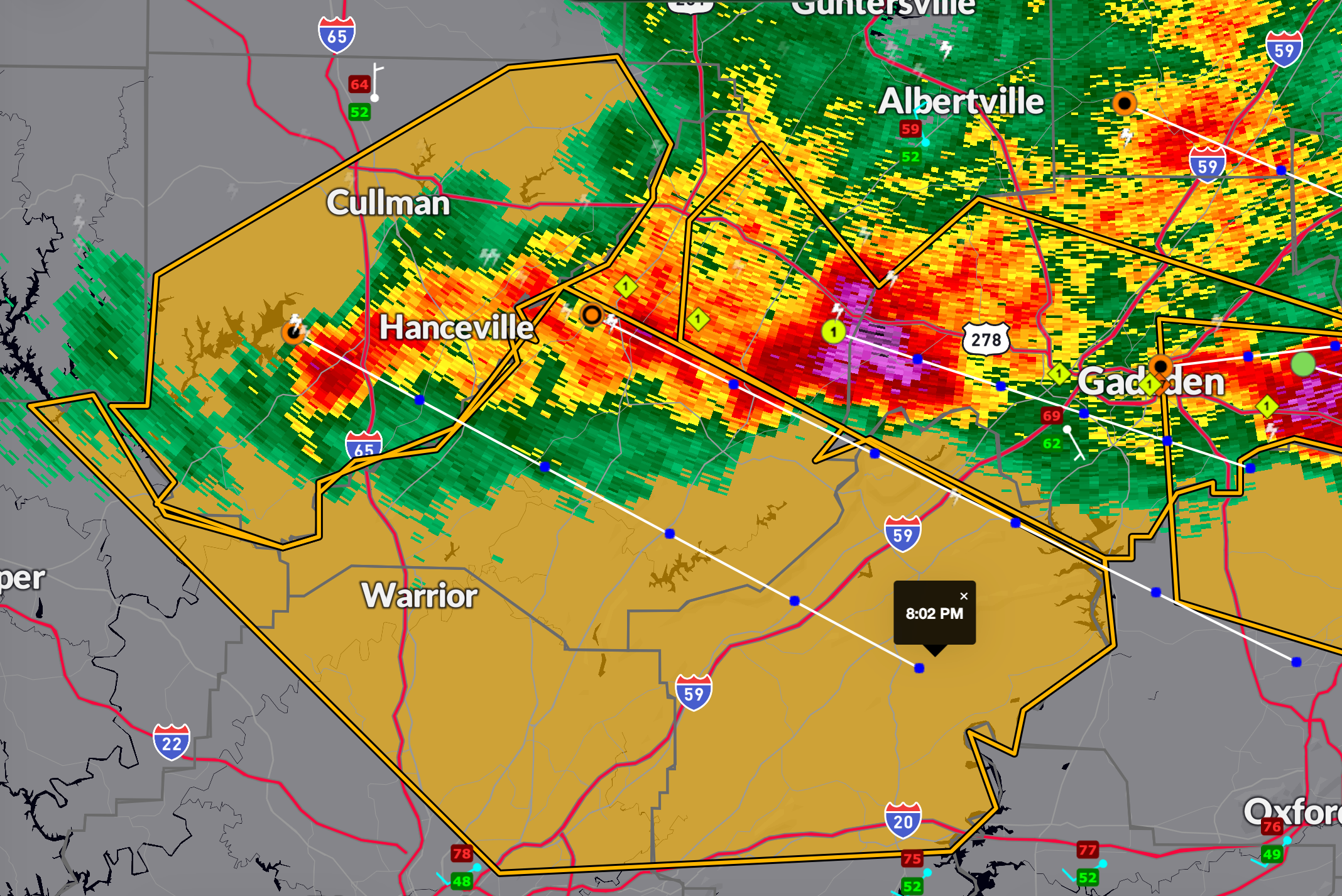
* At 715 PM CDT, severe thunderstorms were located along a line
extending from near Smith Dam to near Bangor to near Susan Moore,
moving southeast at 35 mph.
HAZARD…60 mph wind gusts and quarter size hail.
SOURCE…Radar indicated.
IMPACT…Hail damage to vehicles is expected. Expect wind damage
to roofs, siding, and trees.
* Locations impacted include…
Whitney Junction, Pinson, Palmerdale, Wattsville, Chalkville, Smoke
Rise, New Castle, Fairview, Bangor, Gardendale, Morris, Clay,
Chamblees Mill, Holly Springs, Village Springs, Chula Vista,
Birmingham Race Course, Locust Fork, Trussville, and Blount
Springs.
PRECAUTIONARY/PREPAREDNESS ACTIONS…
For your protection move to an interior room on the lowest floor of a
building.
Category: Alabama's Weather, ALL POSTS, Severe Weather, Social Media
About the Author (Author Profile)
Bill Murray is the President of The Weather Factory. He is the site's official weather historian and a weekend forecaster. He also anchors the site's severe weather coverage. Bill Murray is the proud holder of National Weather Association Digital Seal #0001 @wxhistorianSubscribe
If you enjoyed this article, subscribe to receive more just like it.


