Midday Nowcast: Cloudy with Colder Air Moving into Alabama Today
Apologies for the later than usual update, in my viewing area in Middle Georgia, most of yesterday, overnight, and this morning we have been dealing with ongoing severe storms, but I have caught enough of break to shoot out this forecast.
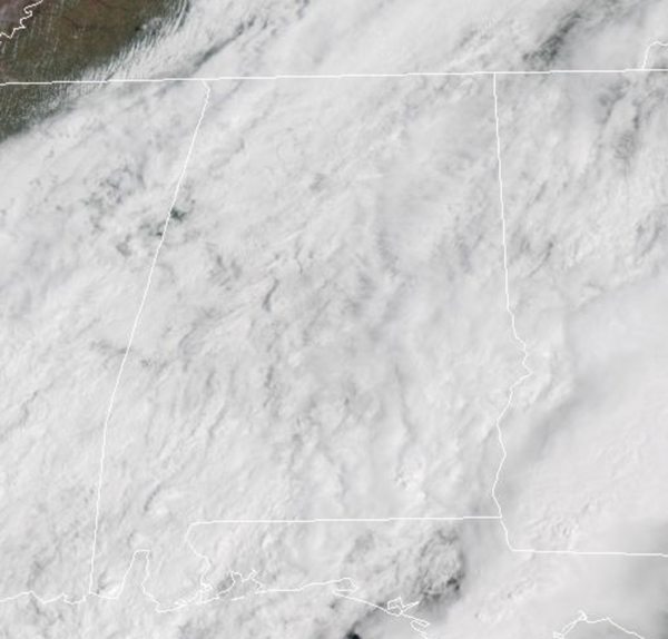
COLDER AIR MOVING IN: A cold front continues to push south through the state today and is pushing the rain and storms out of the state. It is bringing much colder air into the state. It remains mostly cloudy with temperatures holding in the 50s over the northern half of the state. Tonight, the sky will clear, and colder spots over North Alabama could dip into the 30s early tomorrow morning. Tomorrow will be a mostly sunny and cool day with a high in the 60s for most places.
BIRMINGHAM ALMANAC: For April 7th, the average high for Birmingham is 73° and the average low is 50°. The record high is 88° set in 1986, while the record low is 27° set in 1950. We average 0.17” of precipitation on this date and the record value is 3.90” set in 1938.
RIVER FLOODING: Pick a river across the state and it is most likely under some sort of flood warning this week. This includes the Black Warrior, Tombigbee, Alabama, Tennessee, and Upper Coosa Rivers. Expect higher water flow and more debris in the waterways due to heavy rainfall. Many dams across the state have floodgates open.
GROWERS BEWARE: A late season frost/freeze potential is expected Wednesday morning across much of North and Central Alabama. Wednesday will be our coldest morning with low to mid 30s expected. Frost is likely, and colder spots will see a freeze. Make sure you protect any sensitive plants and vegetation that could be damaged by the cold. This will more than likely be the last widespread freeze/frost threat of the season for most communities, and after Wednesday morning we are giving the green light to plant. Next time we see lows in the low and mid 30s will likely be November.
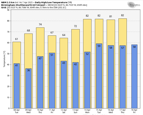
SHOWERS RETURN: A wave of energy will bring the chance of some light rain showers to the state late Thursday, Thursday night, and Friday, but rain amounts will be generally under 1/4 inch for most places. The high Thursday will be in the 70s, then dropping back into the 60s Friday.
WEEKEND AND BEYOND: The weekend will be cool and dry across the Deep South. Lows will be mostly in the 40s, with highs in the 60s Saturday and 70s Sunday. At this point it looks like the weather will stay mostly dry next week as an upper ridge begins to rebuild; highs return to the low 80s.
WORLD TEMPERATURE EXTREMES: Over the last 24 hours, the highest observation outside the U.S. was 115.5F at Nawabshah, Pad Idan, and Sibi, Pakistan. The lowest observation was -97.1F at Dome A, Antarctica.
CONTIGUOUS TEMPERATURE EXTREMES: Over the last 24 hours, the highest observation was 94F at numerous locations across Florida. The lowest observation was -3F at Peter Sinks, UT.
Category: Alabama's Weather, ALL POSTS, Social Media
About the Author (Author Profile)
Macon, Georgia Television Chief Meteorologist, Birmingham native, and long time Contributor on AlabamaWX. Stormchaser. I did not choose Weather, it chose Me. College Football Fanatic. @Ryan_StinnetSubscribe
If you enjoyed this article, subscribe to receive more just like it.


