A Small Threat for Severe Weather Still Present over Parts of Central and South Alabama
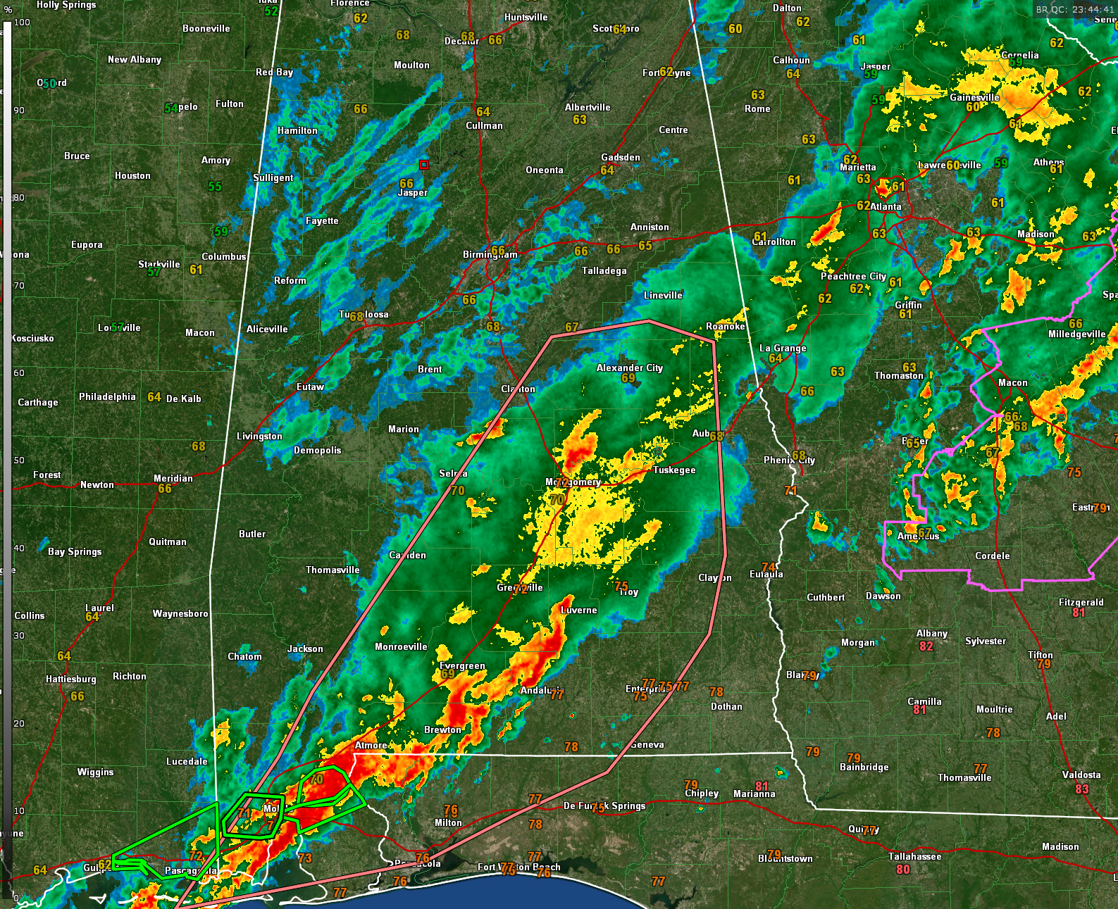
While the widespread severe weather threat has eased across much of Alabama, the Storm Prediction Center notes that some risk for isolated damaging winds or even a brief tornado remains in parts of central and southern Alabama through the evening. A few storms near Montgomery and east of Mobile have recently shown signs of strengthening, especially where they interact with old outflow boundaries.
Even though storms have generally struggled to maintain structure due to weaker lapse rates and undercutting outflows, there is still enough instability—along with a persistent low-level jet enhancing wind shear—to support the possibility of a few more robust cells. Any storms that manage to root along the boundaries could quickly ramp up, especially in environments with 1000–1500 J/kg of CAPE and 30–40 kt of low-level wind speeds.
At this time, a new watch is not anticipated. However, trends will continue to be monitored closely, particularly in areas like the Montgomery vicinity and across the Florida Panhandle. Residents in those areas should remain weather-aware as the evening progresses.
Category: Alabama's Weather, ALL POSTS, Severe Weather, Social Media
About the Author (Author Profile)
Bill Murray is the President of The Weather Factory. He is the site's official weather historian and a weekend forecaster. He also anchors the site's severe weather coverage. Bill Murray is the proud holder of National Weather Association Digital Seal #0001 @wxhistorianSubscribe
If you enjoyed this article, subscribe to receive more just like it.


