Spoke Too Soon: SVR Issued in Montgomery Area
SEVERE STORMS CONTINUE…
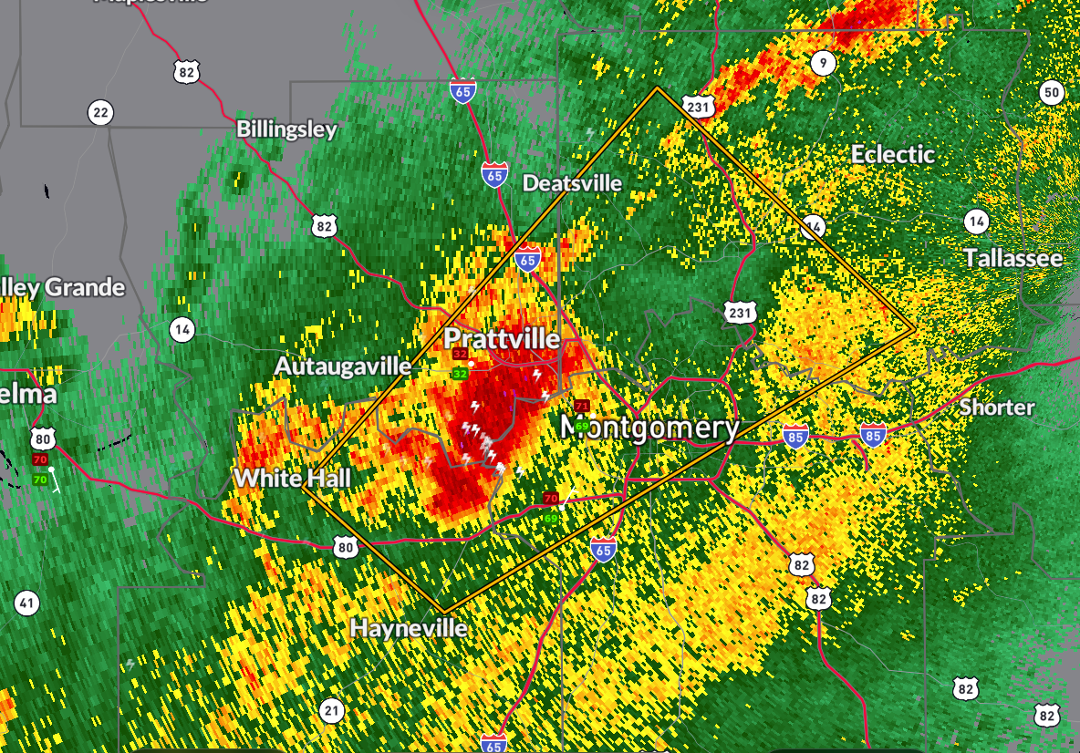
The threat isn’t over yet. The National Weather Service in Birmingham has issued a
Severe Thunderstorm Warning until 7:00 PM CDT for parts of Autauga,
Elmore, Lowndes, and Montgomery counties.
At 6:05 PM CDT, a severe thunderstorm near Hunter—just northwest of Montgomery—was
moving northeast at 35 mph. Radar indicates the storm could produce wind gusts up to 60 mph
and penny-size hail. This storm has the potential to damage roofs, siding, and trees.
Locations in the path include:
Prattville, Millbrook, Wetumpka, Maxwell AFB, Lagoon Park, the Montgomery Zoo,
Alabama State University, Deatsville, and Coosada.
Meteorologist Hunter Robinson at NWS Birmingham reports some weak rotation with the storm
as it crosses the river near Montgomery, but no tornado warning has been issued at this time.
Take cover now if you’re in the warning area. Move to an interior room on the lowest
floor of a sturdy building.
More updates as needed…stay weather aware this evening.
Category: Alabama's Weather, ALL POSTS, Severe Weather, Social Media
About the Author (Author Profile)
Bill Murray is the President of The Weather Factory. He is the site's official weather historian and a weekend forecaster. He also anchors the site's severe weather coverage. Bill Murray is the proud holder of National Weather Association Digital Seal #0001 @wxhistorianSubscribe
If you enjoyed this article, subscribe to receive more just like it.


