TORNADO WARNING Issued for Mobile County Until 3:30pm
A tornado warning has been issued for West Central Mobile county until 3:30pm. The area of concern is currently located over Hurley, MS and will move across the state line soon. It will be headed northeast towards the Semmes area. Take shelter now if you are within the warning area!
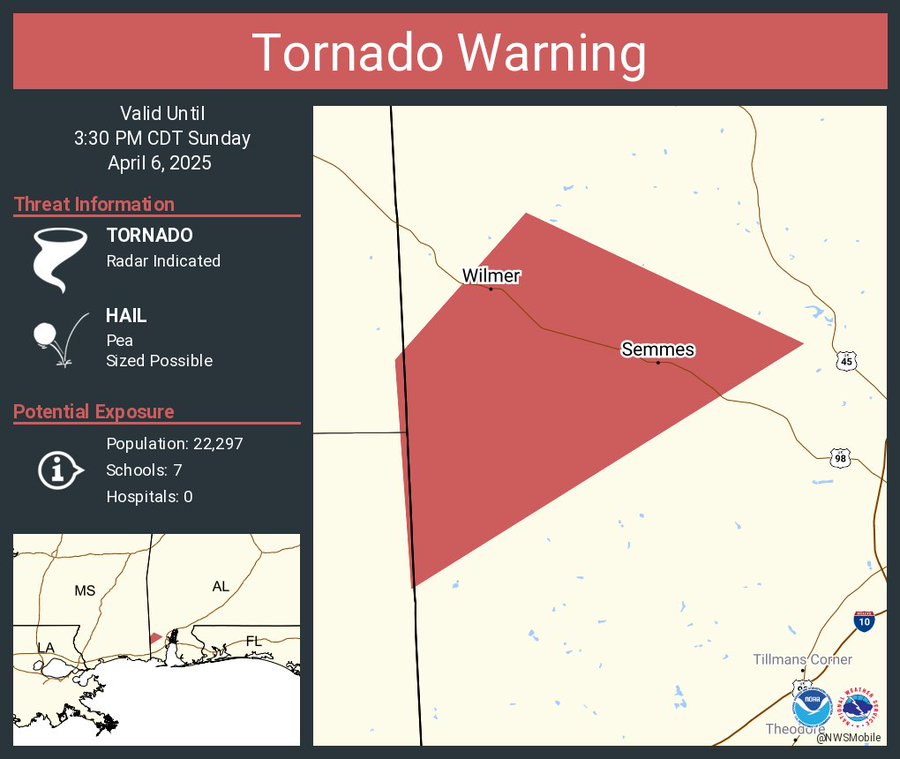
The National Weather Service in Mobile has issued a

* Tornado Warning for...
  West central Mobile County in southwestern Alabama...

* Until 330 PM CDT.

* At 249 PM CDT, a severe thunderstorm capable of producing a tornado
  was located over Hurley, or 11 miles northeast of Escatawpa, moving
  northeast at 40 mph.

  HAZARD...Tornado.

  SOURCE...Radar indicated rotation.

  IMPACT...Flying debris will be dangerous to those caught without
           shelter. Mobile homes will be damaged or destroyed.
           Damage to roofs, windows, and vehicles will occur.  Tree
           damage is likely.

* This dangerous storm will be near...
  Tanner Williams around 255 PM CDT.
  Semmes around 305 PM CDT.

PRECAUTIONARY/PREPAREDNESS ACTIONS...

TAKE COVER NOW! Move to a basement or an interior room on the lowest
floor of a sturdy building. Avoid windows. If you are outdoors, in a
mobile home, or in a vehicle, move to the closest substantial shelter
and protect yourself from flying debris.
Category: Alabama's Weather, ALL POSTS, Severe Weather, Social Media
About the Author (Author Profile)
Scott is a senior at Mississippi State University studying professional and broadcast meteorology.Subscribe
If you enjoyed this article, subscribe to receive more just like it.


