Update on the Alabama Weather Situation at 935 a.m.
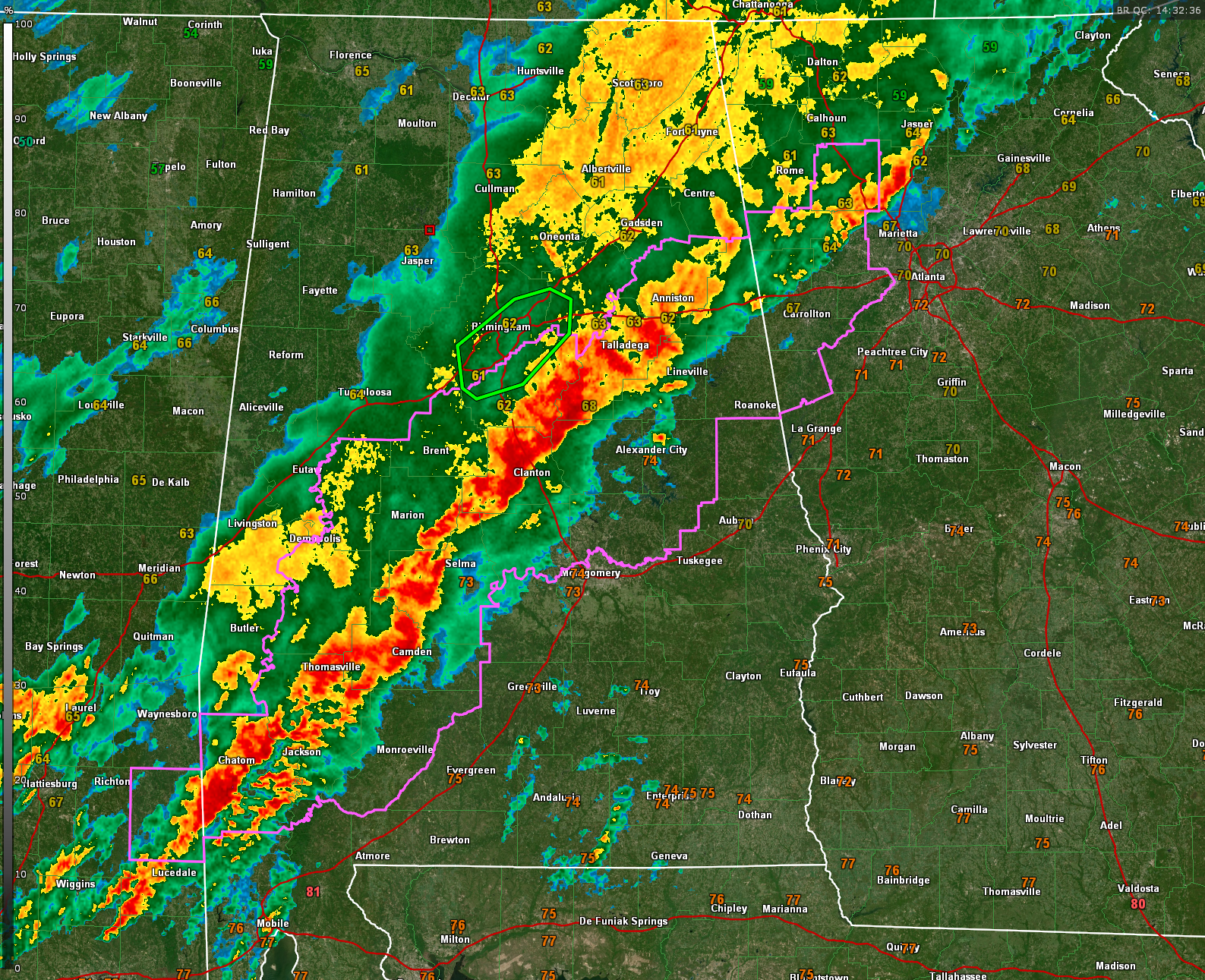
Storm coverage has diminished slightly in recent hours, but that lull may not last much longer. A new round of intensification is likely, and the Storm Prediction Center indicates a new tornado watch will probably be needed soon for areas east of the current one. Strengthening low-level winds and some daytime heating are expected to increase storm organization and intensity as the morning progresses, especially across southeast Mississippi, southwest and central Alabama, and eventually into Georgia and the Florida Panhandle.
The most persistent area of rain and embedded storms stretches from Calhoun and Cleburne counties through Talladega, St. Clair, southern Shelby, northern Chilton, and into parts of Perry, Dallas, Wilcox, and Clarke counties. There is some concern about a developing inflection point in the line over Chilton County that could enhance the severe or even tornadic threat in that area over the next hour or two.
Flash flood warnings have been allowed to expire across much of the state, including the one for Jefferson and Shelby counties that has been replaced with a flood advisory. Flooding is ongoing in parts of Hoover, where Valleydale Road is impassable near Veteran’s Park. Please avoid flooded roads and continue to use caution in areas with poor drainage.
Tornado Watch 131 remains in effect until 10 AM, but with storms expected to ramp up again late this morning, forecasters are already discussing issuing a new watch to cover central and eastern Alabama. Remain alert, especially if you live east or southeast of the current line of storms.
Category: Alabama's Weather, ALL POSTS, Severe Weather, Social Media
About the Author (Author Profile)
Bill Murray is the President of The Weather Factory. He is the site's official weather historian and a weekend forecaster. He also anchors the site's severe weather coverage. Bill Murray is the proud holder of National Weather Association Digital Seal #0001 @wxhistorianSubscribe
If you enjoyed this article, subscribe to receive more just like it.


