Tornado Warning for DeKalb and Jackson Counties
BULLETIN – EAS ACTIVATION REQUESTED
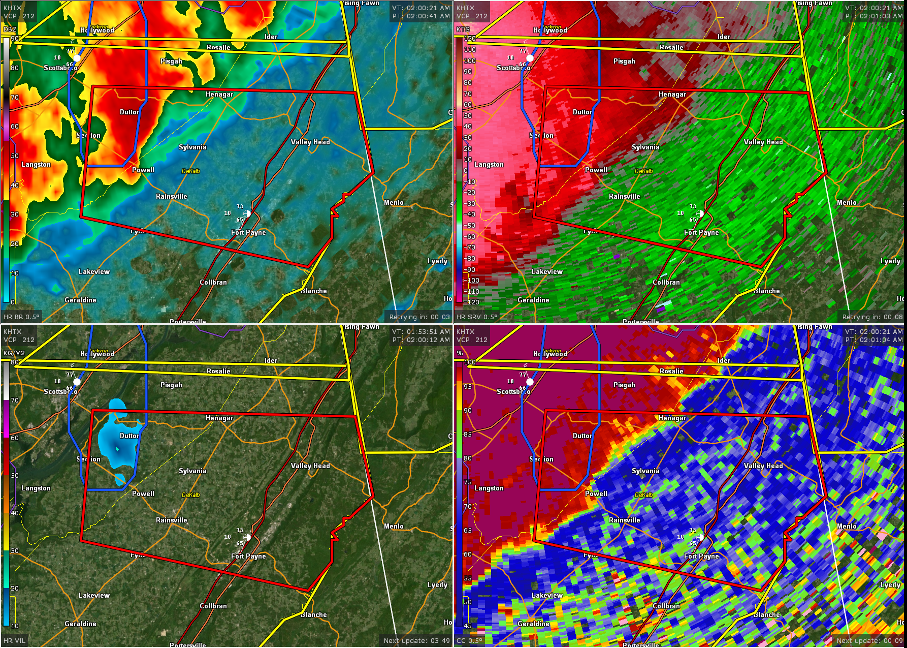
Tornado Warning
National Weather Service Huntsville AL
201 AM CDT Sun Apr 6 2025
The National Weather Service in Huntsville Alabama has issued a
* Tornado Warning for…
South central Jackson County in northeastern Alabama…
Central DeKalb County in northeastern Alabama…
* Until 245 AM CDT.
* At 201 AM CDT, a severe thunderstorm capable of producing a tornado
was located over Powell, or near Rainsville, moving east at 40 mph.
HAZARD…Tornado.
SOURCE…Radar indicated rotation.
IMPACT…Flying debris will be dangerous to those caught without
shelter. Mobile homes will be damaged or destroyed.
Damage to roofs, windows, and vehicles will occur. Tree
damage is likely.
* This dangerous storm will be near…
Sylvania, Powell, and Rainsville around 205 AM CDT.
Fort Payne around 210 AM CDT.
Other locations impacted by this tornadic thunderstorm include
Dutton, Pine Ridge, Mentone, Desoto State Park, Valley Head,
Hammondville, and Little River Canyon NP.
PRECAUTIONARY/PREPAREDNESS ACTIONS…
TAKE COVER NOW! Move to a basement or an interior room on the lowest
floor of a sturdy building. Avoid windows. If you are outdoors, in a
mobile home, or in a vehicle, move to the closest substantial shelter
and protect yourself from flying debris.
Heavy rainfall may hide this tornado. Do not wait to see or hear the
tornado. TAKE COVER NOW!
Category: Alabama's Weather, ALL POSTS, Severe Weather, Social Media
About the Author (Author Profile)
Bill Murray is the President of The Weather Factory. He is the site's official weather historian and a weekend forecaster. He also anchors the site's severe weather coverage. Bill Murray is the proud holder of National Weather Association Digital Seal #0001 @wxhistorianSubscribe
If you enjoyed this article, subscribe to receive more just like it.


