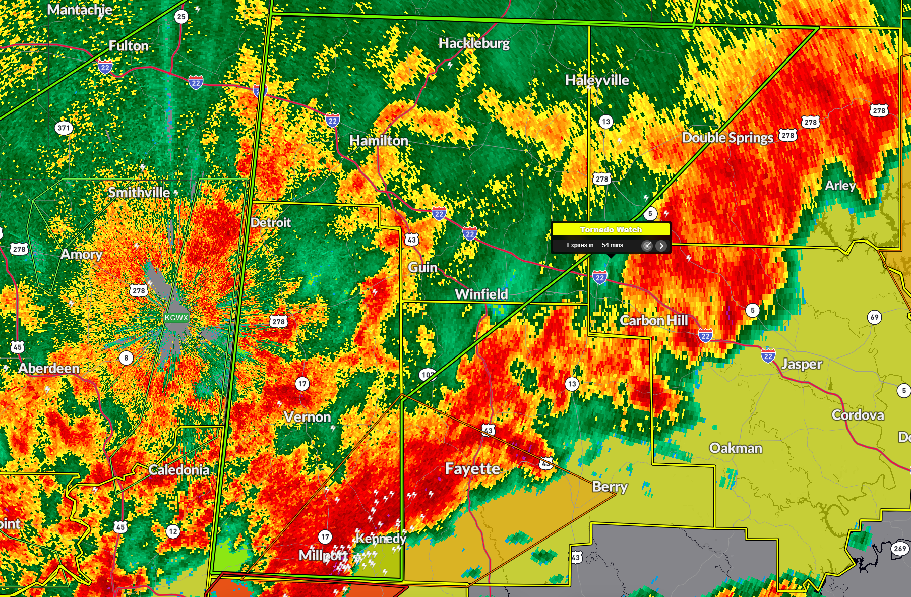
Flash Flood Warning for Marion, Winston, Fayette, and Lamar Counties
BULLETIN – EAS ACTIVATION REQUESTED
Flash Flood Warning
National Weather Service Birmingham AL
156 AM CDT Sun Apr 6 2025
The National Weather Service in Birmingham has issued a
* Flash Flood Warning for…
Marion County in northwestern Alabama…
Western Winston County in northwestern Alabama…
Northwestern Fayette County in west central Alabama…
Lamar County in west central Alabama…
* Until 630 AM CDT.
* At 156 AM CDT, Doppler radar indicated thunderstorms producing
heavy rain across the warned area. Between 1.5 and 2.5 inches of
rain have fallen. Additional rainfall amounts of 1 to 2 inches are
possible in the warned area. Flash flooding is ongoing or expected
to begin shortly.
HAZARD…Flash flooding caused by thunderstorms.
SOURCE…Radar.
IMPACT…Flash flooding of small creeks and streams, urban
areas, highways, streets and underpasses as well as
other poor drainage and low-lying areas.
* Some locations that will experience flash flooding include…
Hamilton, Winfield, Haleyville, Vernon, Sulligent, Millport, Lynn,
Guin, Hackleburg, Double Springs, Brilliant, Glen Allen, Kennedy,
Detroit, Beaverton, Gu-Win, Brinn, Bluff, Weston and Crews.
PRECAUTIONARY/PREPAREDNESS ACTIONS…
Turn around, don’t drown when encountering flooded roads. Most flood
deaths occur in vehicles.
Be especially cautious at night when it is harder to recognize the
dangers of flooding.
Be aware of your surroundings and do not drive on flooded roads.
Category: Alabama's Weather, ALL POSTS, Severe Weather, Social Media
About the Author (Author Profile)
Bill Murray is the President of The Weather Factory. He is the site's official weather historian and a weekend forecaster. He also anchors the site's severe weather coverage. Bill Murray is the proud holder of National Weather Association Digital Seal #0001 @wxhistorianSubscribe
If you enjoyed this article, subscribe to receive more just like it.


