Storms Increasing in Intensity Across West, Northwest, and North Alabama
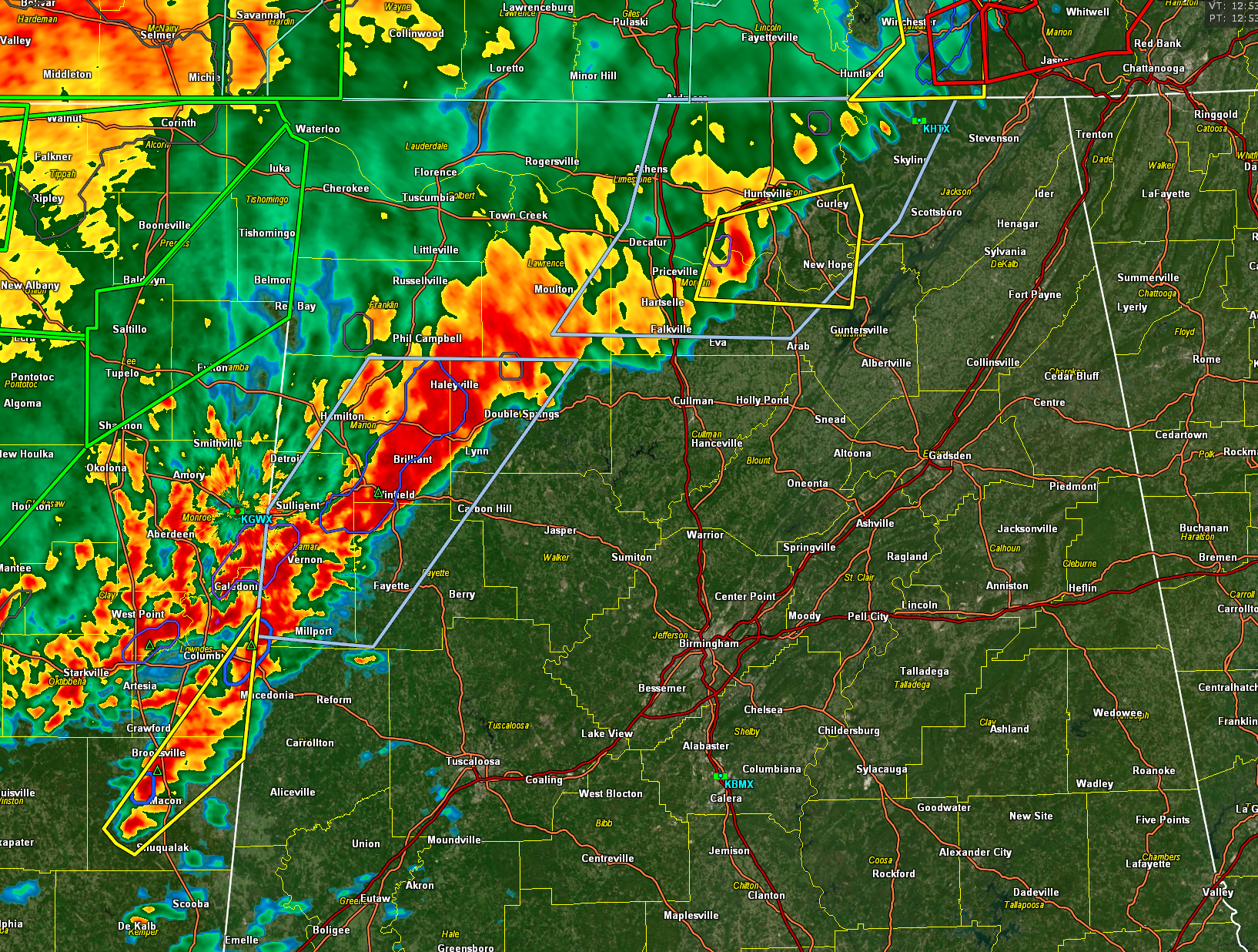
We’re watching storms just west of Alabama closely — one near Macon, MS, is showing signs of better organization with weak rotation, and another strong cell is approaching far northwest Pickens County. Stay alert as these storms move eastward.
Overall, the intensity of the initial line has ramped up substantially in the past hour. There is 1000-1500 joules of CAPE, 50-60 knots of bulk 0-6 km shear, and 250-350 m2/s2 of 0-1km helicity over West Alabama, so the storms remain capable of producing severe weather.
The severe threat will continue through the overnight hours and much of the day on Sunday for much of Alabama as the storms slowly shift southeastward ahead of a cold front.
A tornado watch remains in effect until 3 a.m. for parts of North and Central Alabama and additional watches will be required later.
Category: Alabama's Weather, ALL POSTS, Severe Weather, Social Media
About the Author (Author Profile)
Bill Murray is the President of The Weather Factory. He is the site's official weather historian and a weekend forecaster. He also anchors the site's severe weather coverage. Bill Murray is the proud holder of National Weather Association Digital Seal #0001 @wxhistorianSubscribe
If you enjoyed this article, subscribe to receive more just like it.


