Tornadic Storm Moving out of North Alabama; Main Even for Central Alabama Later; Flooding Threat Will Ramp Up
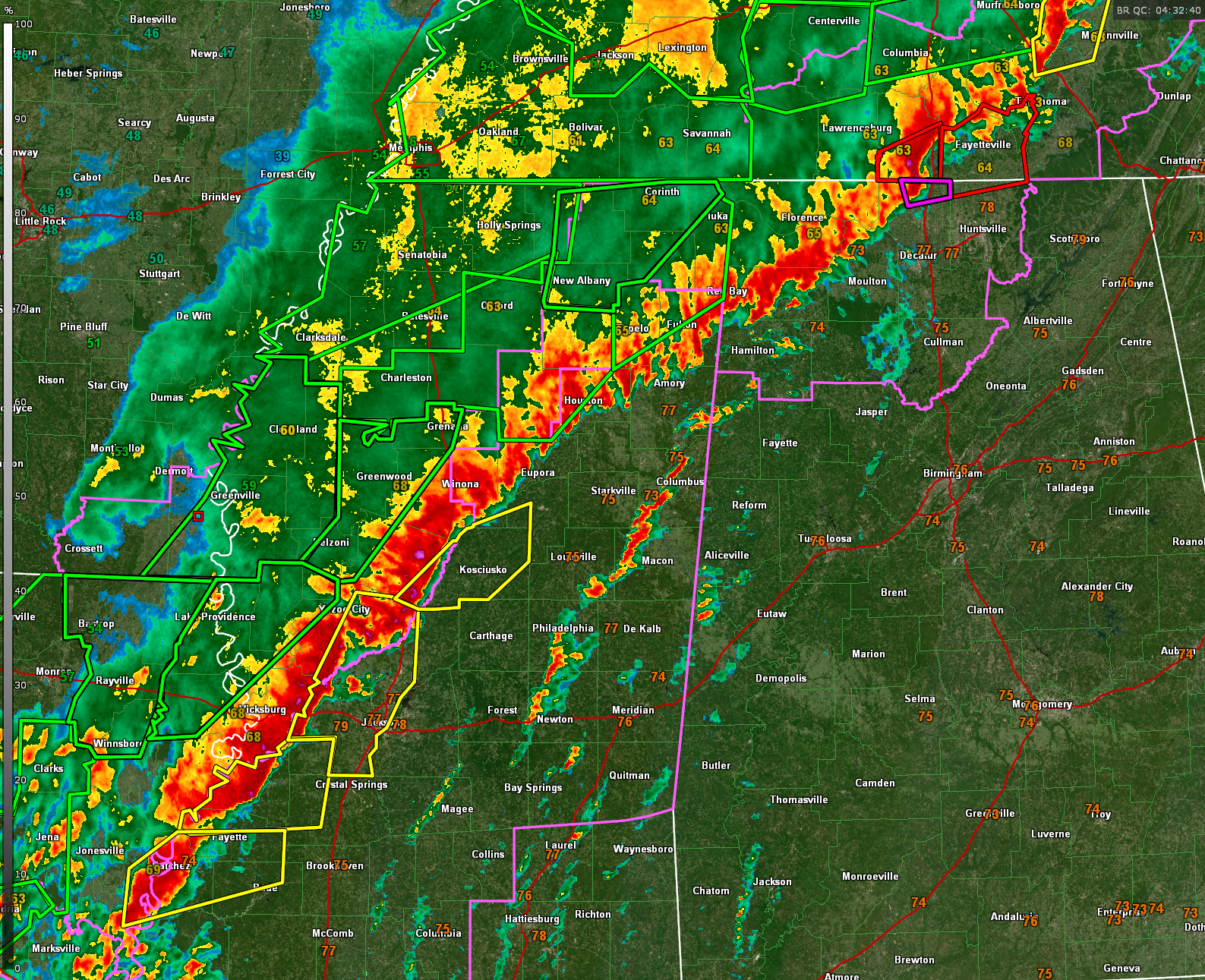
Severe weather continues tonight across northern Mississippi and northwest Alabama. A powerful squall line stretches from Limestone County through eastern Colbert and Franklin Counties in Alabama, extending southwestward through Smithville, Okolona, Winona, Lexington, Edwards, and into Vidalia, Mississippi.
In northern Alabama, the tornadic storm is beginning to bow out as it pushes eastward northeastward, and the greatest tornado risk now lies along and south of a boundary that’s shifted into southern Tennessee. While storms trailing behind the outflow boundary are likely elevated and less favorable for tornado development, any new storms that interact with that boundary could regain tornado potential. Cloud bases are lowering, and a new watch or extension may be needed for parts of north Alabama.
In Mississippi, a new tornado watch has been issued all the way to the Alabama state line. The primary concern with this line will be damaging straight-line winds, but isolated spin-up tornadoes remain possible, especially if any cells develop ahead of the main line. Central Alabama is not included in the new watch for now, but conditions will be monitored closely for a potential downstream watch later tonight.
Flash flooding is also becoming a growing concern, especially as storms train over the same areas through the overnight and early morning hours.
Category: Alabama's Weather, ALL POSTS, Severe Weather, Social Media
About the Author (Author Profile)
Bill Murray is the President of The Weather Factory. He is the site's official weather historian and a weekend forecaster. He also anchors the site's severe weather coverage. Bill Murray is the proud holder of National Weather Association Digital Seal #0001 @wxhistorianSubscribe
If you enjoyed this article, subscribe to receive more just like it.


