New Tornado Warning For Parts of Franklin, Colbert and Lauderdale
Circulation crossing state line into southwestern Colbert County will move near Barton and eventually the Quad Cities.
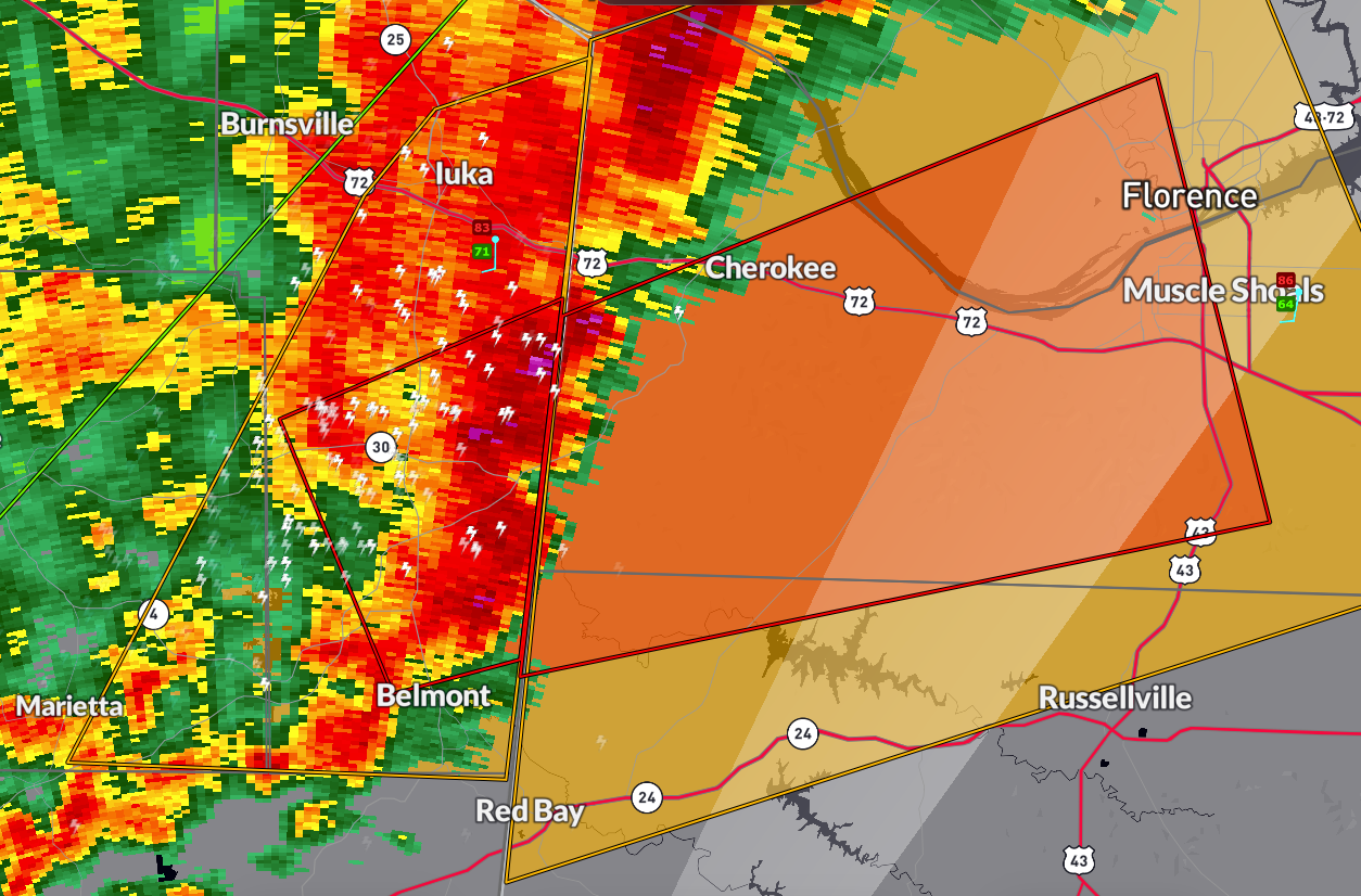
BULLETIN – EAS ACTIVATION REQUESTED
Tornado Warning
National Weather Service Huntsville AL
951 PM CDT Sat Apr 5 2025
The National Weather Service in Huntsville Alabama has issued a
* Tornado Warning for…
South central Lauderdale County in northwestern Alabama…
Southwestern Colbert County in northwestern Alabama…
Northwestern Franklin County in northwestern Alabama…
* Until 1030 PM CDT.
* At 950 PM CDT, a confirmed tornado was located over Tishomingo
State Park, moving east at 35 mph.
HAZARD…Damaging tornado.
SOURCE…Weather spotters confirmed tornado.
IMPACT…Flying debris will be dangerous to those caught without
shelter. Mobile homes will be damaged or destroyed.
Damage to roofs, windows, and vehicles will occur. Tree
damage is likely.
* This tornadic thunderstorm will remain over mainly rural areas of
south central Lauderdale, southwestern Colbert and northwestern
Franklin Counties, including the following locations… Malone,
Posey Loop, Pogo, Mt Hester, Srygley Church, New Bethel, Allsboro,
Maud, Barton, and Red Rock.
PRECAUTIONARY/PREPAREDNESS ACTIONS…
To repeat, a tornado is on the ground. TAKE COVER NOW! Move to a
basement or an interior room on the lowest floor of a sturdy
building. Avoid windows. If you are outdoors, in a mobile home, or in
a vehicle, move to the closest substantial shelter and protect
yourself from flying debris.
&&
Category: Alabama's Weather, ALL POSTS, Severe Weather, Social Media
About the Author (Author Profile)
Bill Murray is the President of The Weather Factory. He is the site's official weather historian and a weekend forecaster. He also anchors the site's severe weather coverage. Bill Murray is the proud holder of National Weather Association Digital Seal #0001 @wxhistorianSubscribe
If you enjoyed this article, subscribe to receive more just like it.


