Extreme Northwest Alabama Under the Gun with New Tornado Warning
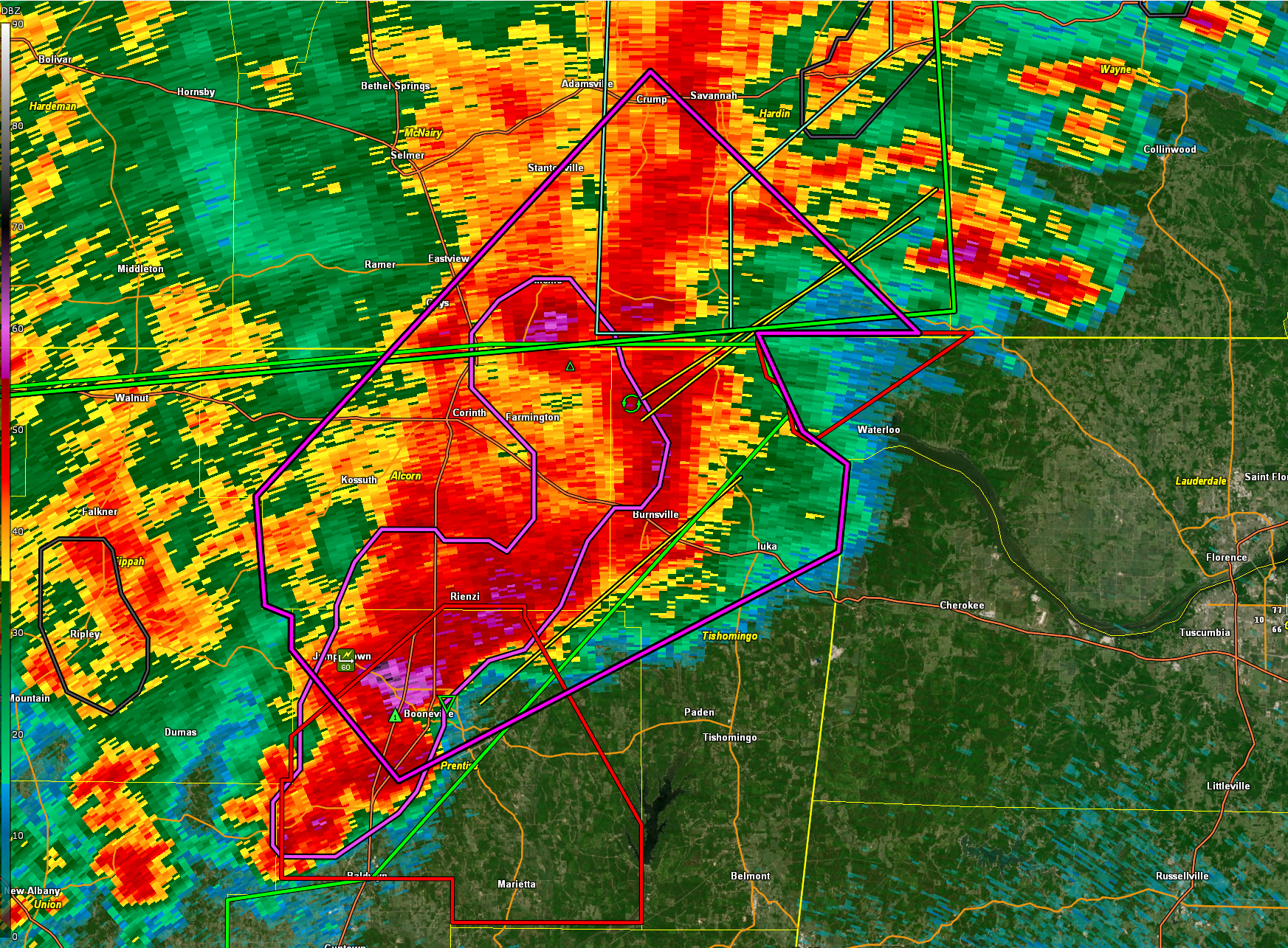
A dangerous situation is unfolding this evening across northeastern Mississippi and now spreading into northwest Alabama as a cluster of tornadic supercells continues to produce damage.
The most dangerous storm at this hour is in southeastern Alcorn County, approaching US-72 west of Burnsville. Another tornadic storm is southwest of Booneville in Prentiss County, and a third is just west of Baldwyn. A new tornado warning is also in effect for Calhoun and Pontotoc Counties, where a dangerous storm is tracking between Bruce and Pittsboro.
Damage has already been reported in New Albany and other parts of Union County, with another tornado sighted near the Toyota plant in Blue Springs.
At 8:00 PM, a new tornado warning was issued for northwestern Lauderdale County, Alabama. A severe storm with radar-indicated rotation was located near Pineflat, moving northeast at 45 mph. While this storm will mainly remain over rural areas, anyone in its path should seek shelter immediately. Nighttime tornadoes are especially dangerous — do not wait to see it.
Residents across northwest Alabama should remain alert, have multiple ways to receive warnings, and be ready to act quickly if a warning is issued.
These storms are expected to affect parts of Colbert, Franklin, and possibly Marion Counties in northwest Alabama over the next 2 to 3 hours. Additional storms will move into the region closer to midnight. These storms will move slowly east and southeast through the overnight hours and much of the day on Sunday.
Category: Alabama's Weather, ALL POSTS, Severe Weather, Social Media
About the Author (Author Profile)
Bill Murray is the President of The Weather Factory. He is the site's official weather historian and a weekend forecaster. He also anchors the site's severe weather coverage. Bill Murray is the proud holder of National Weather Association Digital Seal #0001 @wxhistorianSubscribe
If you enjoyed this article, subscribe to receive more just like it.


