Severe Thunderstorm Warning In Effect Until 5:45pm For Parts Of Franklin, Lawrence, And Colbert Counties
The National Weather Service in Huntsville Alabama has issued a
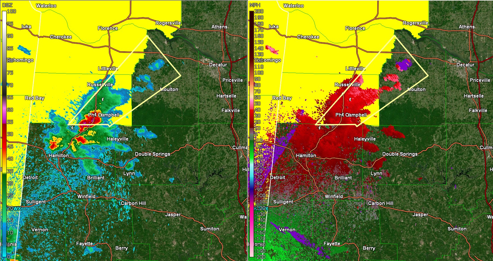
* Severe Thunderstorm Warning for...
Southeastern Colbert County in northwestern Alabama...
Eastern Franklin County in northwestern Alabama...
Northwestern Lawrence County in northwestern Alabama...
* Until 545 PM CDT.
* At 451 PM CDT, a severe thunderstorm was located over Hackleburg,
or 12 miles northwest of Haleyville, moving northeast at 40 mph.
HAZARD...60 mph wind gusts and quarter size hail.
SOURCE...Radar indicated.
IMPACT...Hail damage to vehicles is expected. Expect wind damage
to roofs, siding, and trees.
* Locations impacted include...
Mt Hope, Chalybeate Springs, La Grange, Tharptown, Ne Smith,
Duketon, Landersville, Town Creek, Hatton, and Newburg.
PRECAUTIONARY/PREPAREDNESS ACTIONS...
For your protection move to an interior room on the lowest floor of a
building.
A Tornado Watch remains in effect until 900 PM CDT for northwestern
Alabama.
Category: Alabama's Weather, ALL POSTS, Social Media
About the Author (Author Profile)
Jack is a junior at Mississippi State University studying meteorology. He has several years of forecasting experience through a local group of forecasters in Maryland where he resides. Jack plans to become a broadcast meteorologist after graduation.Subscribe
If you enjoyed this article, subscribe to receive more just like it.


