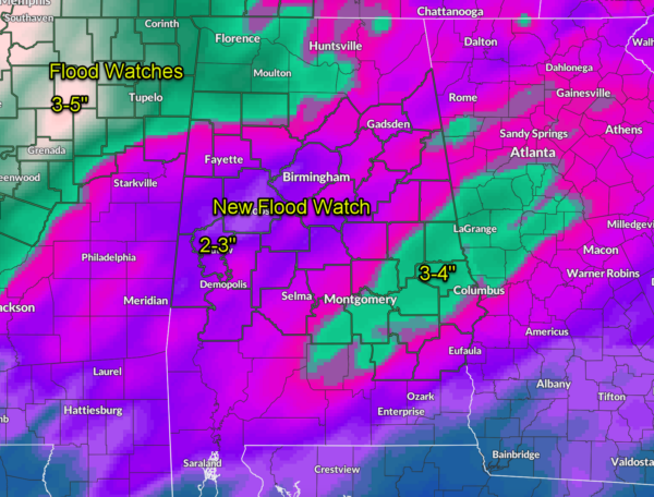
Flood Watch Issued for Central Alabama
The National Weather Service in Birmingham has issued a Flood Watch for a large portion of Central Alabama, in effect from 9 p.m. this evening through Monday evening. Widespread heavy rain is expected as a slow-moving frontal system and line of thunderstorms sweep across the state, bringing the potential for 2 to 4 inches of rain—with locally higher totals possible. The watch includes nearly every county from Marion and Lamar in the northwest to Barbour and Russell in the southeast, including the Birmingham, Montgomery, Tuscaloosa, and Auburn metro areas.
This setup could result in significant runoff and flooding, especially in urban locations and low-lying or flood-prone areas. Rivers, creeks, and streams will be on the rise late tonight into Sunday, with the heaviest rainfall expected overnight and during the day Sunday. Localized flash flooding will be possible where storms train over the same areas, and water could quickly cover roads—particularly in areas with poor drainage.
If you live in a flood-prone area, now is the time to prepare. Stay weather aware through the weekend, avoid driving through flooded roadways, and be ready to act quickly if a Flash Flood Warning is issued. Conditions could deteriorate rapidly tonight and Sunday as storms ramp up and the front slows across the region. As always, Turn Around, Don’t Drown.
Category: Alabama's Weather, ALL POSTS, Severe Weather, Social Media


