Saturday Morning Weather Briefing Video: Severe Threat Tonight Through Sunday Afternoon for Alabama
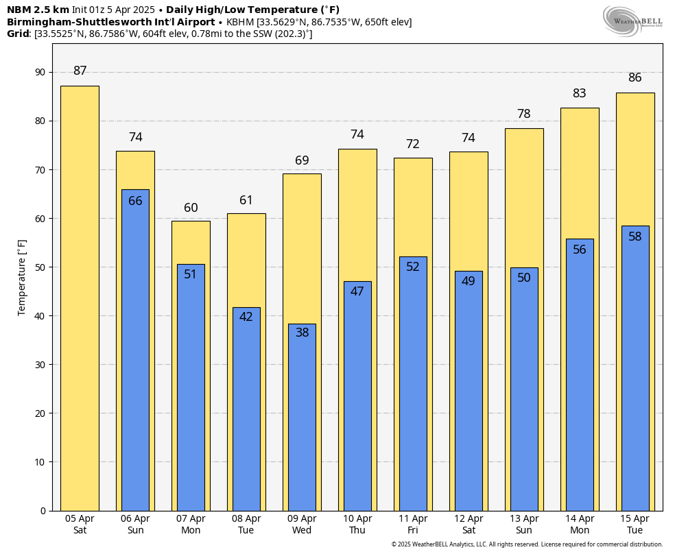
Record-breaking heat closed out the workweek across Central Alabama, with Tuscaloosa and Anniston setting or tying high temperature marks. Tuscaloosa hit 88°, breaking the old record of 87° set just two years ago, while Anniston matched its long-standing record of 86° from 1969. Highs surged into the mid to upper 80s across much of North and Central Alabama, with a few isolated showers popping up in the western half of the state. Winds were gusty from the southeast and skies were partly to mostly cloudy—classic ingredients in a pattern fueled by a stubborn ridge aloft that’s finally beginning to break down.
SATURDAY STORMS
While the day will start warm and mostly dry, attention quickly turns to the west. A potent upper trough over the Southwest U.S. will send a cold front marching eastward, and pre-frontal thunderstorms could begin developing over western Alabama by midday Saturday. The severe threat during the daylight hours will be more limited, with enough convective inhibition and lingering ridging to keep most storms under control—but we can’t rule out a strong storm or two by afternoon, especially in the far western and northwestern counties.
HEAT HANGS ON ONE MORE DAY
Despite increasing clouds and shower chances, Saturday will again feature unseasonably hot temperatures. Highs will reach the upper 80s across much of Central and South Alabama, with a few 90s not out of the question if enough sun breaks through early. Expect breezy conditions out of the south, with gusts up to 25 mph making it feel like the kind of day better suited for late May than early April.
SATURDAY NIGHT: THINGS GET SERIOUS
The main show begins after dark. A rain cooled boundary will sink into North Alabama Saturday evening. Some of the storms along this boundary could be severe during the evening. A strengthening low-level jet, favorable wind profiles, and a sharpening frontal boundary will combine to generate a line of thunderstorms that will begin crossing the Mississippi River Saturday evening and reach western Alabama around or just after midnight. This is when the severe threat ramps up significantly. Damaging winds, isolated tornadoes, and large hail will all be possible—especially with any discrete cells that can form ahead of the main line. The 0–1 km helicity values will support low-level rotation, and lapse rates suggest large hail could be a concern in those more isolated updrafts.
SUNDAY: THE SLOW ROLL EAST
By Sunday morning, storms will be moving slowly through Central Alabama, reaching Birmingham by mid morning and continuing into South Alabama through the afternoon and evening. The slower forward progression means storms will have more time to tap into the moist and unstable environment, and that could elevate the tornado risk in the southern and southeastern counties by afternoon. The entire state remains under a Level 2 (Slight) risk for severe weather, but don’t let that lower tier fool you—storm mode and timing will determine impacts. All modes of severe weather are on the table, including damaging winds, hail, and a few tornadoes. We’ll be watching for areas that destabilize quickly ahead of the front, especially in zones where the sun peeks out between waves.
FLOOD RISK TAKES CENTER STAGE
In addition to the severe threat, very heavy rainfall is expected with these storms. The setup features anomalously high precipitable water values, rich low-level moisture, and training cells. Rainfall totals of 2 to 4 inches are likely across much of the area, with some spots picking up even more. Flash flooding and localized inundation are possible, especially in areas with poor drainage or where storms repeat. The Weather Prediction Center has much of the region in a Moderate Risk for excessive rainfall—so stay alert if you’re in a flood-prone location.
MONDAY: COOL AIR COMES CRASHING IN
As the front finally exits the state Sunday night, a much cooler airmass will filter in from the northwest. Monday’s highs may not get out of the 50s across North Alabama, a stark contrast from the upper 80s just two days earlier. Clouds may linger early, and a few wraparound showers could dot the northern counties, but most of the day will be dry and breezy. It’s a brisk reset that marks the beginning of an extended cooldown.
FROSTY MORNINGS AHEAD
Clear skies and calm winds will set the stage for a chilly pair of mornings Tuesday and Wednesday. Lows will dip into the mid to upper 30s across much of North Alabama, and sheltered valleys could touch freezing. This raises the specter of frost—and even a late-season freeze can’t be ruled out in a few spots. Sensitive plants should be protected, especially in areas that traditionally run a little colder.
MIDWEEK MODERATION
By Wednesday afternoon, the pattern begins to shift again. Sunshine will help push highs back into the 60s, and Thursday will bring a climb into the 70s. Another system may approach by late Thursday or Friday, but for now, the forecast leans dry with only a low-end chance of showers. Humidity will stay comfortably low, and the midweek period looks calm and pleasant after a turbulent weekend.
SNEAK PEEK AT NEXT WEEKEND
Next weekend is trending warmer and more seasonal. Early signals point to dry weather on Saturday with highs in the mid to upper 70s. Another frontal system could arrive late in the weekend or early the following week, but timing is uncertain. We’ll keep an eye on that as the models hone in, but for now, plan on a fairly nice start to the weekend and fingers crossed it holds through Sunday.
DOWN AT THE BEACH
It’s not an ideal beach weekend, unfortunately. A high rip current risk remains in place through Sunday evening along both the Alabama and Florida Panhandle coasts. Surf heights of 4 to 6 feet and breezy southeast winds will persist through Sunday. A few showers are possible Saturday, but Sunday brings more widespread rain and thunderstorms, with highs in the 70s both days. If you’re headed to Gulf Shores, Orange Beach, or Destin, stay out of the water and be weather-aware—thunderstorms and strong currents are a dangerous combo.
WEATHERBRAINS
Monday night’s episode of WeatherBrains features two timely and compelling guests. First, Ron Foster joins us—a prolific author and Southern preparedness expert whose 75+ novels weave together real-world emergency management training with vivid, often weather-driven survival stories. From tornadoes and hurricanes to solar flares and grid-down scenarios, Foster brings a uniquely grounded, culturally rich approach to self-reliance. Also with us is Jared Rennie from NCEI, who returns to reflect on Episode 1001’s candid discussion about NOAA and NWS cuts. Jared shares both personal and professional insights on the challenges facing the Asheville data center, its critical role in climate and weather data, and how his team is still pushing forward with big data, AI, and research initiatives—even amid uncertainty. Listen live at www.youtube.com/weatherbrains at 7 p.m. CDT or on the ABC3340 digital channel. Or listen on all the major podcast platforms when it is released Tuesday morning.
ON THIS DATE IN 1936: One of the deadliest tornado outbreaks in U.S. history claimed 446 lives across the Deep South. A total of 17 tornadoes touched down from Mississippi to the Carolinas. Tupelo, Mississippi suffered catastrophic losses, with 216 fatalities. Among the survivors was a young infant named Elvis Presley. The destruction continued into the early morning hours of April 6, when Gainesville, Georgia was devastated by a powerful tornado that killed 203 people and injured over 900. In an unusual twist, a photograph lifted by the Tupelo tornado was found sixty miles away in Cherokee, Alabama, and returned to its owner.
Category: Alabama's Weather, ALL POSTS, Severe Weather, Social Media
About the Author (Author Profile)
Bill Murray is the President of The Weather Factory. He is the site's official weather historian and a weekend forecaster. He also anchors the site's severe weather coverage. Bill Murray is the proud holder of National Weather Association Digital Seal #0001 @wxhistorianSubscribe
If you enjoyed this article, subscribe to receive more just like it.


