Midday Nowcast: Warm Days, Weekend Storms, Cold Snap Next Week
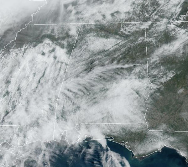
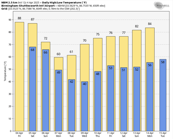
The strong upper ridge remains in place across the Deep South for a couple of more days keeping most of Alabama mainly dry with only isolated showers and storms in the forecast. It is very warm to almost hot with highs ranging from the mid-80s to low 90s. Again, very near record levels for early April in Alabama. Here are the record highs for Birmingham today and tomorrow:
April 4 88 (1934)
April 5 88 (2010)
BIRMINGHAM ALMANAC: For April 4th, the average high for Birmingham is 72° and the average low is 49°. The record high is 88° set in 1934, while the record low is 29° set in 1987. We average 0.17” of precipitation on this date and the record value is 3.75” set in 1957.
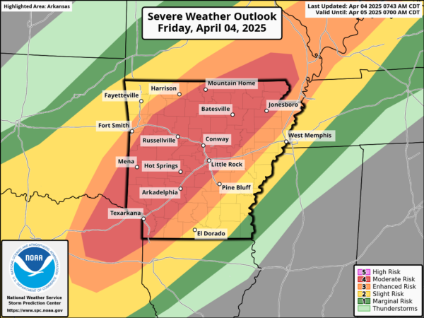
ACROSS THE USA: Life-threatening, catastrophic, and potentially historic flash flood event continues across the Lower Ohio Valley and Mid-South to Lower Mississippi Valley. Additional episodes of significant severe weather expected from the Mid-South west through the Ozarks and ArkLaTex with very large hail and strong tornadoes possible. Moderate to locally heavy snow showers expected for the Rockies, with some snow showers spreading into the High Plains through Saturday.
STRONG/SEVERE STORMS THIS WEEKEND: The ridge begins to break down late tomorrow, and that will allow showers and thunderstorms to return to Alabama. Most of Saturday will be dry, but an organized batch of showers and storms will enter Northwest Alabama around midnight Saturday night/Sunday morning.
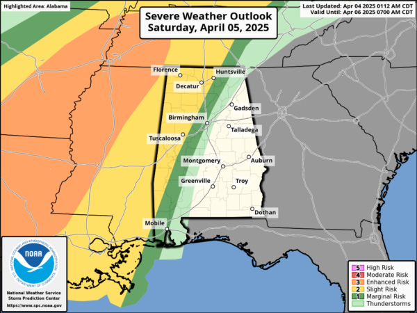
The Storm Prediction Center (SPC) has all of Alabama in a level 2 of 5 risk of severe storms during this timeframe. These showers and storms will then move south and east through the state during the morning hours and then should exit the southeast corner of the state Sunday afternoon.
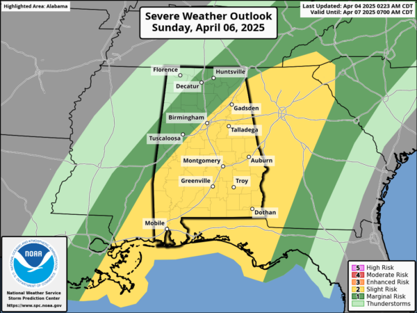
Storms that pass through Alabama will be capable of producing strong winds and hail; a brief tornado or two is possible, but the better chance of a tornado will come over southern sections of the state later Sunday. Rain amounts of 1-2 inches are expected.
LATE SEASON COLD SNAP: Much colder weather returns to Alabama next week as we go from highs in the 80s and 90s this week, to highs on Monday across North Alabama in the 50s. Morning lows for Tuesday and Wednesday will be in the 30s, and there is a decent chance for some frost and a late season freeze for parts of Alabama. Model data as trended drier and most of next week looks dry with beautiful spring weather. Expect temperatures to moderate with highs in the 70s and lows in the 40s for the second half of the week. These temperatures will be pretty close to average for the second week of April in Alabama.
WORLD TEMPERATURE EXTREMES: Over the last 24 hours, the highest observation outside the U.S. was 112.3F at Vioolsdrif, South Africa. The lowest observation was -93.6F at Vostok, Antarctica.
CONTIGUOUS TEMPERATURE EXTREMES: Over the last 24 hours, the highest observation was 106F at Laredo, TX. The lowest observation was -15F at Peter Sinks, UT.
Category: Alabama's Weather, ALL POSTS, Social Media
About the Author (Author Profile)
Macon, Georgia Television Chief Meteorologist, Birmingham native, and long time Contributor on AlabamaWX. Stormchaser. I did not choose Weather, it chose Me. College Football Fanatic. @Ryan_StinnetSubscribe
If you enjoyed this article, subscribe to receive more just like it.


