EXPIRED Severe Thunderstorm Warning for Northeastern Marion and Northwestern Winston: Ping Pong Ball Sized Hail Possible
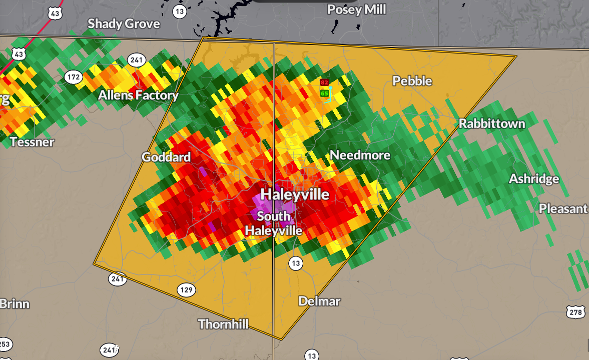
UPDATE: Hail 0.70″ in diameter was reported near Haleyville.
Most dangerous part of the storm just past Haleyville, moving into southern Franklin and Lawrence Counties. New warning for them.
It shows 1.5 inch hail which is the size of ping pong balls.
The National Weather Service in Birmingham has issued a
* Severe Thunderstorm Warning for…
Northeastern Marion County in northwestern Alabama…
Northwestern Winston County in northwestern Alabama…
* Until 600 PM CDT.
* At 545 PM CDT, a severe thunderstorm was located over Haleyville,
moving northeast at 45 mph.
HAZARD…Quarter size hail.
SOURCE…Radar indicated.
IMPACT…Damage to vehicles is expected.
* Locations impacted include…
Posey Field Airport, Needmore, Haleyville, Pebble, Upper Bear Creek
Reservoir, and Bear Creek.
PRECAUTIONARY/PREPAREDNESS ACTIONS…
For your protection move to an interior room on the lowest floor of a
building.
Category: Alabama's Weather, ALL POSTS, Severe Weather, Social Media
About the Author (Author Profile)
Bill Murray is the President of The Weather Factory. He is the site's official weather historian and a weekend forecaster. He also anchors the site's severe weather coverage. Bill Murray is the proud holder of National Weather Association Digital Seal #0001 @wxhistorianSubscribe
If you enjoyed this article, subscribe to receive more just like it.


