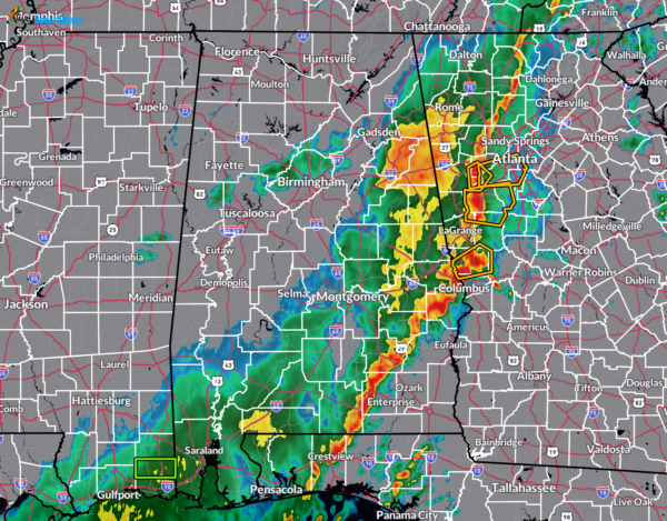
A Quick Radar Check Just Before the Noon Hour
As we are making our way to the midday hour across Alabama, and the severe weather threat is winding down. All the state except for the southeastern corner is now free and clear from any severe storms. For now, the line of storms that remain in Alabama remain under severe limits. The good news is that this line was pretty hefty to start with this morning, but it reached air that was much more stable and kept the storms from getting severe. We had one surprise warning for Lee County, but it was quickly canceled just several minutes later.
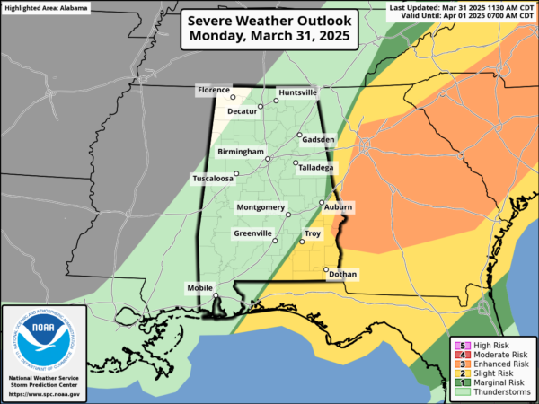
The Storm Prediction Center agrees with this, and has shrunk the slight risk to the southeast corner of the state, and has nearly removed the enhanced risk completely out of state. Also, NWS Birmingham will allow the Severe Thunderstorm Watch remaining in effect for Barbour, Bullock, Chambers, Clay, Cleburne, Coosa, Elmore, Lee, Macon, Montgomery, Pike, Randolph, Russell, and Tallapoosa counties in Central Alabama to expire at noon.
Category: Alabama's Weather, ALL POSTS, Severe Weather


