A Look At The Current Severe Weather Parameters In Place
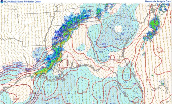
Taking a look at the SPC mesoanalysis, we can see a plume of modestly unstable air across much of Alabama ahead of the line of storms. The most unstable air is across west and south Alabama, where as much as 1,500-2,000 j/kg of mixed layer CAPE is present. This is not overwhelming, but certainly sufficient for severe weather and rather impressive for this early in the morning.
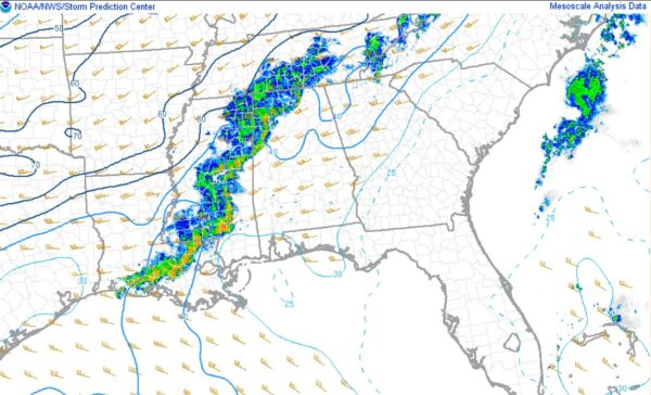
In addition, we can also look at the wind shear. Currently there is about 30-40kts of 0-6km shear across the area, with the strongest over the northern half of the state. While we have seen events in the past with much stronger shear, similar to the CAPE, this is sufficient to maintain storms. For a little good news, the low level shear is not at all impressive. For that reason, tornadoes are not expected to be a huge concern. However, a few isolated tornadoes certainly cannot be ruled out, so do not let your guard down!
Finally, severe thunderstorm watches remain in effect statewide, with the exception of the southeastern corner of Alabama, although its likely they will be added later on. I will keep you posted on any mesoscale discussion, parameter updates, and other large scale information, while Scott Martin will keep you covered on any warnings that are issued.
Category: Alabama's Weather, ALL POSTS, Social Media


