Alabama Update at 12:15 a.m.
Our line of storms is about 20 miles northwest of the northwest corner of Alabama at this early hour.
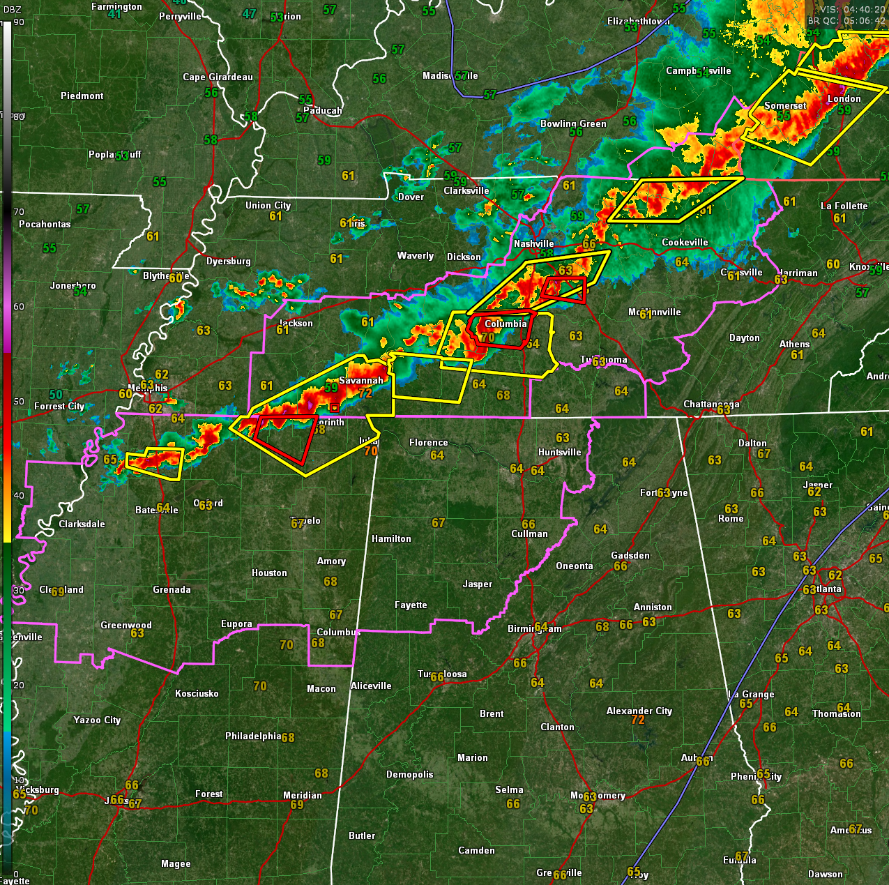
The long line extends all the way from southeastern Ohio through eastern Kentucky into Central Tennessee and now North Mississippi.
There are 11 severe thunderstorm warnings and 3 tornado warnings in effect at this hour. Two tornadoes are in Middle Tennessee, one near Murfreesboro and another approaching Columbia, TN. The storm near Murfreesboro did produce wind damage near Fairview and severe hail near Franklin. The storm approaching Columbia has strong rotation.
Another tornado warning is in effect for northern Benton, Tippah, and western Alcorn counties in northern Mississippi. This storm appears slightly weaker at this time.
The storms will near northwestern Lauderdale county around 1245 a.m., and Colbert county a short time after that, so warnings will be coming soon.
Damaging winds and hail will be the main threats, but quick spin up tornadoes are possible as well.
Monitor the line of storms if it is approaching your location and be prepared to move to your safe place if a warning is issued.
A tornado watch is in effect for the northwestern quarter of Alabama until 5 a.m.
Category: Alabama's Weather, ALL POSTS, Severe Weather, Social Media
About the Author (Author Profile)
Bill Murray is the President of The Weather Factory. He is the site's official weather historian and a weekend forecaster. He also anchors the site's severe weather coverage. Bill Murray is the proud holder of National Weather Association Digital Seal #0001 @wxhistorianSubscribe
If you enjoyed this article, subscribe to receive more just like it.


