Early Evening Severe Weather Update
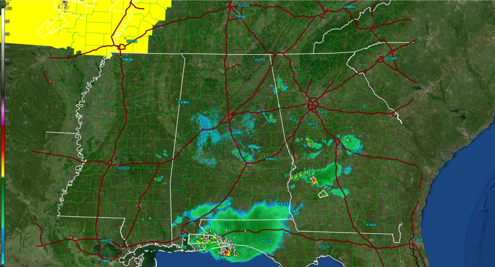
As of early this evening, radar across Alabama has become much quieter, with only a few remaining showers over east Alabama, and a couple residual storms near the AL/FL state line. Elsewhere, its quiet. Flash flood warnings remain in effect for southern Baldwin county.
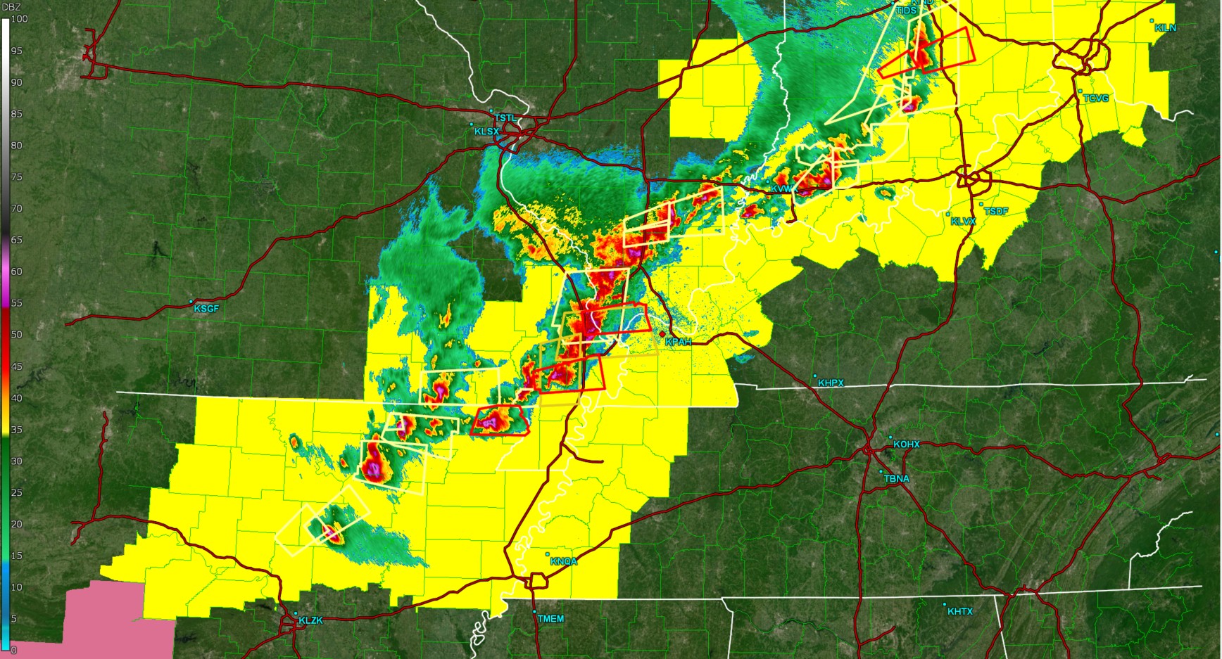
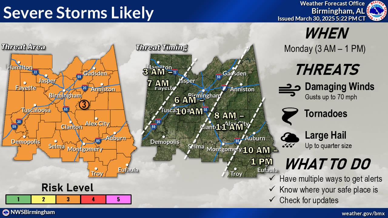
Upstream, across portions of IL, MO, AR, IN, numerous severe thunderstorms have prompted severe thunderstorm and tornado warnings, as well as a tornado watch. These are the storms we will be watching as they approach Alabama. Storms will likely enter the state a few hours after midnight, and leave by early afternoon tomorrow. Below is a graphic from the NWS in Birmingham depicting the latest timing and severe weather outlook in central AL.
Category: Alabama's Weather, ALL POSTS, Social Media
About the Author (Author Profile)
Jack is a junior at Mississippi State University studying meteorology. He has several years of forecasting experience through a local group of forecasters in Maryland where he resides. Jack plans to become a broadcast meteorologist after graduation.Subscribe
If you enjoyed this article, subscribe to receive more just like it.


