Mid-Morning Update on Alabama’s Weather
Here is a quick update of the Alabama weather situation…
CURRENT CONDITIONS:
Clouds are widespread across Central Alabama this morning with scattered showers developing, especially over western counties. Temperatures range from the mid 60s to around 70 degrees, with dewpoints climbing into the mid to upper 60s. The atmosphere is moist and increasingly unstable, and we’re already seeing some embedded thunderstorm activity across the state line in Mississippi. South winds are steady at 5–15 mph with occasional gusts. A few peeks of sun are likely by midday, which could further destabilize the atmosphere.
AFTERNOON OUTLOOK:
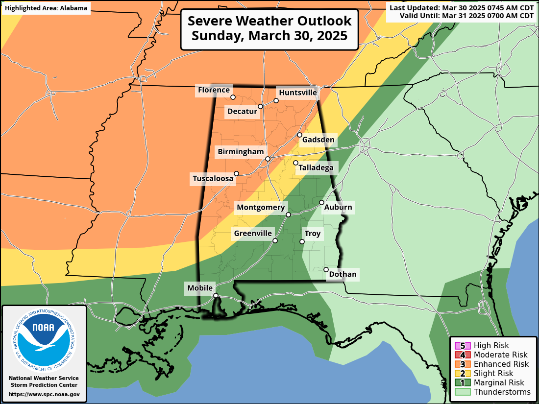
A few isolated strong to marginally severe storms may develop this afternoon ahead of the main system, particularly across West and Central Alabama. These will be fueled by modest CAPE values between 1000–2000 J/kg and steepening mid-level lapse rates. The main hazard this afternoon will be hail up to quarter size, though any storms that can briefly organize may also produce gusty winds. However, the coverage is expected to remain scattered, and this is not the main event.
MAIN EVENT – OVERNIGHT SQUALL LINE:
A dangerous line of severe thunderstorms will move into Northwest Alabama shortly after midnight, racing southeastward through the early morning hours on Monday. The primary threat is damaging straight-line winds, which has prompted the SPC to upgrade much of Central Alabama to an Enhanced Risk (Level 3/5). Within the line, embedded QLCS tornadoes and large hail are also possible. The line is expected to reach the I-20/59 corridor—including Tuscaloosa and Birmingham—between 3 AM and 6 AM, continuing southeast through sunrise. Most storms will exit east of I-65 by midday Monday.
ADDITIONAL THREATS AND OUTLOOK:
In addition to the severe threat, there is a Level 2 out of 4 risk of excessive rainfall, with a general 1–2 inches of rain expected. Some northwestern counties may exceed 2 inches, increasing the risk of localized flash flooding. After a brief break Monday night and Tuesday, we’ll need to monitor another conditional severe threat Wednesday afternoon into Wednesday night, especially for northwest portions of the area. A summerlike pattern sets up later this week with near-record warmth and highs pushing well into the 80s.
Category: Alabama's Weather, ALL POSTS, Severe Weather, Social Media
About the Author (Author Profile)
Bill Murray is the President of The Weather Factory. He is the site's official weather historian and a weekend forecaster. He also anchors the site's severe weather coverage. Bill Murray is the proud holder of National Weather Association Digital Seal #0001 @wxhistorianSubscribe
If you enjoyed this article, subscribe to receive more just like it.


