Midday Nowcast: Warm and Dry Friday; Rain, Storms, and Severe Storms in the Forecast through Monday
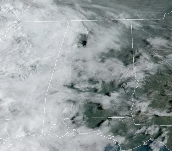
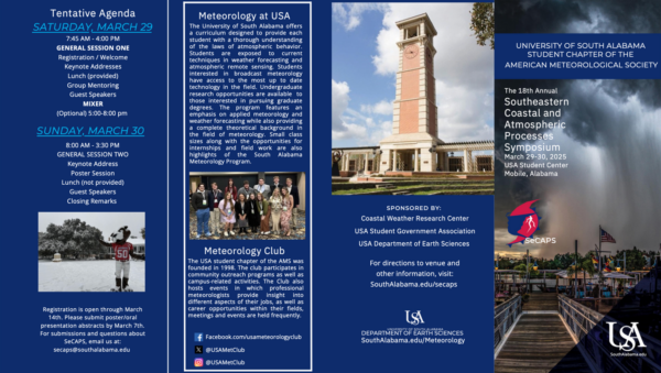
Greetings from the road as I travel to the University of South Alabama as the Meteorology Department host their annual SeCAPS (Southeastern Coastal and Atmospheric Processes Symposium) weather conference. Since I graduated from South, I love attending and supporting this completely student led conference each year. The weather today is ideal for traveling across Alabama as it is dry day and we are seeing more clouds than sun. Temperatures today are climbing into the upper 70s and lower 80s. Tonight will be mostly cloudy and cool with lows in the 60s.
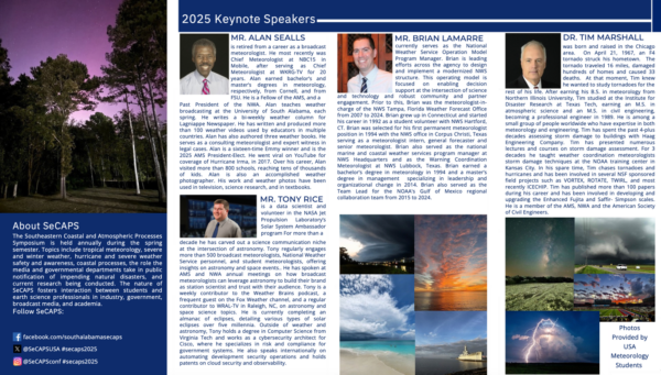
Here is more info on this year’s SeCAPS, and if you ever get chance to attend, I highly suggest it. It is open to the public.
Click image to enlarge.
Click image to enlarge.
BIRMINGHAM ALMANAC: For March 28th, the average high for Birmingham is 70° and the average low is 47°. The record high is 89° set in 1919, while the record low is 28° set in 1937. We average 0.17” of precipitation on this date and the record value is 5.89” set in 1951.
WEEKEND WEATHER: With more moisture in place, rain will be possible at times this weekend across Alabama, but certainly no weekend “wash out” by any means. Most of the weekend will be dry, but be prepared that it could rain at anytime. The general idea has most of the daytime hours this weekend dry. The most widespread rain over the weekend, looks to be overnight Saturday night. Highs this weekend will be in the upper 70s and lower 80s.
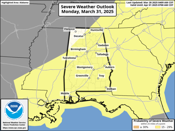
SEVERE WEATHER POTENTIAL: To our north and west Sunday, a dynamic storm system will cause severe weather in the Mississippi and Ohio River Valleys. These storms will then head towards Alabama late Sunday night (mainly after midnight) into Monday, and the SPC maintains the risk of severe storms for the entire state during this timeframe.
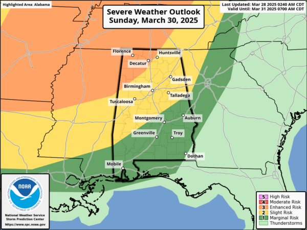
Late Sunday night, an organized band of storms with the potential for hail, damaging winds, and tornadoes will move into Northwest Alabama, around midnight Sunday night (12AM Monday). These storms will continue to move south and east through the state during the predawn hours Monday, unfortunately this will be a mainly overnight event for much of the state. The rain and storms will exit the state through the day Monday.
Over the next couple of days, we will continue to fine-tune the forecast and we will continue to have a much better understanding of the timing, potential magnitude, and impacts we could see across Alabama, so stay tuned to future updates.
With any severe weather event, but especially an overnight event, make sure you can hear your alerting devices, and be ready to act immediately…Have multiple, reliable ways to receive severe weather alerts, NEVER, ever, ever rely on a outdoor siren. Every Alabama home and business needs a NOAA Weather Radio (the most popular model is the Midland WR-120, which is sold in most local big box retailers). The other way is your phone…be sure emergency alerts are enabled (look under settings, and notifications), and install the free ABC 33/40 Weather app.
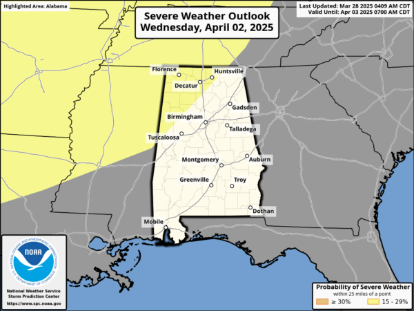
NEXT WEEK: Tuesday will be dry with mid and upper 70s. Wednesday will feature another chance for rain and storms, and some strong storms are possible. The SPC has portions of Northwest Alabama outlined in a risk of severe storms on their day 6 convective outlook.
Dry weather returns Thursday and Friday as an upper ridge builds in over the Deep South, and this will bring the warmest weather so far this year widespread mid 80s expected.
WORLD TEMPERATURE EXTREMES: Over the last 24 hours, the highest observation outside the U.S. was 110.8F at Sarh, Chad. The lowest observation was -92.4F at Vostok, Antarctica.
CONTIGUOUS TEMPERATURE EXTREMES: Over the last 24 hours, the highest observation was 97F at Death Valley, CA. The lowest observation was 9F at Mount Washington, NH.
Category: Alabama's Weather, ALL POSTS, Social Media
About the Author (Author Profile)
Macon, Georgia Television Chief Meteorologist, Birmingham native, and long time Contributor on AlabamaWX. Stormchaser. I did not choose Weather, it chose Me. College Football Fanatic. @Ryan_StinnetSubscribe
If you enjoyed this article, subscribe to receive more just like it.


