Midday Nowcast: Great Weather Today/Tomorrow, Some Rain Saturday Night, Strong Storms Possible Monday
MORE GREAT WEATHER: The mainly sunny weather continues today and tomorrow and we are seeing highs in the mid and upper 70s, with some low 80s showing up on the maps. Tonight will be warmer as we see more clouds, lows should generally be in the 50s.
BIRMINGHAM ALMANAC: For March 27th, the average high for Birmingham is 70° and the average low is 47°. The record high is 89° set in 1919, while the record low is 18° set in 1955. We average 0.17” of precipitation on this date and the record value is 2.99” set in 1902.
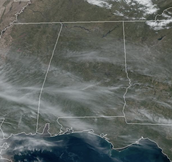
ACROSS THE USA: Periods of excessive rainfall are forecast to slowly shift east from southern Texas today, into the upper Texas coast on Friday, and into Louisiana Friday night and Saturday morning. Snow and ice expected to develop over the northern Plains close to the Canadian border on Friday and then expand toward the upper Great Lakes Friday night. Windy and wet weather continues for the Pacific Northwest as thunderstorms could become severe across portions of the central Plains and southern Texas today.
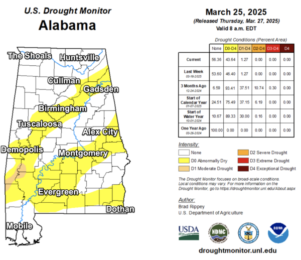
Click image to enlarge.
DROUGHT MONITOR: Subtle changes in the latest drought monitor released this morning. Last week, 46.40% of the state was Abnormally Dry and that is down to 43.64% this week. Last week, 1.27% of the state had moderate drought, and that number has not changed. These moderate drought conditions are impacting Southwest Alabama mainly in the Washington, Choctaw, Clarke, and Marengo counties. Thankfully we have rain in the forecast of the next seven days.
WEEKEND WEATHER: With more moisture in place, rain will be possible at times this weekend across Alabama, but the general idea has most of the daytime hours this weekend will be dry. The most widespread rain over the weekend, looks to be overnight Saturday night. Highs this weekend will be in the upper 70s and lower 80s.
SEVERE WEATHER POTENTIAL: The models have trended slower with the potential threat of strong and severe storms returning to Alabama late this weekend. Sunday will be a warm and breezy day, and no doubt unstable air will be in place across the state.
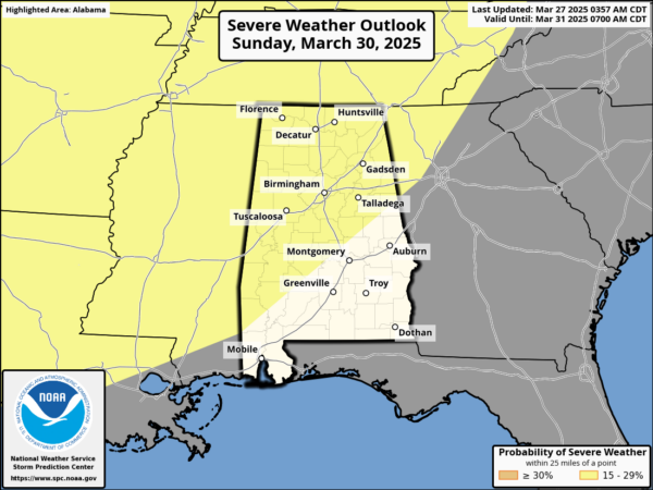
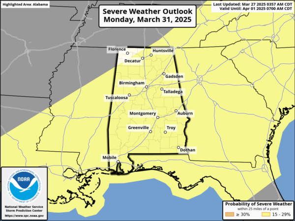
To our north and west Sunday, a dynamic storm system will cause severe weather in the Mississippi and Ohio River Valleys. These storms will then head towards Alabama late Sunday night (mainly after midnight) into Monday, and the SPC maintains the risk of severe storms for the entire state during this timeframe.
With this event, at this point, there is a lot of uncertainty with the overall potential. Again the synoptic (large scale) features will be in place for severe weather, but the models continue to differ with the mesoscale (small scale) details which will really determine the magnitude of the threat.
For now, we are expecting an organized band of storms with the potential for hail, damaging winds, and isolated tornadoes to into North Alabama early Monday morning, shifting into Central and South Alabama through the day on Monday. The higher tornado threat could form after midnight Sunday night and through the pre-dawn hours Monday over North Alabama if discrete cells can form ahead of the main line. Over the next couple of days, as the short range and higher resolution models come into play, we will begin to have a much better understanding of the timing, potential magnitude, and impacts we could see across Alabama, so stay tuned to future updates.
NEXT WEEK: Tuesday will be dry with mid and upper 70s. For the rest of the week, expect very warm days, in fact we will see the warmest temperature so far this year across Alabama with widespread low and mid 80s. Some showers are possible each day, but these will be few and far between, and many locations look to remain dry as an upper ridge build in over the Deep South.
WORLD TEMPERATURE EXTREMES: Over the last 24 hours, the highest observation outside the U.S. was 110.5F at Ndjamena, Chad. The lowest observation was -83.9F at Amundsen-Scott South Pole Station, Antarctica.
CONTIGUOUS TEMPERATURE EXTREMES: Over the last 24 hours, the highest observation was 102F at Tecopa, CA. The lowest observation was 10F at Peter Sinks, UT.
Category: Alabama's Weather, ALL POSTS, Social Media
About the Author (Author Profile)
Macon, Georgia Television Chief Meteorologist, Birmingham native, and long time Contributor on AlabamaWX. Stormchaser. I did not choose Weather, it chose Me. College Football Fanatic. @Ryan_StinnetSubscribe
If you enjoyed this article, subscribe to receive more just like it.


