Rain Returns Saturday; Severe Storms Possible Sunday Night/Monday
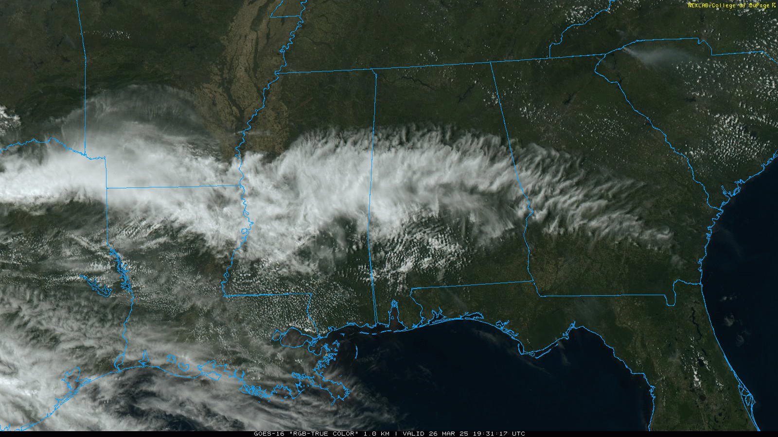
MILD MARCH DAY: Temperatures are in the 70s over most of Alabama this afternoon, but places like Dothan and Mobile in South Alabama are in the low 80s. Most of the state is enjoying a good supply of sunshine, but mid level clouds have moved into the central counties. We note a few sprinkles on radar over West-Central Alabama, but they won’t last long. Tonight will be mostly fair with a low in the 40s and 50s.
DRY THROUGH FRIDAY: Alabama’s weather will stay dry through Friday with partly to mostly sunny days and fair nights. Highs will be generally in the 75-80 degree range today, followed by low 80s tomorrow and Friday.
THE ALABAMA WEEKEND: Moist air returns to Alabama Saturday with occasional showers and a thunderstorm or two. Not expecting any severe storms, and it won’t be a total wash-out, but occasional rain is likely with a high in the 70s.
It sure looks like a decent part of Sunday will be dry, although a few scattered showers are certainly possible. The day will be warm and breezy with a high in the low 80s. Then, a dynamic storm system will bring an organized batch of showers and storms into the state late Sunday night (mainly after midnight) into Monday. All 67 Alabama counties are in a severe weather risk defined by SPC for this event.
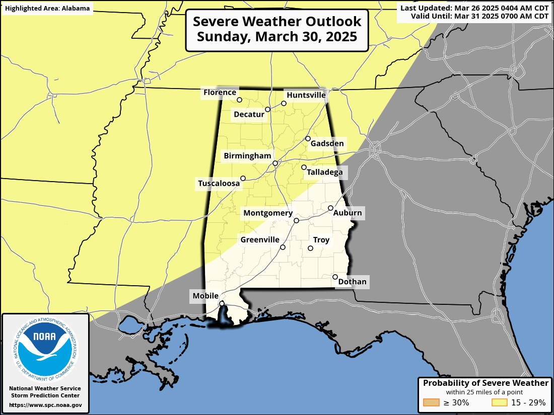
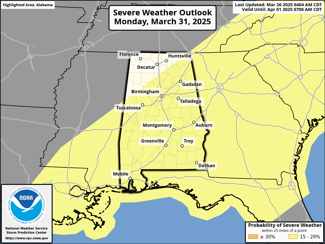
Models continue to trend slower. The main risk of severe storms for North Alabama will come from around midnight Sunday night through noon Monday, with the risk of the rest for the southern 2/3 of the state from 4:00 a.m. until 4:00 p.m. Monday. And it looks like all modes of severe weather will be possible, including large hail, damaging winds, and a few tornadoes. We will be much more specific about the magnitude of the event and the timing later this week.
REST OF NEXT WEEK: For now the weather looks dry Tuesday and Wednesday, followed by another chance of rain and thunderstorms Thursday and Friday. Models suggest we will have the warmest weather so far this year by the end of the week with mid 80s possible… See the video briefing for maps, graphics, and more details.
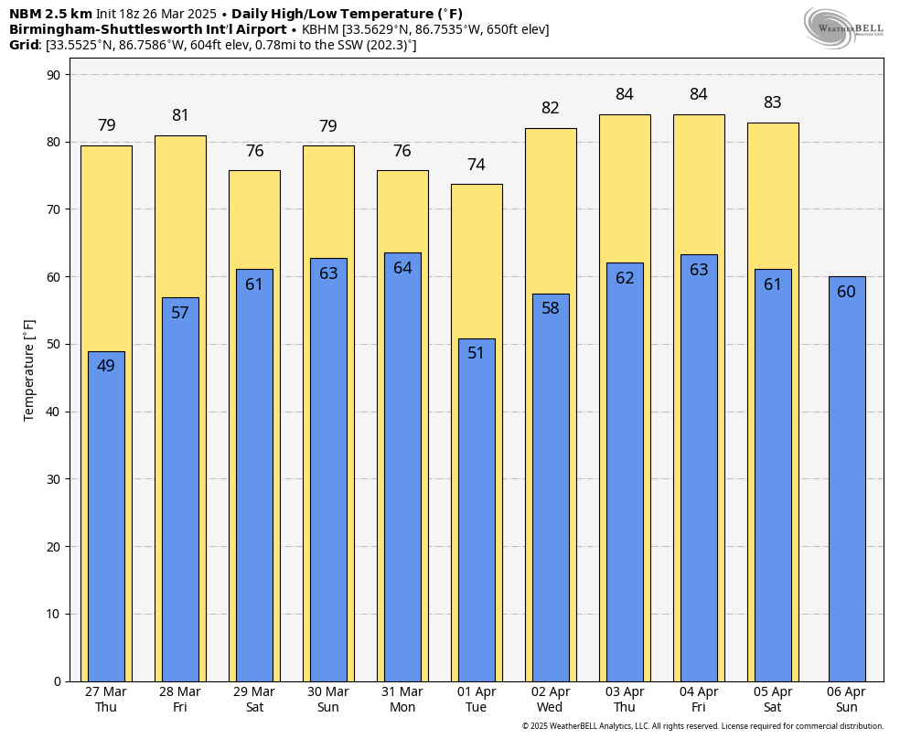
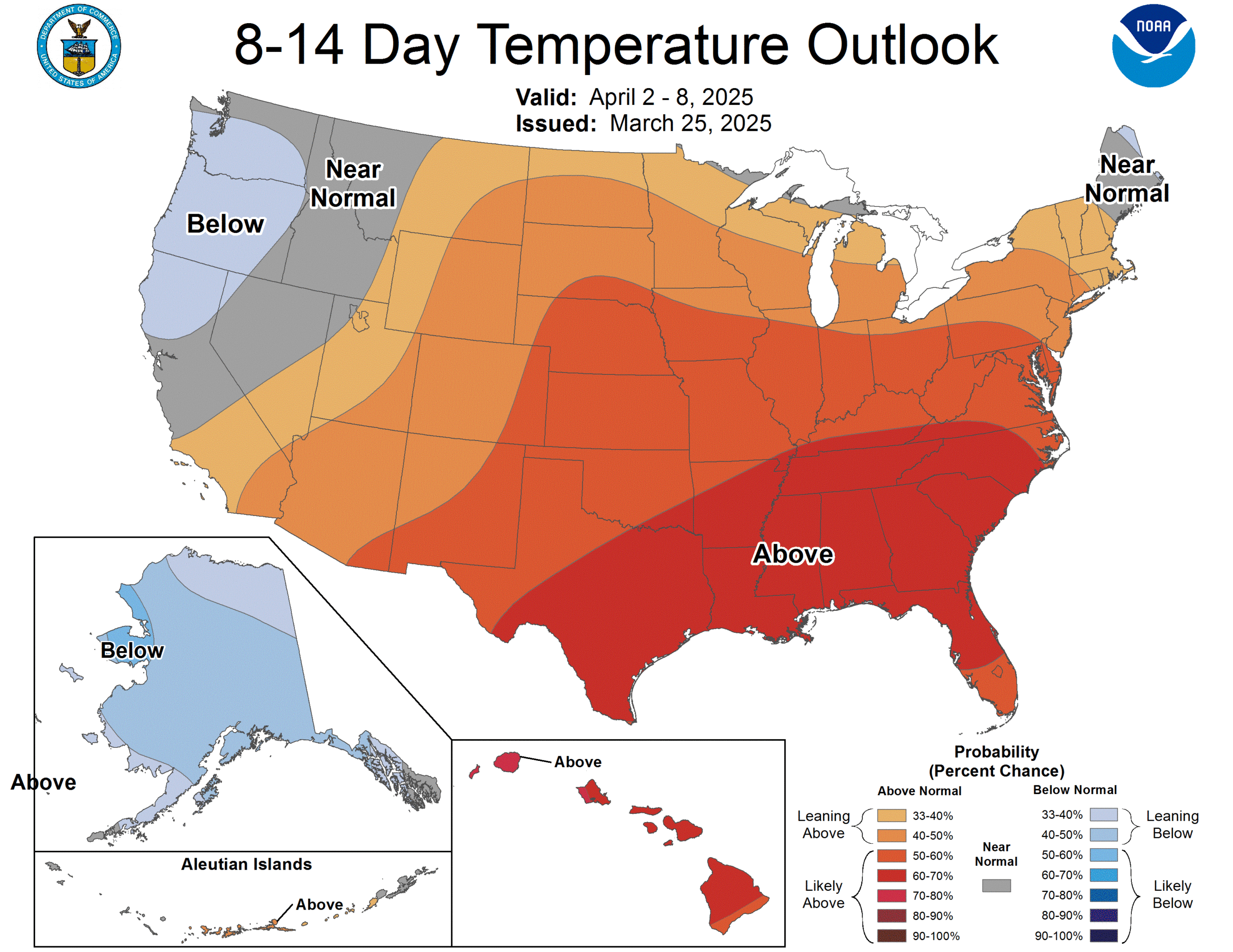
LAST FREEZE? Have we experienced the last freeze of the season? Maybe; maybe not. Models show no chance of a freeze (or frost) through April 8, but long time Alabama residents know we almost always have a late season cold snap toward mid-April. The advice remains the same… I would wait until April 15 to plant anything that would be harmed by frost or a freeze.
ON THIS DATE IN 2011: An EF-1 tornado moved through parts of Shelby County; it touched down near the intersection of County Road 10 and Homeland Way in the Aldrich Community near Montevallo.
ON THIS DATE IN 2023: An EF-1 tornado moved across Lake Martin; it was down for a little over seven miles.
Look for the next video briefing here by 6:00 a.m. tomorrow…
Category: Alabama's Weather, ALL POSTS, Weather Xtreme Videos
About the Author (Author Profile)
James Spann is one of the most recognized and trusted television meteorologists in the industry. He holds the AMS CCM designation and television seals from the AMS and NWA. He is a past winner of the Broadcast Meteorologist of the Year from both professional organizations.Subscribe
If you enjoyed this article, subscribe to receive more just like it.


