Midday Nowcast: Quiet, Warm, Spring Weather Continues into the Weekend
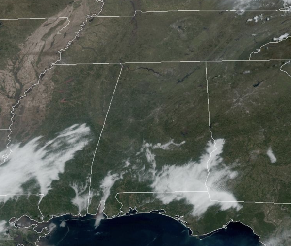
Most of the fog from this morning is gone, and what it left over southern portions of Alabama will quickly mix out in the coming hours.
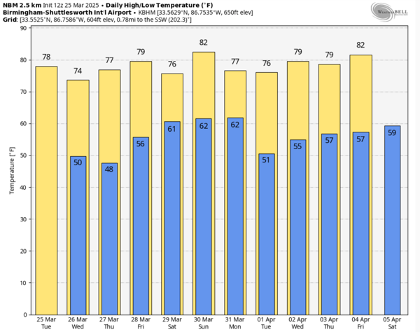
FANTABULOUS: Hard to find fault with the weather today and the rest of this week across Alabama. We are enjoying sunny days with highs in the mid and upper 70s, with low 80s expected in some spots. Nights are fair and cool with upper 40s and lower 50s. It is oh so nice, with the pleasant afternoons and refreshing nights. This could be one of the best weeks of weather we see this year across Alabama, so enjoy it, because all good things must come to an end.
BIRMINGHAM ALMANAC: For March 25th, the average high for Birmingham is 70° and the average low is 47°. The record high is 88° set in 1907, while the record low is 25° set in 1983. We average 0.17” of precipitation on this date and the record value is 2.47” set in 2021.
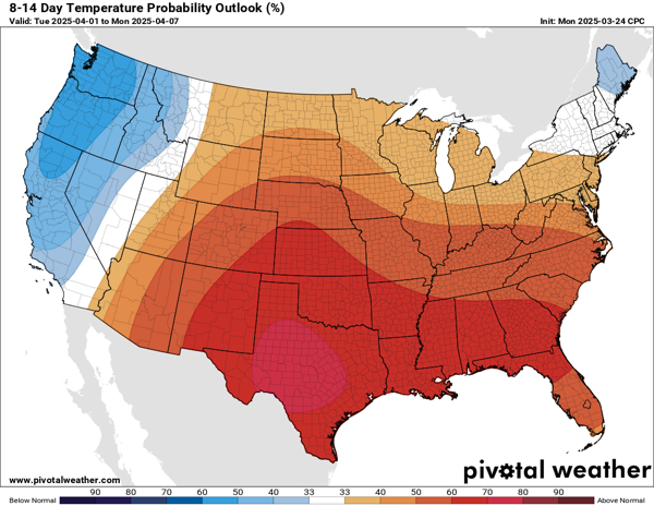
WHEN TO PLANT?: Since weather records have been kept for Birmingham dating back to 1897, the average last freeze for the city is March 24th. More recent data over the last 30 years, the average last freeze is today, March 25th. The earliest last freeze for Birmingham was February 3, 1945, while the latest on record was April 23, 1986. For years, myself and James have always said that Tax Day, April 15th is when we can give the greenlight to plant. Looking at the 8-14 day temperature outlook issued by the Climate Prediction Center (CPC), well-above average temperature are in the forecast. Spring has certainly sprung across Alabama, and I am fairly confident we are done with freezing weather for the season, but growing up in Alabama, and also listening the the old-timers, we know there is always a cold snap close to Easter, which this year is April 20th. So all that being said, I will say to hold off just a couple of more weeks, just to be safe.
STORMS RETURN THIS WEEKEND: The Gulf of Mexico opens up and moisture begins to surge northward this weekend ahead of our next developing storm system. Scattered showers and storms are possible on Saturday, but we do not expect severe storms in Alabama on Saturday, the severe weather threat will be well to the west of Alabama. Highs Saturday will be in the upper 70s.
As we roll into Sunday, a very dynamic storm system will bring the potential for severe thunderstorms to much of the Deep South. The Storm Prediction Center (SPC) maintains a large severe weather risk from the Gulf Coast to the southern Great Lakes and this risk includes the northern two-thirds of Alabama, on their day 6 convective outlook.
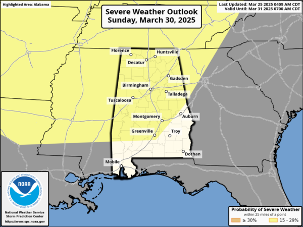
For now, the highest severe weather risk for Alabama looks to arrive very late Sunday night, continuing into Monday. While the synoptic (large) scale pattern favors severe storms, we won’t know the mesoscale (small scale) details for a few more days. Meaning, it is still too early to know the magnitude of the event, the timing, and the primary threats/hazards. We will be able to be more specific later this week. As I said yesterday, let us in the weather department worry and I encourage everyone to enjoy this incredible spring weather we have this week.
WORLD TEMPERATURE EXTREMES: Over the last 24 hours, the highest observation outside the U.S. was 107.2F at Kayes, Mali. The lowest observation was -87.0F at Vostok, Antarctica.
CONTIGUOUS TEMPERATURE EXTREMES: Over the last 24 hours, the highest observation was 100F at Indio and Thermal, CA. The lowest observation was -11F at Forest Center, MN.
Category: Alabama's Weather, ALL POSTS, Social Media
About the Author (Author Profile)
Macon, Georgia Television Chief Meteorologist, Birmingham native, and long time Contributor on AlabamaWX. Stormchaser. I did not choose Weather, it chose Me. College Football Fanatic. @Ryan_StinnetSubscribe
If you enjoyed this article, subscribe to receive more just like it.


