Storms Tomorrow Night; Frost By Friday Morning
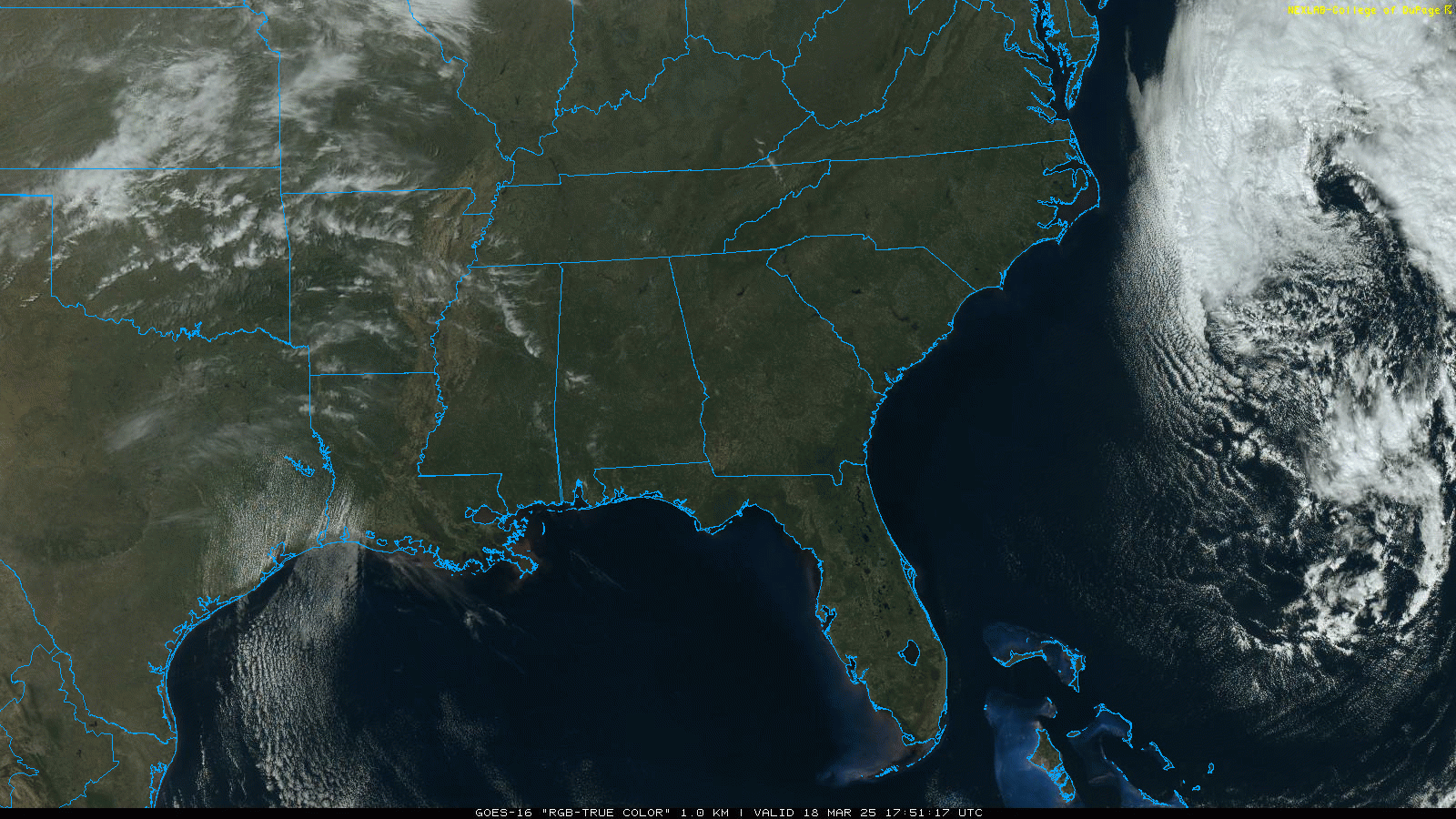
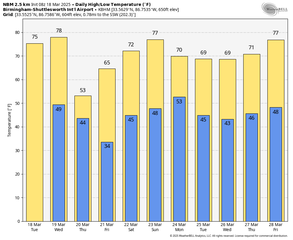
SUNNY, MILD MARCH DAY: Temperatures are mostly in the 74-79 degree range across Alabama today with sunshine in full supply. Tonight will be clear with lows in the 40s and low 50s.
Tomorrow will be warm and breezy with a high in the 77-82 degree range; clouds will increase by afternoon ahead of a cold front that will bring showers and few storms tomorrow night. SPC maintains a low end “marginal risk” (level 1/5) of severe storms for areas north and west of Birmingham.
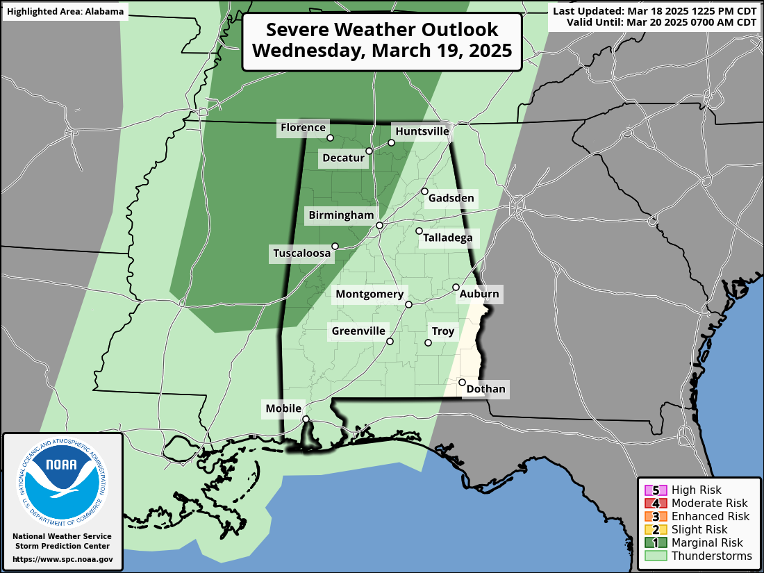
With hardly any surface based instability and weak dynamic support, the severe threat is low. But a few storms could produce small hail and gusty winds. We also note a wind advisory is in effect for the northern third of Alabama tomorrow and tomorrow night for gradient winds that could gust to 30 mph at times.
On Thursday the weather will be windy and sharply colder. Most Tennessee Valley communities won’t get out of the 40s with the risk of a few spotty showers. For the rest of the state the sky becomes partly sunny with highs in the 50s.
FRIDAY FREEZE: Temperatures across a good part of North Alabama will drop into the 26-35 degree range early Friday morning with widespread frost, and a freeze for colder spots. Frost is likely even down into South Alabama with lows in the mid 30s. Then we warm into the 60s Friday afternoon with sunshine in full supply.
THE ALABAMA WEEKEND: We are getting better clarity on the weekend situation. Saturday looks dry and mild with highs in the 70s. And, most of Sunday will be warm and dry with temperatures reaching the upper 70s and low 80s. A batch of showers and storms will then move through Sunday night into early Monday morning.
We note SPC maintains a risk of severe storms for areas west of Alabama Sunday, but models suggest the air will be relatively stable across Alabama late Sunday night, which will keep the overall severe threat here fairly low. We will watch model trends closely as we approach the weekend.
NEXT WEEK: Lingering showers are possible over South Alabama Monday, otherwise the week looks dry and pleasant with highs not far from 70 degrees. See the video briefing for maps, graphics, and more details.
NWS SURVEYS: NWS Birmingham has now confirmed 11 tornadoes from the weekend severe weather event; work continues today and tomorrow. It is likely that a total of 16 tornadoes touched down across the state. The strongest tornadoes so far…
Plantersville/Maplesville EF-3
Sipsey (Walker County) EF-2
Troy/Bullock Counties EF-2
Gordo EF-2
Winterboro EF-2
Jackson’s Gap EF-2
100 YEARS AGO TODAY: In the midday and afternoon hours of Wednesday, March 18, 1925, the deadliest tornado in United States history moved through Eastern Missouri, Southern Illinois and Southern Indiana, killing 695 people and injuring 2,027 more in what is known as the Great Tri-State Tornado. The town of Murphysboro, Illinois was one of the hardest hit communities with 234 of the fatalities occurring there.
The tornado touched down as part of a larger severe weather outbreak that hit the United States on the same day, and produced catastrophic damage across numerous villages and towns across all three states. Despite not being officially rated, it is widely accepted to have been equivalent to an F5 on the Fujita scale.
Look for the next video briefing here by 6:00 a.m. tomorrow…
Category: Alabama's Weather, ALL POSTS, Weather Xtreme Videos
About the Author (Author Profile)
James Spann is one of the most recognized and trusted television meteorologists in the industry. He holds the AMS CCM designation and television seals from the AMS and NWA. He is a past winner of the Broadcast Meteorologist of the Year from both professional organizations.Subscribe
If you enjoyed this article, subscribe to receive more just like it.


