Severe Thunderstorm Warning for Northwestern Winston County Until 6:30 p.m.
A severe thunderstorm warning is in effect for northwestern Winston County in northwestern Alabama until 6:30 PM CDT…
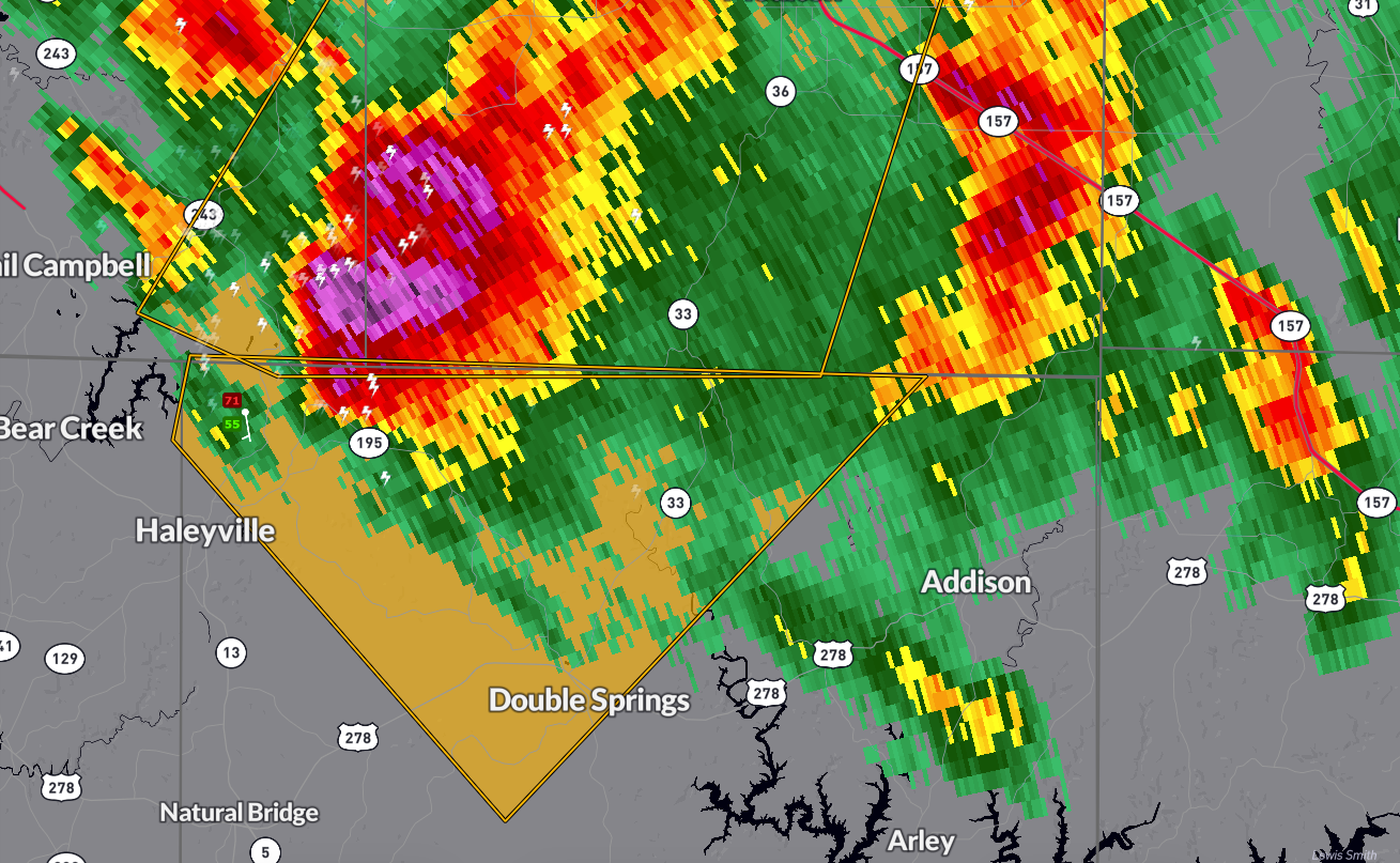
WHAT’S HAPPENING… At 5:26 PM, a severe thunderstorm was located near Needmore, or 7 miles northeast of Haleyville, moving southeast at 15 mph… This storm is capable of producing…
…Winds up to 60 mph…
…Quarter-size hail (1.00 inch in diameter)…
IMPACTS…
…Hail may damage vehicles…
…Strong winds could cause damage to roofs, siding, and trees…
…Frequent cloud-to-ground lightning is occurring—stay indoors…
AFFECTED AREAS…
…Weiss…
…Posey Field Airport…
…Houston Recreational Area…
…Double Springs…
…Pebble…
…Brushy Lake…
…Needmore…
…Moreland…
…Winston Free State Barn…
…Sipsey River Rec Area…
…Ashridge…
…Grayson…
…Haleyville…
…Bankhead National Forest…
WHAT TO DO… Seek shelter in an interior room on the lowest floor of a sturdy building… If you’re outside, move indoors immediately—lightning can strike from miles away…
Stay weather-aware and be prepared for possible additional warnings as this storm moves southeast…
Category: Alabama's Weather, ALL POSTS, Severe Weather, Social Media
About the Author (Author Profile)
Bill Murray is the President of The Weather Factory. He is the site's official weather historian and a weekend forecaster. He also anchors the site's severe weather coverage. Bill Murray is the proud holder of National Weather Association Digital Seal #0001 @wxhistorianSubscribe
If you enjoyed this article, subscribe to receive more just like it.


