Severe Thunderstorm Warning for Franklin and Lawrence Counties Until 545 pm
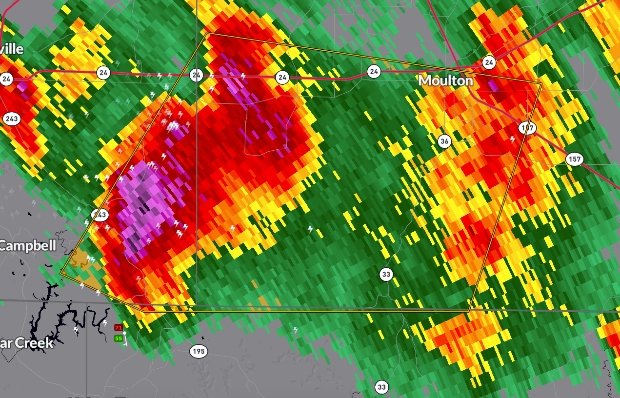
A severe thunderstorm warning is in effect for southeastern Franklin County and southwestern Lawrence County in northwestern Alabama until 5:45 PM CDT…
WHAT’S HAPPENING… At 5:09 PM, a severe thunderstorm was located 10 miles northeast of Needmore, or 12 miles northeast of Haleyville, moving east at 15 mph… This storm has a history of producing accumulating small hail and remains capable of producing…
…Winds up to 60 mph…
…Quarter-size hail (1.00 inch in diameter)…
IMPACTS…
…Hail may damage vehicles…
…Strong winds could cause damage to roofs, siding, and trees…
…Frequent cloud-to-ground lightning is occurring—stay indoors…
LATE REPORT
…0.50 inch hail was reported 6 miles NE of Phil Campbell at 5:12 p.m.
…1.25 inch hail was reported 9 miles north of Red Bay in Franklin County at 5:17 p.m.
AFFECTED AREAS…
…Mt Hope…
…Bankhead National Forest…
…Wren…
…Landersville…
…Moulton…
WHAT TO DO… Seek shelter in an interior room on the lowest floor of a sturdy building… If you’re outside, move indoors immediately—lightning can strike from miles away…
Stay weather-aware and be prepared for possible flooding or additional warnings as this storm moves east…
Category: Alabama's Weather, ALL POSTS, Severe Weather, Social Media
About the Author (Author Profile)
Bill Murray is the President of The Weather Factory. He is the site's official weather historian and a weekend forecaster. He also anchors the site's severe weather coverage. Bill Murray is the proud holder of National Weather Association Digital Seal #0001 @wxhistorianSubscribe
If you enjoyed this article, subscribe to receive more just like it.


