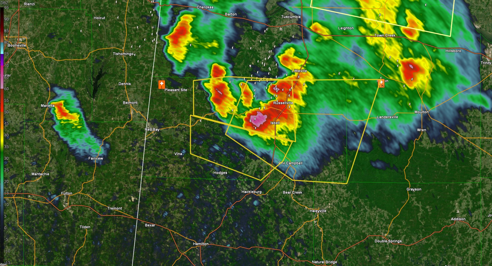
New Severe Thunderstorm Warning In Effect Until 5:15pm For Eastern Franklin And Western Lawrence Counties
The National Weather Service in Huntsville Alabama has issued a

* Severe Thunderstorm Warning for...
  Eastern Franklin County in northwestern Alabama...
  West central Lawrence County in northwestern Alabama...

* Until 515 PM CDT.

* At 422 PM CDT, a severe thunderstorm was located near Belgreen, or
  near Russellville, moving east at 15 mph.

  HAZARD...70 mph wind gusts and ping pong ball size hail.

  SOURCE...Radar indicated.

  IMPACT...People and animals outdoors will be injured. Expect hail
           damage to roofs, siding, windows, and vehicles. Expect
           considerable tree damage. Wind damage is also likely to
           mobile homes, roofs, and outbuildings.

* Locations impacted include...
  Mt Hope, Newburg, Belgreen, Tharptown, Isbell, Spruce Pine,
  Russellville, Rockwood, Phil Campbell, and Bankhead National
  Forest.

PRECAUTIONARY/PREPAREDNESS ACTIONS...

Prepare immediately for large hail and damaging winds. People outside
should move immediately to shelter inside a strong building. Stay
away from windows.
Category: Alabama's Weather, ALL POSTS, Social Media
About the Author (Author Profile)
Jack is a junior at Mississippi State University studying meteorology. He has several years of forecasting experience through a local group of forecasters in Maryland where he resides. Jack plans to become a broadcast meteorologist after graduation.Subscribe
If you enjoyed this article, subscribe to receive more just like it.


