New Severe Thunderstorm Warning In Effect For Franklin county until 4:30pm
Update: The damage threat has been raised to considerable for the potential for 70mph winds and 2″ diameter hail. MOVE INDOORS and away from windows immediately.
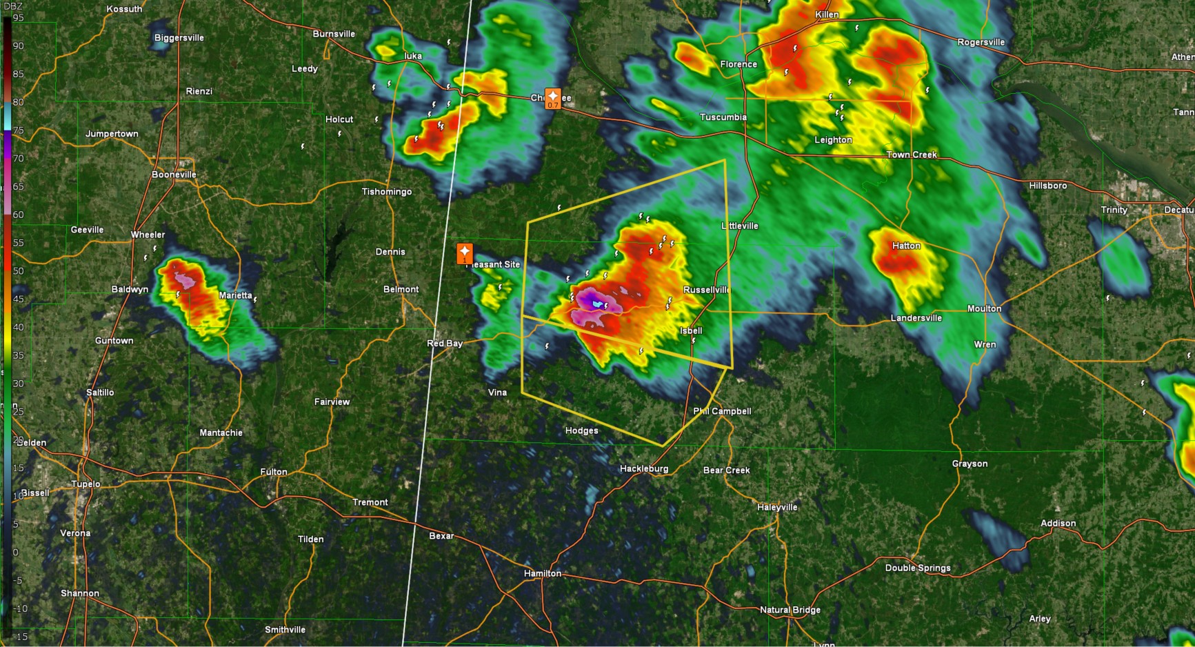
The National Weather Service in Huntsville Alabama has issued a

* Severe Thunderstorm Warning for...
  South central Franklin County in northwestern Alabama...

* Until 430 PM CDT.

* At 404 PM CDT, a severe thunderstorm was located near Belgreen, or
  11 miles west of Russellville, moving southeast at 15 mph.

  HAZARD...Golf ball size hail and 60 mph wind gusts.

  SOURCE...Radar indicated.

  IMPACT...People and animals outdoors will be injured. Expect hail
           damage to roofs, siding, windows, and vehicles. Expect
           wind damage to roofs, siding, and trees.

* Locations impacted include...
  Duketon, Little Bear Creek Reservoir, and Spruce Pine.

PRECAUTIONARY/PREPAREDNESS ACTIONS...

For your protection move to an interior room on the lowest floor of a
building.

This storm is producing large hail. Quarter size hail has been
observed and the storm has strengthened.  SEEK SHELTER NOW inside a
sturdy structure and stay away from windows!
Category: Alabama's Weather, ALL POSTS, Social Media
About the Author (Author Profile)
Jack is a junior at Mississippi State University studying meteorology. He has several years of forecasting experience through a local group of forecasters in Maryland where he resides. Jack plans to become a broadcast meteorologist after graduation.Subscribe
If you enjoyed this article, subscribe to receive more just like it.


