Radar Check: Expansive Snow Shield Over KS, MO, OK; Still Quiet Across Alabama So far
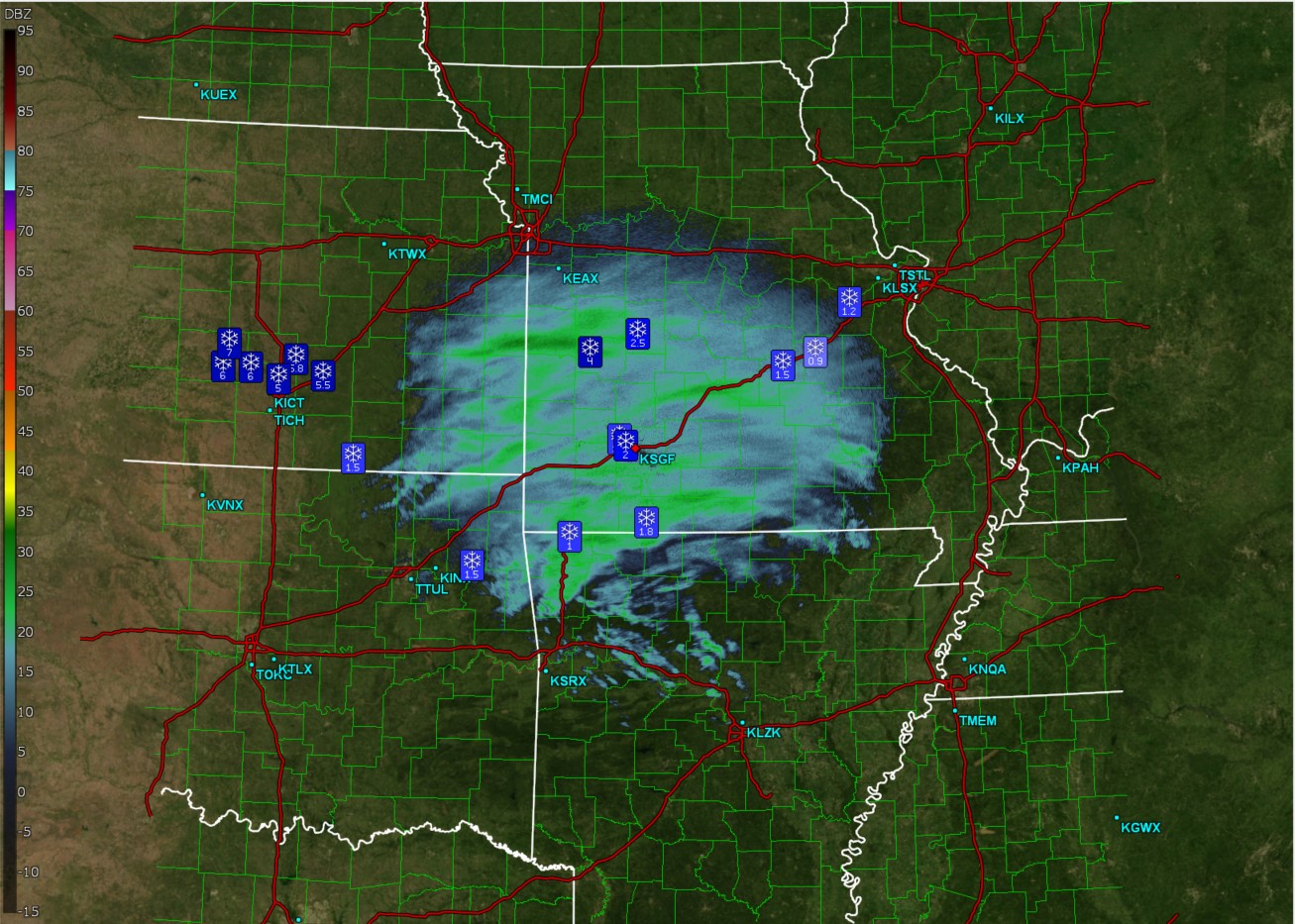
A rather expansive area of snow is ongoing across portions of Missouri, Kansas, and Oklahoma. I have pulled up the radar imagery out of KSGF, which is the radar in Springfield MO. You can clearly see the mesoscale banding features showing up in the darker shades of green. Its within these bands that snowfall totals are ranging form 3-6″ in some areas.
Some snowfall reports so far:
Hutchinson KS: 7″
Mount Hope KS: 6″
Wichita KS: 5″
Willard MO: 3″
Locust Grove OK: 1.5″
It will be several more hours before any wintry mischief reaches the northern part of Alabama, but I thought you all might find it interesting to see what the storm has done in other areas of the country so far. For the record, we do not anticipate that much snow in AL, but it is still cool to see what the storm has done already.
Category: Alabama's Weather, ALL POSTS, Social Media, Winter Weather
About the Author (Author Profile)
Jack is a junior at Mississippi State University studying meteorology. He has several years of forecasting experience through a local group of forecasters in Maryland where he resides. Jack plans to become a broadcast meteorologist after graduation.Subscribe
If you enjoyed this article, subscribe to receive more just like it.


