Midday Nowcast: Breezy & Mild With Increasing Clouds; Rain Arrives Overnight
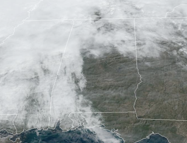
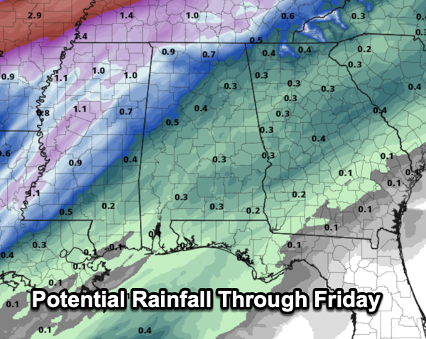
RAIN ARRIVES OVERNIGHT: Scattered rain moved through Alabama overnight and this morning as a warm front lifted north through the state, but this afternoon we are dry with mild and breezy conditions and temperatures are climbing into the upper 60s and lower 70s. We are seeing a mix of sun and clouds, but clouds will be increasing through the rest of today. Tonight, a cold front will push an organized band of showers, and possibly a thunderstorm into the state late tonight into the day tomorrow. With little to no surface based instability, most of Alabama will not have an issue with severe storms. Rainfall amounts will be less than one-half inch, with some higher amounts north of Birmingham.
BIRMINGHAM ALMANAC: For January 30th, the average high for Birmingham is 56° and the average low is 35°. The record high is 78° set in 1950, while the record low is -4° set in 1966. We average 0.17” of precipitation on this date and the record value is 1.82” set in 2013.
ALABAMA WEATHER HISTORY: On January 30th 1966, Alabama’s lowest recorded temperature of -27° occurred at New Market, in north Madison County, just north of Huntsville. All recording stations across Alabama set record lows for the date, all of which still stand today. Here are some of the recorded lows from that morning: Huntsville -11°, Muscle Shoals -6°, Birmingham -4°, Tuscaloosa 1°, Gadsden -2°, Anniston 0°, Montgomery 5°, Dothan 10°, and Mobile 13°.
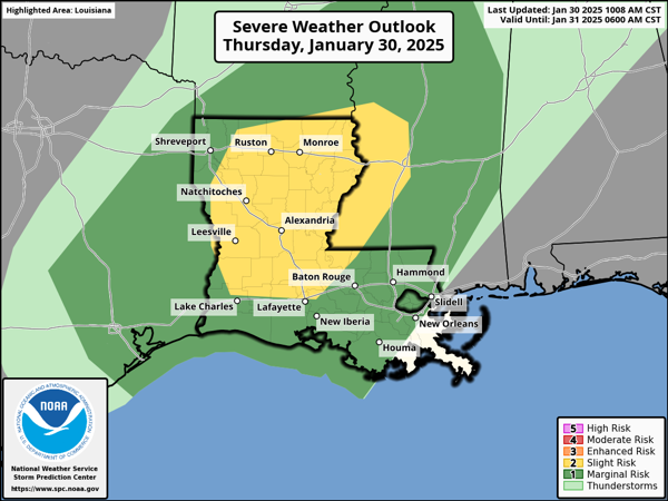
ACROSS THE USA: A storm system will produce severe thunderstorms over the Lower Mississippi River Valley, and heavy to excessive rainfall from the Southern Plains through the Ohio River Valley. A strong Pacific storm will bring the potential for flash flooding, severe thunderstorms, strong to locally damaging non-thunderstorm winds, and high elevation snow to the Hawaiian Islands through Friday.
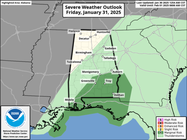
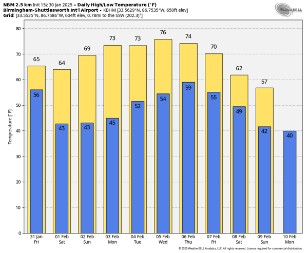
TOMORROW AND THE WEEKEND: The SPC maintains a low end “marginal risk” (level 1/5) for the southeast counties of the state tomorrow, as stronger storms over Southeast Alabama tomorrow could produce gusty winds, but most storms will remain below severe limits there with instability very limited. Tomorrow afternoon should be dry across the much of Central Alabama with highs in the mid 60s to low 70s range. We note, as the upper trough swings through, additional showers will likely develop over North Alabama tomorrow afternoon and tomorrow evening, but these will be out of here tomorrow night.
For the weekend, it will be the best weekend of weather so far in this young year. Expect mostly sunny mild days and clear cool nights; highs in the low to mid 60s Saturday and upper 60s to low 70s Sunday, lows will be in the 40s.
SPRING-LIKE WEATHER: The dry and very pleasant weather continues for much of next week, with models trending warmer and warmer with highs in the 70s expected most days across the state. The first half of the week will be dry, with the chance of some rain returning at times for the second half of the week.
WORLD TEMPERATURE EXTREMES: Over the last 24 hours, the highest observation outside the U.S. was 111.2F at Morawa Airport, Australia. The lowest observation was -62.1F at Delyankir, Russia.
CONTIGUOUS TEMPERATURE EXTREMES: Over the last 24 hours, the highest observation was 85F at Ochopee, FL. The lowest observation was -21F at Mount Washington, NH and Gray, ID.
Category: Alabama's Weather, ALL POSTS, Social Media
About the Author (Author Profile)
Macon, Georgia Television Chief Meteorologist, Birmingham native, and long time Contributor on AlabamaWX. Stormchaser. I did not choose Weather, it chose Me. College Football Fanatic. @Ryan_StinnetSubscribe
If you enjoyed this article, subscribe to receive more just like it.


