Spring-Like Afternoons Ahead; Rain Returns Late Tomorrow Night
THE BIG THAW CONTINUES: All of Alabama will enjoy a high in the 60s this afternoon with a partly to mostly sunny sky; temperatures will peak around 70 degrees on the Gulf Coast. Some clouds will move into the state tomorrow, and a few sprinkles are possible during the day. But, the more meaningful chance of rain comes late tomorrow night into Friday ahead of a Pacific cold front. There is little to no surface based instability over the northern 2/3 of the state, but we do note SPC has introduced a low end “marginal risk” of severe storms for Southeast Alabama Friday.
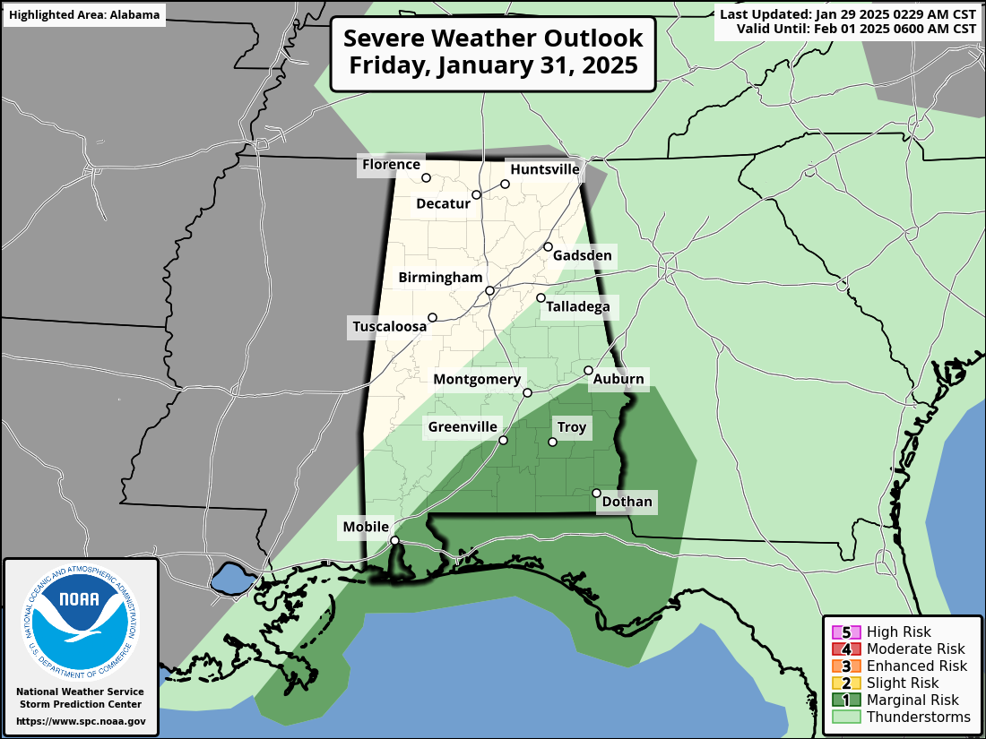
A few storms across the southeast counties of Alabama Friday afternoon could produce gusty winds, but even there instability values are very low. For the northern half of the state, the rain should be over by midday Friday. Rain amounts for most places will be around 1/2 inch.
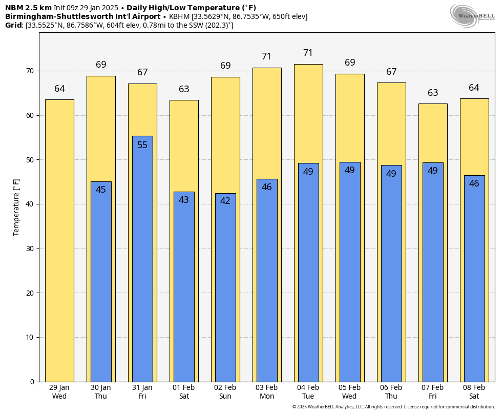
THE ALABAMA WEEKEND: Expect mostly sunny mild days and clear cool nights; highs will be in the 60s Saturday, and on Sunday the high will be in the 67-74 degree range. It should be the warmest day so far this year.
NEXT WEEK: The spring-like weather continues with highs in the 60s and 70s through the week. Global models are not in especially good agreement about the rain opportunities through the week; the reliable European model suggests the best chance of rain comes late in the week on Friday.
No sign of any snow or ice issues for Alabama through mid-February… See the video briefing for maps, graphics, and more details.
ON THIS DATE IN 1936: Eleven inches of snow was on the ground at Birmingham. It would be the city’s greatest snowfall until the Blizzard of 1993 in the Magic City. Snow fell as far south as Brewton in South Alabama. Other amounts across the state: Tuscaloosa 8 inches; Montgomery 3/4 of an inch; Gadsden 9 inches; Huntsville 9 inches; Decatur 7 inches; Anniston 10 inches and Selma 1 inch. Under the deep snow cover and clear skies, the mercury would fall to -4F at Birmingham the following morning.
ON THIS DATE IN 2002: A major three-day winter storm blasted parts of Kansas and Missouri. A catastrophic ice storm occurred south of the snow area, with two inches of ice and snow accumulating in the Kansas City, Missouri area. Thousands of trees were felled by the storm, blocking roads, felling utility lines, and causing fires. Two “Bicentennial Trees,” estimated at being over 200 years old, were badly damaged from this storm.
Look for the next video briefing here by 3:00 this afternoon… enjoy the day!
Category: Alabama's Weather, ALL POSTS, Weather Xtreme Videos
About the Author (Author Profile)
James Spann is one of the most recognized and trusted television meteorologists in the industry. He holds the AMS CCM designation and television seals from the AMS and NWA. He is a past winner of the Broadcast Meteorologist of the Year from both professional organizations.Subscribe
If you enjoyed this article, subscribe to receive more just like it.


